The ground and who manages it
The Congressional Research Service splits California’s 45.4 million federal acres among five agencies: the Forest Service with 20,838,146 acres, the BLM with 14,989,808, the National Park Service with 7,655,258, the Department of Defense with 1,597,180 and the Fish and Wildlife Service with 311,107. That is 45.3 percent of the state, and it is why a trip here is mostly a question of which agency’s rules you are under at any hour.
The Forest Service holds the most and runs it as one region. Eighteen national forests cover 20 million acres in California, ranging, as the region puts it, across the North Coast, Cascade and Sierra Nevada ranges and from Big Sur to the Mexican border. The Inyo alone, on the eastern slope of the Sierra, covers almost 2 million acres and publishes more than 3,600 miles of motorized route, 70 campgrounds and nine wilderness areas. On every forest the Motor Vehicle Use Map, not the road surface, decides where you may legally drive.
The BLM ground is concentrated in the desert. In 1976 Congress designated a 25 million acre California Desert Conservation Area, and the BLM’s California Desert District looks after nearly 11 million of those acres from field offices in Barstow, El Centro, Needles, Palm Springs and Ridgecrest. The rest of the state is run from the Central California and Northern California districts. Inside that ground sit the national monuments and conservation areas most drivers come for.
Two more systems matter. The Park Service holds Death Valley, which it calls the largest national park outside Alaska at more than 3.4 million acres with over 93 percent of it roadless wilderness, and Mojave National Preserve at 1.6 million acres. California State Parks runs 280 units with 15,000 campsites and more than 637 miles of motorized trail, and nine of those units are state vehicular recreation areas set aside for off-highway vehicles. The blocks a driver plans around:
- 01Death Valley National Park: more than 3.4 million acres, over 93 percent roadless wilderness, and nearly a thousand miles of paved and dirt road
- 02Mojave National Preserve: 1.6 million acres, where most off-pavement roads need high clearance and four-wheel drive
- 03Anza-Borrego Desert State Park: the largest state park in California, with five hundred miles of dirt road and 12 wilderness areas
- 04California Desert Conservation Area (BLM): 25 million acres designated, nearly 11 million of them managed by the California Desert District
- 05Carrizo Plain National Monument (BLM): 211,045 acres of public land, with no water, food or fuel on the monument
- 06King Range National Conservation Area (BLM): 68,000 acres along 35 miles of coast, the first national conservation area in the country
- 07Imperial Sand Dunes Recreation Area (BLM): a dune system more than 40 miles long in a band averaging 5 miles wide
- 08Alabama Hills National Scenic Area (BLM): 18,610 acres west of Lone Pine
Source 1
Seasons: the desert and the Sierra trade places
NOAA describes a state where average annual temperatures run from under 40°F at the highest mountain elevations to over 70°F in the southeast, and where the North Pacific High pushes storms north in summer and lets them in during winter. The practical reading is that California has two driving seasons that barely overlap, and that the same week is right for one half of the state and wrong for the other.
The desert belongs to the cool months. The Park Service says Death Valley summer temperatures often top 120°F in the shade with overnight lows in the 90s, and records the world air temperature record of 134°F at Furnace Creek on July 10, 1913. Average rainfall there is under 2 inches a year, and late summer thunderstorms are what cause the flash floods. Anza-Borrego closes Coyote Canyon above Lower Willows, its horse camp, Tamarisk Grove campground and part of Borrego Palm Canyon from June 1 to September 30, and takes campground reservations only from October 1 through April 30. The BLM sells its long term visitor area permits for September 15 to April 15 and not for the summer.
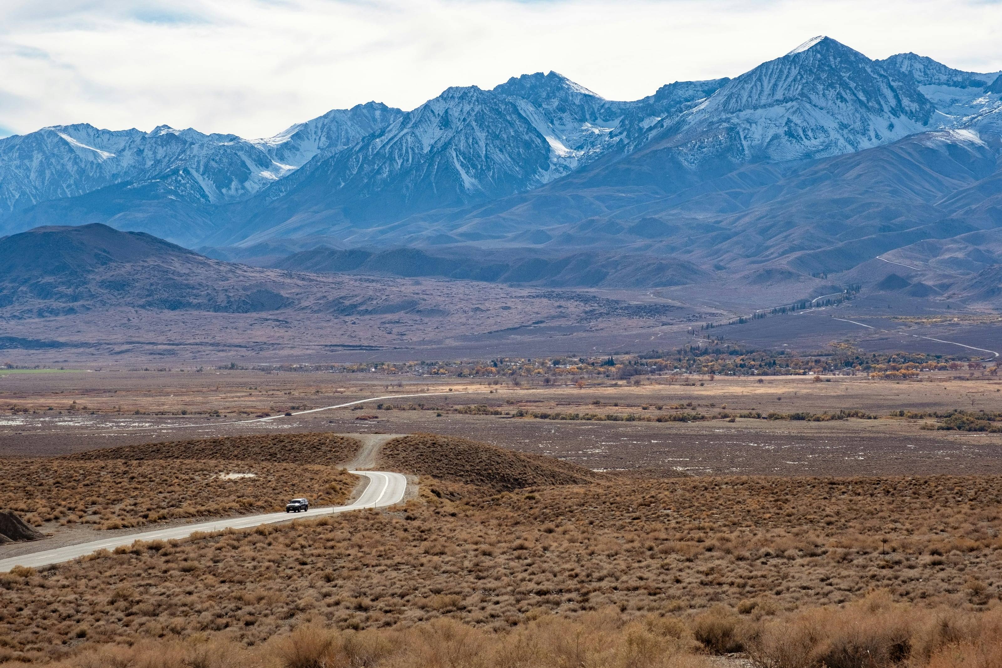
The mountains belong to the warm months. Yosemite says Tioga Road is typically open from late May or June until sometime in November, that plowing its 45.5 miles from Crane Flat to Tioga Pass usually starts about April 15, and that when the road is closed there is no way to drive into the park from the east. The Sequoia National Forest gives Sherman Pass Road a season of use of May to November and says it is closed to passenger vehicles in winter. Inyo’s Bristlecone Pine Forest Scenic Byway ends at 11,000 feet, so it follows the same calendar.
Between the two sits winter driving law. Caltrans posts chain controls in the mountains at three levels, and the speed limit where chains are required is 25 or 30 miles an hour. Those are the days when a Sierra crossing costs hours, and the reason many drivers run the deserts from November to April and the high country from June to October.
Source 4
What California asks of a vehicle
Tires first, and two of them spare. On the Death Valley backcountry the Park Service tells drivers to travel prepared to survive with two full size spare tires and extra food and water, to fit off-road tires rather than highway or street tires, and to carry a plug kit, a 12-volt compressor, a lug wrench and every part of the jack. It says flat tires are a common problem and that rescue is likely to be extremely delayed. On Racetrack Road it says flats are very common and standard rental vehicles often get them, and the Forest Service suggests 15 mph on the unpaved half of the Bristlecone byway to keep sharp rock out of your sidewalls.
Water and fuel next. The Park Service asks for at least a gallon per person per day in hot weather and calls a 5-gallon container standard emergency backup. There is no fuel on the Carrizo Plain, and the Park Service says there are no gas stations, no food service and no lodging inside Mojave National Preserve. The BLM’s byway guide for Surprise Valley says there are no services of any kind outside the towns and typically no cell service east of the state line. The King Range guide asks drivers to arrive with a full tank because all roads in are narrow, steep and winding.
Then clearance, and only sometimes low range. Most of what California documents is unpaved road rather than trail. Titus Canyon is rated for two-wheel drive with high clearance, the Bradshaw Trail is a graded 70-mile dirt road where the BLM recommends four-wheel drive for stretches of soft sand, and Saline Valley Road is a county-maintained dirt road that wants high clearance over two passes. The exceptions are clear: the Racetrack usually needs four-wheel drive and good tires, the Mojave Road is not regularly maintained and four-wheel drive is recommended, and Anza-Borrego says many of its roads cross washes of deep sand that need four-wheel drive and the ability to air down.
Last, be street legal. California requires every vehicle driven off-highway on public land to be either street licensed or registered as an off-highway vehicle, and the big federal and state units here take only the first. Mojave National Preserve does not recognize green or red stickers and bans anything that is not street legal in California, Anza-Borrego allows only street-legal vehicles on its roads, and Carrizo Plain requires every vehicle including a side-by-side to be plated. A licensed truck from any state is welcome on all three.
Source 31
Passes and routes
-
Mojave Road
About 150 miles
The Colorado River near Piute Spring to Soda Dry Lake near Zzyzx, mostly inside Mojave National Preserve
The Park Service describes an east-west route roughly 150 miles long between the Colorado River and the Mojave River, not regularly maintained, with rough and sandy sections, and says the full length usually takes three days. Undeveloped camping along it is free and first come first served, and there is no registration fee. Groups of more than 7 vehicles or 25 people need a Special Use Permit. Land on both sides of the road is wilderness, so leaving the track is illegal as well as a good way to sink a vehicle: the agency says Soda Lake is never truly dry and the ground off the compacted road can be a deep, sticky slurry. It recommends not driving it alone. 38
- Vehicle
- Four-wheel drive recommended. Street-legal vehicles only; green and red stickers are not recognized
- Season
- None published. The Park Service warns of water on Soda Lake, summer monsoon washouts and winter snow or ice
-
Titus Canyon Road
5,250 ft 27 miles
Nevada Highway 374, the Daylight Pass Road, two miles east of the park boundary, west into Death Valley
The Park Service calls this the most popular backcountry road in Death Valley and runs it one way from east to west, with only the last 3 miles at the west end open both ways. It climbs to Red Pass at 5,250 feet, drops past the ghost town of Leadfield and the petroglyphs at Klare Spring, and finishes in narrows where the walls close to less than 20 feet apart. Allow 2 to 3 hours. The park’s backcountry map labels Red Pass 5,280 feet; the road page gives 5,250 and that is the figure used here. The road is day use only, so camping along it is not allowed. 36
- Vehicle
- Two-wheel drive with high clearance recommended; four-wheel drive may be needed after bad weather. No RVs, campers or trailers
- Season
- None published. Often closed by snow, mud or washouts, and summer travel is not advised
-
Racetrack Road
26 miles to the Grandstand
Ubehebe Crater south past Teakettle Junction to the Racetrack playa
The Park Service puts the drive at 3.5 hours each way from Furnace Creek, with no cell coverage and flat tires very common on loose gravel, deep washboard and sharp rock. Teakettle Junction comes at 20 miles and the Grandstand parking area at 26. The playa itself is about 3 miles long and 2 miles wide, and driving on the lakebed is prohibited, as is walking on it when wet. The road left at Teakettle Junction runs into Hidden Valley and the Hunter Mountain road, which the agency says usually needs four-wheel drive. 37
- Vehicle
- High clearance with off-road tires; four-wheel drive and good tires usually required. No RVs, sedans or low-clearance vehicles
- Season
- None published. Conditions change with weather and maintenance is irregular
-
Saline Valley Road
7,200 ft
CA 190 in the south and Big Pine Road in the north, through Saline Valley
The Park Service splits it in two. The South Pass section from CA 190 to the Warm Springs junction is surfaced for 8 miles to Lee Flat but very potholed, and from South Pass through Grapevine Canyon it can be rocky and rutted. The North Pass section from Big Pine Road expects heavy washboard, with washouts common after rain and snow and ice at a pass the agency puts at 7,200 feet. The park’s map labels North Pass 7,300 feet. This is one of the longest ways across Death Valley and one of the least traveled. 32
- Vehicle
- High clearance. County-maintained dirt road with heavy washboard
- Season
- None published. Occasionally closed by rockfall, washouts, and snow and ice at the high pass
-
Bradshaw Trail Back Country Byway
70 miles
Wiley’s Well Road south of I-10 near Blythe, west toward Indio
The BLM describes a 70-mile dirt road periodically graded by the Riverside County Transportation Department, crossing mostly public land with views of the Chuckwalla Bench and the Orocopia, Chuckwalla and Mule Mountains. William Bradshaw blazed the first road across Riverside County to the Colorado River in 1862 as a stage route, and it carried miners to the La Paz gold fields until 1877. The BLM’s Palm Springs-South Coast Field Office administers it and posts a 14-day stay limit. From Blythe, drive 17 miles west on I-10 to the Wiley’s Well exit, then 9 miles south past Wiley’s Well Campground. 29
- Vehicle
- Four-wheel drive recommended for stretches of soft sand
- Season
- None published
-
Sherman Pass Road
9,200 ft
The North Fork of the Kern River west of the pass to US 395 and the high desert in the east
Forest Road 22S05 crosses the Kern Plateau at 9,200 feet. From the west it climbs out of the Upper Kern River Canyon to the pass, where the forest says you can see the Sierra Crest and Mount Whitney, then descends across the plateau through red fir, mixed conifer and pinyon pine to the Mojave. The forest lists it as one of its four scenic highways along with the Generals Highway, the Kings Canyon Scenic Byway and the Western Divide Highway. No potable water along it. 12
- Vehicle
- Any car in season. Campfire permits required for campfires, barbecues and camp stoves
- Season
- May to November. Open from late May or early June depending on snow, and closed to passenger vehicles in winter
-
Bristlecone Pine Forest Scenic Byway
11,000 ft 35 miles from Big Pine
US 395 at Big Pine, by CA 168 and White Mountain Road, to Patriarch Grove in the White Mountains
From US 395 it is about 12 miles east on CA 168, then 10 paved miles up White Mountain Road to Schulman Grove where the pavement ends, then 12 miles of graded dirt and a one-mile spur to Patriarch Grove, which the Forest Service puts at the end of the byway at 11,000 feet and records at 11,240 feet in the site’s own elevation field. The agency suggests 15 mph on the dirt because sharp rock punctures tires, and notes that CA 168 is narrow and steep with a single-lane section of limited visibility. There is no water, no camping in the forest itself, and the nearest food, water or fuel is Big Pine. 14
- Vehicle
- Paved to Schulman Grove. The final 13 miles are graded dirt and not recommended for light passenger cars
- Season
- None published. The Forest Service keeps the groves day use only, open 6 a.m. to 10 p.m.
-
Surprise Valley-Barrel Springs Back Country Byway
90-mile loop
A loop from Cedarville, reached by CA 299 east from US 395 five miles north of Alturas
The BLM’s self-guided tour runs a 90-mile loop along the base of the Warner Mountains in the far northeast corner of the state, with numbered stops for the 1849 emigrant route, the old towns of Surprise Valley and the geology of a Pleistocene lake bed. Outside the small towns there are no services of any kind, and typically no cell phone service east of the California-Nevada line. Before leaving Cedarville the agency asks drivers to check fuel, the spare’s air pressure and the tire-changing kit, and to carry at least a gallon of drinking water. Camping is permitted on BLM land along the byway. 30
- Vehicle
- Part paved, part improved gravel, part dirt. Allow at least three hours
- Season
- None published. The BLM says to check in Cedarville after a snowstorm or a big rainstorm
-
Soda Lake Road, Carrizo Plain National Monument
CA 58 in the north to CA 33/166 in the south, through the monument
Soda Lake Road is the spine of a 211,045-acre monument with no water, food or fuel, where the nearest communities are 15 miles from the south entrance and 60 from the north. It runs past Soda Lake, the largest remaining natural alkali wetland in southern California, and the trailhead for Painted Rock, which is closed within a quarter mile from March 1 to July 15 except on BLM tours. Most other roads here are unimproved dirt that becomes impassable in rain, and the BLM says Caliente Ridge Road is especially dangerous when wet. Speed limit on BLM roads is 25 mph, and dispersed car camping is allowed across about 100,000 acres of foothill and mountain ground, not on the valley floor. 23
- Vehicle
- High clearance recommended. Every vehicle, including a side-by-side, must be street legal and stay on the road
- Season
- Open year round, though rain can make parts of it slippery, muddy and impassable
-
The Anza-Borrego dirt road network
Five hundred miles
Borrego Springs, CA 78, County S2 and County S22, across the largest state park in California
California State Parks describes five hundred miles of dirt road and 12 wilderness areas, and says auto touring is among the most popular things done here. Many roads cross washes of deep sand that need four-wheel drive, and the park tells drivers to carry a shovel, a tow strap and a tire pressure gauge and be ready to self-rescue. Off-highway vehicles are banned inside the park and sent to Ocotillo Wells State Vehicular Recreation Area next door. The whole backcountry counts as one camping facility with a 30-day limit per calendar year, vehicles must park within one car length of the road, and all fires must be off the ground in a stove or a metal container. 44
- Vehicle
- Street-legal vehicles only, on designated roads. Many roads need four-wheel drive and the ability to air down
- Season
- Coyote Canyon above Lower Willows and several campgrounds close from June 1 to September 30
-
King Peak Road and the King Range back roads
Shelter Cove Road inland to Tolkan and Horse Mountain campgrounds and the King Range ridges
The King Range is the country’s first national conservation area, 68,000 acres along 35 miles of coast where the terrain pushed State Highway 1 inland. King Peak stands 4,088 feet high three miles from the surf. From the King Peak Road junction on Shelter Cove Road the BLM gives 3.5 miles to Tolkan Campground, 6.5 to Horse Mountain and 16 to the Lightning trailhead, and it marks the Smith-Etter and Wilder Ridge roads as four-wheel drive. There is a 14-day camping limit everywhere in the conservation area, none of the four campgrounds has potable water, and campfire restrictions usually run from early summer through fall. 25
- Vehicle
- Four-wheel drive with high clearance on the ridge roads. Roads are rough, narrow and winding
- Season
- None published. The BLM says primitive roads may be closed seasonally and main roads may shut in heavy winter storms
-
Tioga RoadPaved
9,945 ft 45.5 miles plowed
Crane Flat in Yosemite to Tioga Pass and US 395 at Lee Vining
The Park Service plows 45.5 miles from Crane Flat to the Tioga Pass entrance, which it puts at 9,945 feet on the crest of the Sierra Nevada. Crews clear several avalanche zones, downed trees and rockfall before the road opens, and the park says opening the road is closer to opening a park. When it is closed there is no way to drive into Yosemite from the east, so the Owens Valley side loses its shortest link to the west slope for half the year. 42
- Vehicle
- Any car. Limited services along the road and no drinking water at many stops
- Season
- Typically open from late May or June until sometime in November. Plowing usually starts about April 15
Rules worth knowing
- The most visited national forest in the country is the Inyo
- With nearly four million visits a year the Inyo is the most visited national forest in the United States, carrying over 3,600 miles of motorised route, 70 campgrounds, three scenic byways and nine wilderness areas along the east side of the Sierra. Those two numbers together, the visits and the route miles, are the whole planning problem on this side of the mountains in July. 9
- A California campfire permit covers a stove as well as a fire
- Campfire permits are required on all Inyo National Forest land, and on nearby BLM land, and the requirement is not limited to open fires: the permit covers campfires, barbecues and camp stoves. It is free, it is issued by the state, and it is the single most commonly missed piece of paper in California. 10
- The same permit rule runs on the northern forests
- The Plumas National Forest states the rule in general terms for its own ground, which is how the campfire permit works across California: it is a statewide requirement administered by the state fire agency and applied on federal land through each forest. Get one once and it covers the trip. 11
- The southern Sierra has four named scenic highways
- The Sequoia National Forest publishes four scenic highways in its area, among them the Generals Highway and the Kings Canyon road, and requires campfire permits for campfires, barbecues and camp stoves alike. Sherman Pass Road, 22S05, is the route across the Kern Plateau and the one that matters most to this guide. 13
- The Patriarch Grove is 13 miles of dirt past Schulman
- Beyond Schulman Grove in the Ancient Bristlecone Pine Forest, the Patriarch Grove lies 13 miles north on a dirt road, at an elevation where the oldest trees in the world grow on almost nothing. It is the highest easy driving in California and a genuinely strange place to arrive in a vehicle. 15
- The BLM runs California from three districts
- The Bureau of Land Management’s California state office works through the California Desert District, the Central California District and the Northern California District. Almost everything this guide covers on BLM ground is in the first of those, and the district office is the level at which desert route designations and closures are published. 16
- The California Desert District is five field offices
- The California Desert District Office manages the California Desert Conservation Area through field offices at Barstow, El Centro, Needles, Palm Springs-South Coast and Ridgecrest. When a desert road, a dry lake or a dune area raises a question, it belongs to one of those five, and their travel management plans differ. 18
- Carrizo Plain has no water, food or fuel
- The monument provides no services of any kind, and the gateway communities are Taft and Santa Margarita. The valley floor receives between seven and ten inches of rain a year, which is why the plain looks the way it does and why its roads turn to clay when that rain arrives. Come with everything, including more water than the day seems to need. 21
- On the Carrizo, every vehicle must be street legal at 25 miles an hour
- All vehicles on the monument, including side-by-sides, must be street legal and plated, and must stay on designated roads. The speed limit on BLM roads there is 25 miles an hour. It is a national monument rather than an open-riding area, and the distinction is enforced. 22
- The Alabama Hills are 18,610 acres west of Lone Pine
- The Alabama Hills National Scenic Area covers 18,610 acres immediately west of Lone Pine, under the east face of the Sierra. It is the most photographed piece of BLM ground in the state and, because of that, the one with the most rules attached to it. 26
- Camping in the Alabama Hills now needs a free permit
- Camping permits are required for designated camping in the Alabama Hills. They are free, they do not guarantee a campsite, and all camping remains first come, first served. A California campfire permit is required as well on BLM land in the state, and drone operators need a separate drone use permit before flying. 27
- Imperial Sand Dunes: permits from October, and a closed wilderness
- Permits are required at the Imperial Sand Dunes from 1 October through 15 April each year, at 55 dollars a week in advance and 70 at the gate. The North Algodones Dunes Wilderness inside the recreation area encompasses more than 26,000 acres and is closed to all vehicles and mechanised equipment. The busiest sand in the west sits next to ground where no wheel may turn. 28
- Death Valley has more dirt road than paved
- The park counts more than 300 miles of paved road, 300 miles of improved dirt road and several hundred miles of unmaintained backcountry road, with nine developed campgrounds. That ratio is why the park rewards a capable vehicle, and why a first visit on pavement alone misses most of it. 33
- Summer lows in Death Valley are in the nineties
- Summer temperatures often top 120 degrees in the shade with overnight lows only dipping into the nineties, and temperatures fall 3 to 5 degrees for every thousand feet of elevation gained. That last figure is the practical one: the difference between the valley floor and the high country is the difference between dangerous and pleasant on the same afternoon. 34
- There is no fuel in Mojave National Preserve
- The preserve states plainly that there are no petrol stations inside it, and names the nearest at Baker, Cima Road and Interstate 15, and Primm. It covers 1.6 million acres and says the majority of its off-pavement roads require high clearance and four-wheel drive. Fill up before you turn off the interstate, every time. 39
- The main Mojave roads, by length
- Ivanpah Road runs 27 miles connecting Nipton Road to Lanfair Road, and Lanfair Road runs 19 miles on from there. Those two plus Kelbaker and Kelso Cima are the spine of the preserve’s road network, and knowing their lengths is how you judge whether a crossing fits the daylight you have left. 40
- Mojave allows free roadside camping, for fourteen days
- There is a 14-day camping limit in the preserve and no fee to camp at an undeveloped campground, with a maximum of 14 consecutive days per stay and 30 total days a year. Roadside camping is allowed at sites that have already been used, which is the most generous dispersed arrangement of any national park unit in this guide. 41
- Tioga Pass sits at 9,945 feet and closes for half the year
- The Tioga Pass entrance to Yosemite is at 9,945 feet on the crest of the Sierra Nevada, and the Tioga Road is closed seasonally from approximately November through May or June. It is the only road across the range for a very long way, and its closure reshapes every route in eastern California for half the year. 43
- Anza-Borrego’s washes need a shovel and a tire gauge
- The park’s own dirt road conditions page says many roadways involve traversing washes with deep sand and require four-wheel drive with the capacity to air down tires, and that motorists should be prepared to self-rescue with a shovel, tow strap and tire pressure gauge, and always carry sufficient fuel, water and food. That is a state park telling you to arrive equipped, which is rare and worth taking literally. 45
- The state park system is the largest of any state agency
- California State Parks holds 280 units, over 340 miles of coastline, 970 miles of lake and river frontage, 15,000 campsites, 3,543 miles of non-motorised trail and more than 637 miles of motorised trail. In a state where the federal land gets the attention, that is a very large second system with its own rules and its own booking window. 46
- Off-highway riding belongs in the nine vehicular recreation areas
- The state’s off-highway division points riders to nine state vehicular recreation areas for dirt bikes, all-terrain vehicles, side-by-sides, four-wheel drives and dune buggies. That is the designed home for open riding in California, and it is why parks like Anza-Borrego can ban off-highway vehicles outright while Ocotillo Wells next door exists for them. 47
- A visitor without home-state registration needs a 30-dollar permit
- All vehicles operated off-highway on public land in California must be either street licensed or registered as an off-highway vehicle. A visitor from another state whose vehicle does not carry current registration from home must buy a California Nonresident OHV Use Permit, which costs 30 dollars. A plated, registered truck is street licensed and satisfies the first limb of that rule. 49
- Where the elevations in this guide come from
- Town and pass elevations here are read from the 3D Elevation Program surface at the coordinates the Geographic Names Information System holds for each place, unless an agency publishes its own figure. Where the two differ, the agency’s number is used and ours is named: Mount Whitney is 14,494 feet by the USGS table and 14,486 by our own query. 7
- Fourteen days, then twenty-five miles
- Camping on BLM land in California is limited to 14 days in any 28 consecutive days, counted from the day you first occupy a spot. After the fourteenth day you must move outside a 25-mile radius of that location until the twenty-ninth day, and personal property may not be left unattended for more than 10 days. One office is stricter: inside the Bishop Field Office boundaries dispersed camping is limited to 14 days per year. Most of the rest of BLM California is open to dispersed camping, and developed campground fees run $4 to $10 per unit per night. 17
- Long stays in the desert need a winter permit
- California has six long term visitor areas, and from September 15 to April 15 camping in one needs an LTVA permit. Fees are $180 for a long-term permit valid for seven months and $40 for a short-term permit valid for 1 to 14 consecutive days, with no limit on how many short-term permits you buy. The permits are good in any of the six California areas or the two in Arizona. Between April 16 and September 14 camping is free, but the standard 14-day limit for dispersed camping on BLM land applies and no host is on site. The speed limit inside an LTVA is 15 mph. 20
- Street licensed, or registered as an OHV
- Every vehicle driven off-highway on public land in California must be either street licensed or registered as an off-highway vehicle, and a highway-licensed vehicle counts as an OHV the moment it leaves the highway. Off-highway it needs current registration and the vehicle code’s off-highway equipment list, which includes lights after dark, working brakes and a maintained muffler or spark arrester. A California green sticker costs $54 and lasts two years. Red stickers covered non-compliant motorcycles and ATVs of model years 2003 to 2021; from 2025 those machines are no longer held to a riding season, and the DMV stopped issuing red stickers from model year 2022. A visitor whose vehicle carries valid registration from another state needs nothing more, and California accepts the Oregon OHV Permit and the Nevada OHV Registration Decal. A vehicle without it needs a California Nonresident OHV Use Permit, currently $30. Arizona street-legal registration for an off-highway vehicle is not accepted. 48
- A campfire permit covers your stove too
- Every campfire and gas stove fire on public land in California needs a California Campfire Permit, which is free from any Forest Service, BLM or CAL FIRE office or online. The Forest Service states it plainly: the permit is required for a campfire, charcoal fire, camp stove or any open flame outside a designated recreation site. BLM California’s statewide, year-round fire order adds two conditions for any fire outside a developed campground: a five-foot circle cleared to bare soil with nothing flammable overhead, and a working round-point shovel at least 35 inches long within reach. Field offices layer their own orders on top, and several ban motor vehicles off established roads outright. 19
- Spark arresters are the law on wild land
- California Vehicle Code 38366 makes it an offense to operate an off-highway motor vehicle on any forest-covered, brush-covered or grass-covered land unless it carries a spark arrester maintained in effective working order, and the arrester may not be mounted where exhaust flames or heat can ignite anything. The code defines the device as non-flammable and built to catch flammable particles larger than 0.0232 of an inch, or rated by the Forest Service. BLM field offices repeat the requirement in their fire orders for off-road motorcycles, all-terrain vehicles and chainsaws. 50
- Chain controls come in three levels
- Caltrans posts three requirement levels on mountain highways. R-1 requires chains on everything except passenger vehicles and light trucks under 6,000 pounds gross weight with snow tires on at least two drive wheels, and those vehicles must still carry chains. R-2 requires chains or traction devices on everything except four-wheel and all-wheel drive with snow-tread tires on all four wheels, and those vehicles must carry traction devices inside the control area. R-3 requires chains on every vehicle with no exceptions, and Caltrans says a highway is often closed before it goes that far. A snow-tread tire is one stamped MS, M/S, M+S or MUD AND SNOW. The limit where chains are required is 25 or 30 mph, and the CHP can cite you for not stopping to fit them. 51
 Bureau of Land Management (BLM)
 US Forest Service (USFS)
 National Park Service (NPS)
 US Fish and Wildlife (USFW)
 Bureau of Reclamation (USBR)
 Department Of Defense (DOD)
 Bureau of Indian Affairs (BIA)
 Other Federal
 State
 Local
 Alaska Native Lands (Patented or Interim Conveyed)
 Alaska Native Allotment
 Road
 Primitive Road
 Road
 Primitive Road
 Trail
 Roads open to all Vehicles, Yearlong
 Roads open to all Vehicles, Seasonal
 Roads open to highway legal vehicles only, Yearlong
 Roads open to highway legal vehicles only, Seasonal
 Special Designation, Yearlong
 Special Designation, Seasonal
 Trails open to all vehicles, Yearlong
 Trails open to all vehicles, Seasonal
 Trails open to vehicles 50" or less in width, Yearlong
 Trails open to vehicles 50" or less in width, Seasonal
 Trails open to motorcycles, Yearlong
 Trails open to motorcycles, Seasonal
 Special Designation, Seasonal
 Trails Open to Wheeled Vehicles Only < 50" in Width, Yearlong
 Trails Open to Wheeled Vehicles Only < 50" or Less in Width, Seasonal
 Wilderness Area
 Wilderness Study Area



















