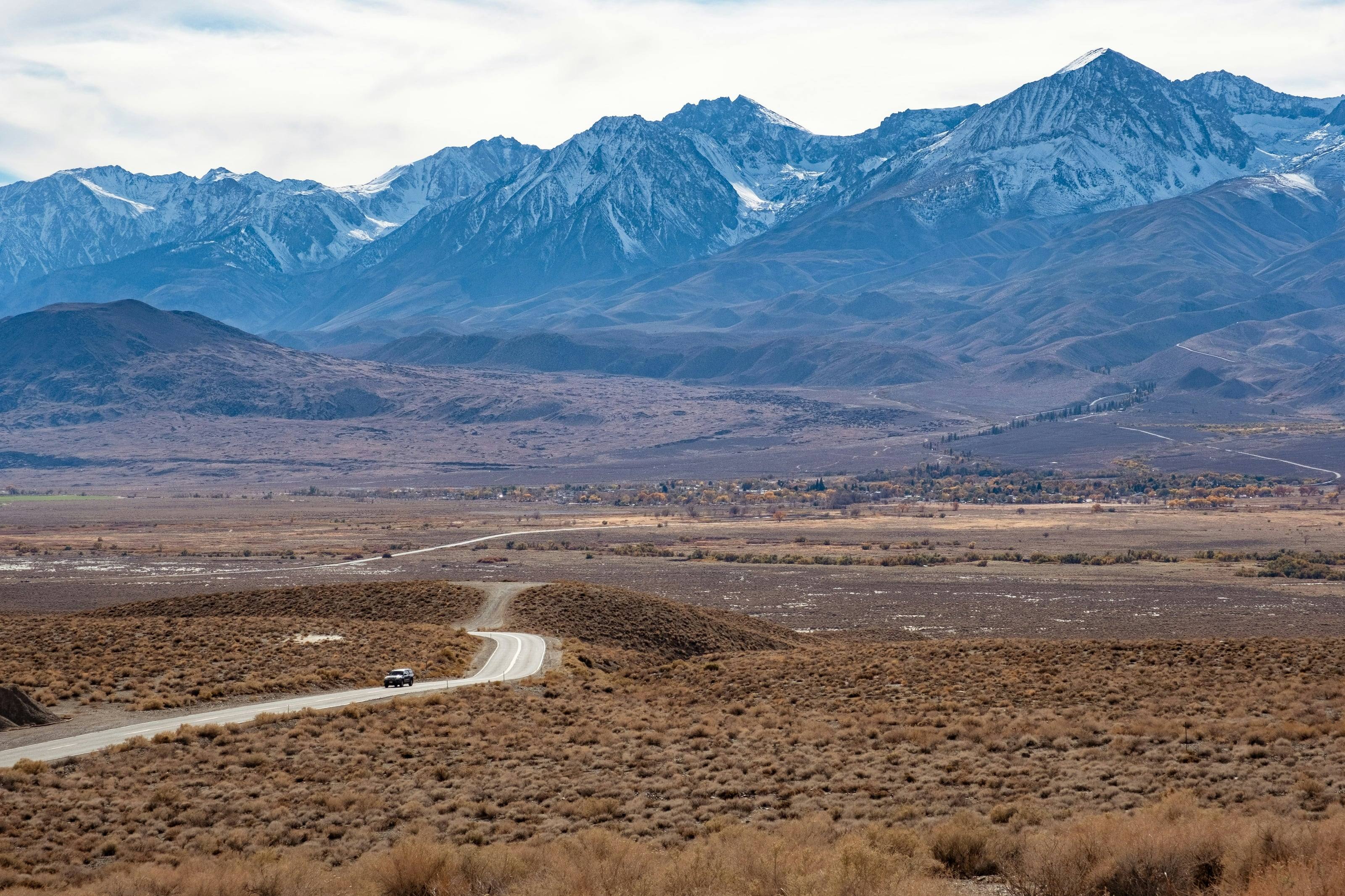
A dirt road winding across sagebrush flats toward a snow-covered mountain range, a single car far along it.

The Overland Directory

Campgrounds in California

Established campgrounds that welcome vehicle-based travelers, from public campgrounds on the way to somewhere to private camps worth a stay of their own.

We’re working on adding the latest campgrounds in California here.

In the meantime, BLM campgrounds are already on the public land map, with the fees and stay limits the agency publishes and a link to each one.

California by the numbers

Of California is federal land 1
45.3%
45,391,499 of 100,206,720 acres, as of September 30, 2024
Acres of national forest in California 8
20M
Eighteen national forests, run as the Forest Service’s Pacific Southwest Region
Acres of BLM public land 1
15.0M
14,989,808 acres. BLM California publishes no statewide total of its own
Miles of BLM route open to motor vehicles 5
32,900+
Roads and trails recorded for public or limited public motorized use, printed as a floor
Mount Whitney, the highest point in the lower 48 2
14,494 ft
Inyo and Tulare counties. Death Valley, at 282 feet below sea level, is the lowest point in North America
Approximate mean elevation 3
2,900 ft
From the same USGS figures that give the high and low points
Federal campgrounds a vehicle can reach 6
788
614 Forest Service, 79 National Park Service, 65 BLM and 25 Corps of Engineers. 586 can be booked ahead
Average annual precipitation, 1895 to 2020 4
22.1 in
Summers are dry statewide. NOAA calls the southern deserts some of the nation’s hottest and driest areas

Camping on public land in California

Developed federal camping here is plentiful by western standards. Our build of the Recreation.gov database finds 788 federal campgrounds a vehicle can reach: 614 Forest Service, 79 National Park Service, 65 BLM and 25 Corps of Engineers, with 586 bookable ahead. California State Parks adds 280 units and 15,000 campsites on top.

Dispersed camping fills the rest of the map. BLM California allows 14 days in any 28 before a 25-mile move, Anza-Borrego treats its whole backcountry as one camping facility with a 30-day annual limit, Mojave National Preserve allows 14 consecutive days and 30 a year, and the King Range holds everyone to 14 days.

The full guide to overlanding California

Three kinds of camping

Developed campgrounds have numbered sites, toilets, often water, usually a fee and sometimes reservations. They are the easy night on the way to somewhere.

Dispersed camping means no facilities and no fee. It is allowed on much Bureau of Land Management and National Forest land, within local rules on where you can pull off, how long you can stay and whether you can have a fire.

Private campgrounds and ranch stays add showers, laundry and hookups: the reset day in the middle of a long trip.

How to find a good one

The managing agency's own page is the only source for current status.

  1. 01Check the agency page for closures, fire restrictions and water before you drive in.
  2. 02Check the stay limit. Many public lands use fourteen days within a set period, but it varies by office.
  3. 03Check vehicle length limits and the condition of the access road.
  4. 04Arrive before dark, and have a second option.

Camp so it stays open

Most closures of dispersed areas follow the same pattern of trash, new fire rings and driving off the track.

  1. 01Use sites that already exist rather than making new ones.
  2. 02Pack out everything, including human waste where it is required.
  3. 03Have fires only where and when they are allowed, and drown them.
  4. 04Leave gates as you found them.

Questions people ask

Is dispersed camping legal?

On much BLM and National Forest land, yes, within local rules on where you can pull off, how long you can stay and whether fires are allowed. Rules are set by the local office and change with conditions, so check before you go. The public land map shows who manages the ground.

How long can I stay?

Many public lands use a 14-day limit within a set period, but it varies by office and by area. The campground details on the public land map show the stay limit the BLM publishes for each site.

Do I need a reservation?

For popular developed campgrounds in season, often. Many public campgrounds are first come, first served. Recreation.gov handles reservations for most federal campgrounds that take them.

How high is California?

From Brawley at -113 feet to Mount Whitney at 14,494. Altitude decides what your engine, your brakes and your lungs have to work with, and how late in the year the passes open.

Towns

  1. Lee Vining On US 395 at the eastern foot of Tioga Pass. When Tioga Road is closed there is no way to drive into Yosemite from this side of the Sierra. 6,790 ft
  2. Alturas On US 395 in Modoc County. CA 299 leaves US 395 five miles north of town for Cedarville, where the Surprise Valley byway begins and ends. 4,372 ft
  3. Susanville On US 395 in the northeast. BLM Eagle Lake Field Office and a Lassen National Forest office cover the ground east and south of here. 4,194 ft
  4. Bishop The largest town in the Owens Valley, on US 395. BLM Bishop Field Office and an Inyo National Forest office. Dispersed camping inside this field office is capped at 14 days a year. 4,145 ft
  5. Big Pine On US 395. The Forest Service calls it the nearest food, water or fuel to the Ancient Bristlecone Pine Forest. Big Pine Road east from here reaches Eureka Valley and Death Valley. 3,988 ft
  6. Lone Pine On US 395 below Mount Whitney. Movie Road into the Alabama Hills leaves Whitney Portal Road west of the stoplight, and the Eastern Sierra Visitor Center sits south of town. 3,727 ft
  7. Kernville On the Kern River. The Sequoia National Forest’s Kern River Ranger District office is here, near the west end of Sherman Pass Road. 2,647 ft
  8. Ridgecrest BLM Ridgecrest Field Office, between the southern Sierra and the Mojave. The usual base for the Panamint and Searles country and the southwest corner of Death Valley. 2,294 ft
  9. Barstow Where I-15 meets I-40. BLM Barstow Field Office and the headquarters of Mojave National Preserve. The natural place to service a vehicle before the desert. 2,174 ft
  10. Baker On I-15 where Kelbaker Road heads south into Mojave National Preserve. The Park Service lists Baker as one of the nearest gas stations and says there is none inside the preserve. 932 ft
  11. Borrego Springs Ringed by Anza-Borrego Desert State Park, with the park visitor center at the west end of Palm Canyon Drive. Named an International Dark Sky Community. 589 ft
  12. Needles On I-40 beside the Colorado River. BLM Needles Field Office, and the eastern approach to the Mojave Road by way of Piute Spring. 495 ft
  13. Bakersfield Where CA 58 meets CA 99. BLM Bakersfield Field Office, which manages the Carrizo Plain National Monument to the west. Last full services before the plain. 404 ft
  14. Blythe On I-10 at the Arizona line. The Bradshaw Trail is reached by driving west on I-10 to the Wiley’s Well exit and south past Wiley’s Well Campground. 268 ft
  15. Shelter Cove The road end on the Lost Coast, about 22 miles from US 101 at Redway. King Peak Road and the other King Range back roads climb inland from the road that brought you here. 144 ft
  16. Brawley Below sea level in the Imperial Valley. CA 78 runs east from here to the Imperial Sand Dunes; the BLM’s El Centro Field Office is south. -113 ft

Passes, high roads and summits

  1. Mount Whitney The highest point in California and in the lower 48. No road to the top 14,494 ft
  2. Telescope Peak The highest point in Death Valley National Park, above Badwater Basin 11,049 ft
  3. Patriarch Grove Bristlecone Pine Forest Scenic Byway: US 395 at Big Pine, by CA 168 and White Mountain Road, to Patriarch Grove in the White Mountains 11,000 ft
  4. Tioga Pass Tioga Road: Crane Flat in Yosemite to Tioga Pass and US 395 at Lee Vining 9,945 ft
  5. Sherman Pass Sherman Pass Road: The North Fork of the Kern River west of the pass to US 395 and the high desert in the east 9,200 ft
  6. North Pass Saline Valley Road: CA 190 in the south and Big Pine Road in the north, through Saline Valley 7,200 ft
  7. Red Pass Titus Canyon Road: Nevada Highway 374, the Daylight Pass Road, two miles east of the park boundary, west into Death Valley 5,250 ft
  8. King Peak The highest point in the King Range, three miles from the Pacific 4,088 ft

Pass, road and summit elevations are the figures published by the agency that manages them. Town elevations are the town’s or county’s own figure where it publishes an exact one; the rest are from the U.S. Geological Survey (3D Elevation Program at the place’s official coordinates), retrieved September 18, 2026. Every source is listed at the foot of the page.
Sources for this page

51
  1. Congressional Research Service. Federal Land Ownership: Overview and Data (R42346), Tables 1 and 2, data as of September 30, 2024. Retrieved September 18, 2026.
  2. U.S. Geological Survey. Elevations and Distances in the United States, online edition. The California row, footnoted to the National Geodetic Survey. Retrieved September 19, 2026.
  3. U.S. Census Bureau, from U.S. Geological Survey data. Statistical Abstract of the United States: 2012, Table 366. Extreme and Mean Elevations by State. Retrieved September 19, 2026.
  4. NOAA National Centers for Environmental Information. California State Climate Summary 2022 (NOAA Technical Report NESDIS 150-CA). Retrieved September 19, 2026.
  5. Bureau of Land Management. Ground Transportation Linear Features, public display. Sum of GIS_MILES by administrative state for routes managed for public or limited public motorized use.. Retrieved September 18, 2026.
  6. Recreation.gov. Recreation Information Database (RIDB) full export. Retrieved September 19, 2026.
  7. U.S. Geological Survey. Geographic Names Information System and 3D Elevation Program point query. Elevation of the 3DEP surface at the GNIS coordinates of the named place, rounded to the nearest foot.. Retrieved September 19, 2026.
  8. USDA Forest Service, Pacific Southwest Region. Pacific Southwest Region home: acres managed and the eighteen national forests. Retrieved September 19, 2026.
  9. USDA Forest Service, Inyo National Forest. About the Area. Retrieved September 19, 2026.
  10. USDA Forest Service, Inyo National Forest. Campfire permits. Retrieved September 19, 2026.
  11. USDA Forest Service, Plumas National Forest. Campfire Permits. Retrieved September 19, 2026.
  12. USDA Forest Service, Sequoia National Forest. Sherman Pass Road. Retrieved September 19, 2026.
  13. USDA Forest Service, Sequoia National Forest. Scenic Highways. Retrieved September 19, 2026.
  14. USDA Forest Service, Inyo National Forest. Patriarch Grove Trailhead, at the end of the Bristlecone Pine Forest Scenic Byway. Retrieved September 19, 2026.
  15. USDA Forest Service, Inyo National Forest. Ancient Bristlecone Pine Forest. Retrieved September 19, 2026.
  16. Bureau of Land Management. California state office and its three district offices. Retrieved September 19, 2026.
  17. Bureau of Land Management. California Recreation Activities: camping, dispersed camping, stay limits and campfire permits. Retrieved September 19, 2026.
  18. Bureau of Land Management. California Desert District Office: the California Desert Conservation Area and its field offices. Retrieved September 19, 2026.
  19. Bureau of Land Management. California Fire Information and Fire Restrictions: the statewide year-round order and the field office orders. Retrieved September 19, 2026.
  20. Bureau of Land Management. Midland Long Term Visitor Area: LTVA permits, fees and season. Retrieved September 19, 2026.
  21. Bureau of Land Management. Carrizo Plain National Monument. Retrieved September 19, 2026.
  22. Bureau of Land Management. Carrizo Plain National Monument: plan your visit. Retrieved September 19, 2026.
  23. Bureau of Land Management. Carrizo Plain National Monument Recreation Map and Guide. Retrieved September 19, 2026.
  24. Bureau of Land Management. King Range National Conservation Area. Retrieved September 19, 2026.
  25. Bureau of Land Management. King Range National Conservation Area Trip Planning Guide. Retrieved September 19, 2026.
  26. Bureau of Land Management. Alabama Hills National Scenic Area. Retrieved September 19, 2026.
  27. Bureau of Land Management. Alabama Hills: camping permits, campfire permits and directions. Retrieved September 19, 2026.
  28. Bureau of Land Management. Imperial Sand Dunes Recreation Area: size, permits and the North Algodones Dunes Wilderness. Retrieved September 19, 2026.
  29. Bureau of Land Management. Bradshaw Trail Back Country Byway. Retrieved September 19, 2026.
  30. Bureau of Land Management. Surprise Valley Barrel Springs Back Country Byway: A Self-Guided Tour. Retrieved September 19, 2026.
  31. National Park Service, Death Valley National Park. Backcountry Roads: what to carry, regulations and wilderness boundaries. Retrieved September 19, 2026.
  32. National Park Service, Death Valley National Park. Death Valley Backcountry and Wilderness Access map, with the unpaved road definitions. Retrieved September 19, 2026.
  33. National Park Service, Death Valley National Park. Frequently Asked Questions: Badwater Basin, road mileage, campgrounds and the heat record. Retrieved September 19, 2026.
  34. National Park Service, Death Valley National Park. Weather. Retrieved September 19, 2026.
  35. National Park Service. Telescope Peak. Retrieved September 19, 2026.
  36. National Park Service, Death Valley National Park. Titus Canyon. Retrieved September 19, 2026.
  37. National Park Service, Death Valley National Park. The Racetrack. Retrieved September 19, 2026.
  38. National Park Service, Mojave National Preserve. Mojave Road 4-Wheel Drive Route. Retrieved September 19, 2026.
  39. National Park Service, Mojave National Preserve. Frequently Asked Questions: fuel, food, lodging and cell service. Retrieved September 19, 2026.
  40. National Park Service, Mojave National Preserve. Places To Go: preserve size and the main roads. Retrieved September 19, 2026.
  41. National Park Service, Mojave National Preserve. Camping regulations: stay limits and roadside camping. Retrieved September 19, 2026.
  42. National Park Service, Yosemite National Park. Tioga and Glacier Point Roads Plowing and Road Opening Update. Retrieved September 19, 2026.
  43. National Park Service. Tioga Pass Entrance. Retrieved September 19, 2026.
  44. California State Parks. Anza-Borrego Desert State Park: park rules, camping, vehicles and seasonal closures. Retrieved September 19, 2026.
  45. California State Parks. Anza-Borrego Desert State Park: Dirt Road Conditions. Retrieved September 19, 2026.
  46. California State Parks. About Us: 280 state park units, campsites and trail mileage. Retrieved September 19, 2026.
  47. California State Parks, Off-Highway Motor Vehicle Recreation Division. Off-Highway Motor Vehicle Recreation: the nine state vehicular recreation areas. Retrieved September 19, 2026.
  48. California State Parks, Off-Highway Motor Vehicle Recreation Division. OHMVR Frequently Asked Questions: green stickers, red stickers and off-highway equipment. Retrieved September 19, 2026.
  49. California State Parks, Off-Highway Motor Vehicle Recreation Division. Nonresident OHV Use Permits. Retrieved September 19, 2026.
  50. California State Parks, Off-Highway Motor Vehicle Recreation Division. Spark Arrester Law, quoting California Vehicle Code 38366. Retrieved September 19, 2026.
  51. California Department of Transportation. Chain Controls / Chain Installation: requirement levels R-1, R-2 and R-3. Retrieved September 19, 2026.

Reviewed September 19, 2026. Conditions, closures and rules change; check with the managing agency before you travel.