The Mojave Road crosses the desert between the Colorado River and the Mojave River on the line of a trade route that became a government wagon road. Most of it lies inside Mojave National Preserve, where it is an unmaintained four-wheel-drive route with roadside camps, no fuel and no services.
This guide keeps to what the National Park Service publishes: what the road is, how it runs from east to west, the vehicle it requires, the camping rules and the hazards. NPS does not publish a mile-by-mile log, and its conditions page, not this one, tells you whether the road can be driven this week.
What the Mojave Road is, and why people drive it
The Mojave Road is an east to west route, roughly 150 miles long, across the desert between the Colorado River and the Mojave River. “Most of the Mojave Road is within the boundaries of the Mojave National Preserve,” says the National Park Service, which does not publish a separate mileage for its share. The road enters the preserve near Piute Spring on the east side and leaves across Soda Dry Lake near Zzyzx on the west.
It began as a trade route. Indigenous people carried goods along it between the Colorado River and the coast, moving from spring to spring. NPS’s history of the road says the wagon road was built with congressional funding between 1857 and 1860, that the Army built small forts along it, and that it fell into disuse after the railroad arrived in 1883. It is listed on the National Register of Historic Places. Dennis Casebier popularized it in the 1980s, and NPS still calls his Mojave Road Guide, with its mile-by-mile descriptions, the best resource for planning a trip.
People drive it for that continuity: a desert crossing of several days on the line of a wagon road. NPS says the entire length usually takes 3 days.
Source 1
East to west: Piute Spring to Rock Spring
Coming from the Colorado River side, the road enters the preserve near Piute Spring. Fort Piute stands above Piute Creek, which NPS’s Fort Piute page describes as the only stream that flows year-round in the preserve, lined with cottonwoods below Piute Gorge. Soldiers occupied the fort from 1866 to 1867 to protect mail and emigrants. The same page says 4WD and high clearance are required to reach it, and the conditions table adds a warning for the road to the fort: “Very rocky; no street tires.”
NPS’s map of the historic route traces it west through the Piute Range into Lanfair Valley, a high valley that shelters a Joshua tree forest and was an early ranching and homesteading center. Tracts of private property remain, and NPS asks visitors to respect the rights of landowners.
Then comes Rock Spring, where the road runs parallel to Cedar Canyon Road. A loop trail from the Rock House passes the spring and the site of Camp Rock Spring, an Army outpost of the 1860s, and from the ridge you can see portions of the road. The trail guide explains the logic of the whole route: springs dot the Mojave every 20 to 30 miles, forming a natural travel corridor.
Source 5
East to west: Marl Springs to Soda Lake
West of the Mid Hills the old road kept to its chain of water. NPS’s history names Piute, Rock, Marl and Soda springs as the present-day route inside the preserve, and records Army outposts at each. Its list of stops for Mojave Road travelers also includes the Lava Tube, a side trip on Aiken Mine Road.
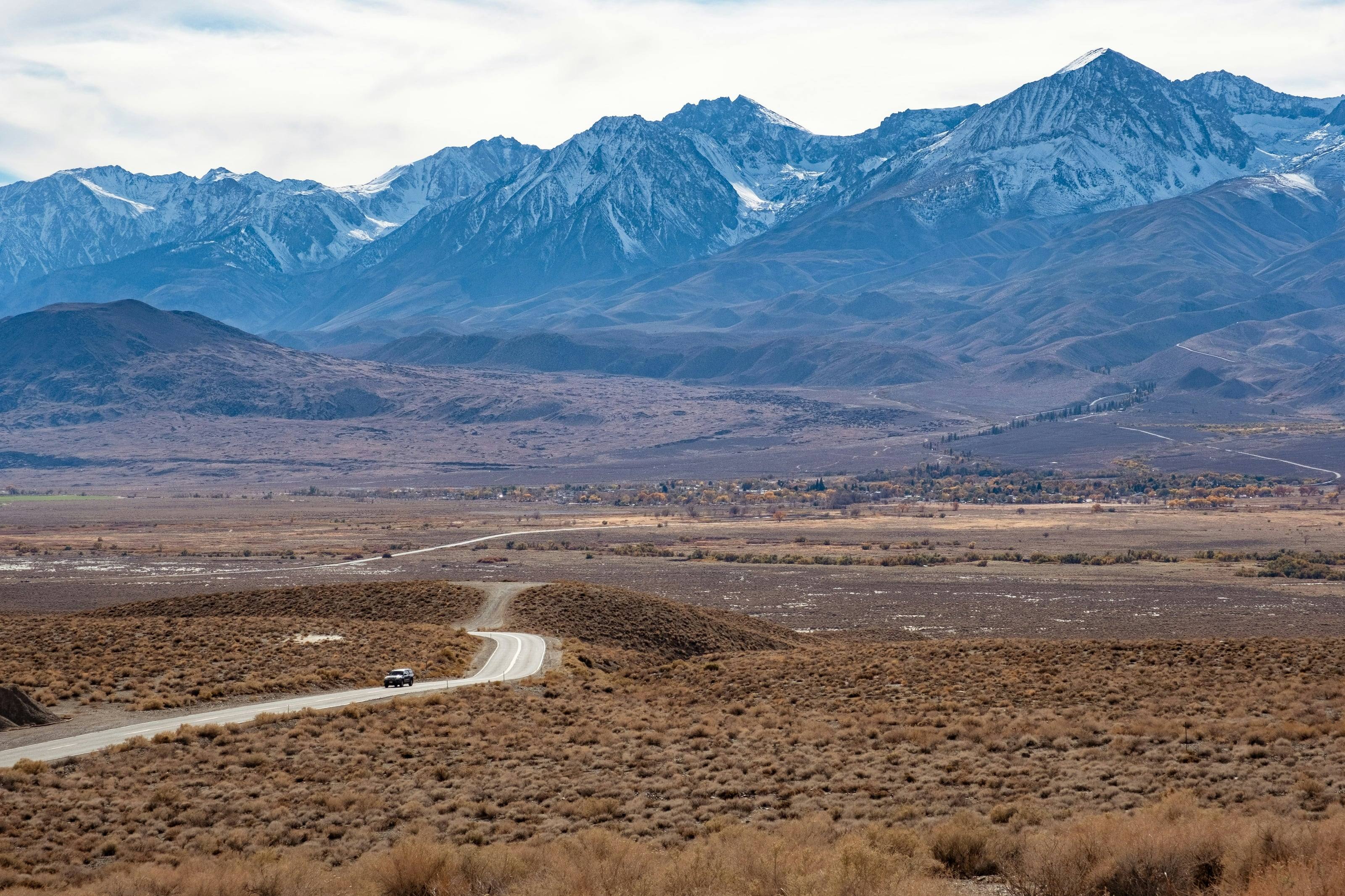
The last stretch is the one NPS writes most about: the crossing of Soda Dry Lake. Street-legal vehicles may use the road itself, but “land on both sides of the road is protected as wilderness,” and the lakebed is never truly dry. It is the terminal basin of the mostly underground Mojave River, and the ground is always moist just beneath the surface. The road is compacted by decades of traffic. Off it, the lakebed “can be a deep and sticky slurry.” NPS puts water on Soda Lake first among the seasonal hazards, so this is the section to ask about before you start.
The preserve ends near Zzyzx, where the Desert Studies Center is a working campus. NPS says public entry to Zzyzx is only by Zzyzx Road from Interstate 15, not from the lakebed. Beyond the boundary the road continues on land managed by the Bureau of Land Management, where, NPS notes, vehicle rules are not the same.
Source 1
Vehicle and driver requirements
The Mojave Road page says the road “is not regularly maintained, and some sections are rough and sandy; 4 x 4 is recommended.” The preserve’s conditions table is firmer. It lists the Mojave Road as “4WD ONLY,” and the entry reads: “4WD with heavy duty tires, 4L low range transfer case, and high clearance required for safe travel. Not appropriate for All Wheel Drive SUVs.” The same page defines high clearance for backcountry roads as 8 inches or more.
Every vehicle must be street legal under California rules, with current registration and tags, lights, turn signals and valid insurance. Jeeps and trucks licensed in any state are fine. ATVs, UTVs and side-by-sides are not permitted, and NPS points out that they cannot complete the segment that crosses the preserve.
NPS recommends that vehicles do not attempt the road alone, because two or more can extricate each other, and that you carry a good map instead of depending solely on GPS. Most of the road has no reliable cell phone coverage.
What NPS says to check and carry
- 01Tires, oil and fuel gauge, checked before you start.
- 02Tools, a tire jack and a tow rope.
- 03Extra water, and fluids for the vehicle.
- 04From the off-pavement guide: an all-terrain spare and a second spare, a shovel, and a satellite phone or messenger.
Source 6
Permits and camping along the road
There is no permit and no registration fee for driving or camping on the Mojave Road, and all campsites are first come, first served. The exception is size: groups of more than 7 vehicles or 25 people require a Special Use Permit, and NPS asks for up to a month of processing time.
Camping is roadside camping under the preserve’s rules: previously used sites only, with vehicles kept in the previously disturbed area. Find a site that fits the group, and do not enlarge one to take extra vehicles or tents.
The roadside camping rules
- 01Camp more than 200 yards from any natural or constructed water source. That rules out camping at the springs themselves.
- 02No camping within 1/2 mile of Fort Piute, within 1/4 mile of any paved road, or within 1/4 mile of the Zzyzx access road.
- 03Fires only in an existing fire ring or a fire pan. Bring firewood with you: collecting or cutting it is prohibited.
- 04Pack out all trash, including toilet paper. Bury human waste at least 6 inches deep.
- 05There is a 14-day camping limit.
Source 7
Fuel and water
There is no fuel on the road or anywhere else in the preserve. The preserve’s FAQ lists the nearest stations at Baker, Cima Road at Interstate 15, Primm, Searchlight, Fenner, Amboy and Ludlow, and warns that running out of gas is a common and expensive problem. NPS does not publish distances between services along the Mojave Road. Work from its one figure, roughly 150 miles, allow for the rough and sandy going that raises fuel use, and confirm your stations before you leave.
Carry all your water. The conditions page lists potable water at only three places in the preserve, the Kelso Depot bathhouse, the Hole-in-the-Wall Visitor Center and Hole-in-the-Wall Campground, and the safety page sets the minimum at one gallon per person per day. The camping page says there is rarely naturally occurring water in the preserve, so treat the springs as history, not supply.
Source 8
When to drive it
NPS publishes no season for the road, but its four-wheel-drive page gives clear advice. Spring and fall offer the most comfortable temperatures and the biggest crowds. Winter days can reach a comfortable 65 degrees or so, with nights below freezing, especially at higher elevations. “Travel during the summer is not recommended.” The Mojave Road page lists the seasonal hazards that can stop a trip: water on Soda Lake, washouts from summer monsoon floods, and winter snow or ice.
Source 9
Hazards
Sand is the usual problem. The off-pavement guide says most rescues involve vehicles stuck in sand, and that many drivers lower tire pressure to 20 psi on soft sand and refill when they return to pavement. Rocks come next: street tires rupture, and drivers sometimes tear the front and rear sidewalls on the same rock.
Weather follows a pattern. In the summer monsoon season, June to September, storms usually occur after 1 pm, so travel in the morning. Above 3,000 feet in winter, roads may be saturated by rain or snow and temperatures can drop well below freezing. The camping regulations say not to make camp in a dry wash, because flash floods develop quickly in the desert, and the National Weather Service warns that 12 inches of rushing water can carry away most cars.
If the vehicle is stuck or broken, stay with it. NPS is explicit that people have died from exposure trying to walk back to the paved roads.
Do not skipFrom the off-pavement guide: “Always assume the road will get worse ahead. If it gets too rough for you, turn around!”
Source 10
Leaving it as you found it
The rules on the Mojave Road page are short. Do not travel cross-country or create new routes: “This rule is strictly enforced; violators will receive citations.” Driving in washes is not permitted. Watch for wilderness boundary signs, because motorized vehicles and bicycles are not allowed in designated wilderness.
On Soda Lake, stay on the road. NPS says tracks left off it scar the lakebed for a decade or more, and that the dust raised by off-road driving harms ecosystems and air quality. Across the preserve, staying on established roads protects the threatened desert tortoise, which spends its days in burrows that a vehicle can crush.
At camp, leave the site better than you found it. Pack out all waste, including toilet paper, which takes a very long time to decompose in the desert. Leave the historic sites alone: at Fort Piute, NPS asks that you do not climb on the foundations or remove anything.
Source 1
Questions people ask
How long is the Mojave Road, and how much of it is in the preserve?
NPS describes the whole road as roughly 150 miles long, between the Colorado River and the Mojave River, and says most of it is within Mojave National Preserve. It does not publish a separate mileage for the part inside the preserve. Driving the entire length usually takes 3 days.
Do I need four-wheel drive for the Mojave Road?
Yes. The Mojave Road page recommends 4 x 4, and the preserve’s conditions table lists the road as 4WD only, requiring heavy duty tires, a low range transfer case and high clearance, and says it is not appropriate for all-wheel-drive SUVs.
Do I need a permit to drive or camp on the Mojave Road?
No. There is no registration fee and campsites are first come, first served. Groups of more than 7 vehicles or 25 people need a Special Use Permit, and NPS asks for up to a month of processing time.
Can I drive an ATV or side-by-side on the Mojave Road?
Not inside the preserve. All vehicles must be street legal under California rules. ATVs, UTVs and side-by-sides are not permitted in Mojave National Preserve and cannot complete the segment of the road that crosses it.
Where can I camp along the road?
In previously used roadside sites, more than 200 yards from any water source, and not within 1/2 mile of Fort Piute, 1/4 mile of a paved road or 1/4 mile of the Zzyzx access road. Fires go in an existing ring or a fire pan, and there is a 14-day camping limit.
Is there fuel or water on the Mojave Road?
No fuel: gas is not sold in the preserve, and NPS lists the nearest stations at Baker, Cima Road at Interstate 15, Primm, Searchlight, Fenner, Amboy and Ludlow. NPS lists potable water at only three places in the preserve, so carry what you need, at least one gallon per person per day.
 Bureau of Land Management (BLM)
 US Forest Service (USFS)
 National Park Service (NPS)
 US Fish and Wildlife (USFW)
 Bureau of Reclamation (USBR)
 Department Of Defense (DOD)
 Bureau of Indian Affairs (BIA)
 Other Federal
 State
 Local
 Alaska Native Lands (Patented or Interim Conveyed)
 Alaska Native Allotment
 Road
 Primitive Road
 Road
 Primitive Road
 Trail
 Roads open to all Vehicles, Yearlong
 Roads open to all Vehicles, Seasonal
 Roads open to highway legal vehicles only, Yearlong
 Roads open to highway legal vehicles only, Seasonal
 Special Designation, Yearlong
 Special Designation, Seasonal
 Trails open to all vehicles, Yearlong
 Trails open to all vehicles, Seasonal
 Trails open to vehicles 50" or less in width, Yearlong
 Trails open to vehicles 50" or less in width, Seasonal
 Trails open to motorcycles, Yearlong
 Trails open to motorcycles, Seasonal
 Special Designation, Seasonal
 Trails Open to Wheeled Vehicles Only < 50" in Width, Yearlong
 Trails Open to Wheeled Vehicles Only < 50" or Less in Width, Seasonal
 Wilderness Area
 Wilderness Study Area