Death Valley is over 93 percent designated wilderness, and the way into it is a road network the National Park Service puts at nearly a thousand miles of pavement and dirt. Graded county roads, canyon washes and rough passes thread between the wilderness blocks. They are the reason to bring a capable vehicle here, and the reason to prepare it properly.
This guide covers how the park classes its unpaved roads, what it asks of your vehicle, where you may camp beside a dirt road and where you may not, which camps need a reservation, and what heat and flash floods mean for a trip. It does not report conditions. The park warns that weather changes its roads regularly, and its conditions page is the only place to learn what is open this week.
Why drive Death Valley
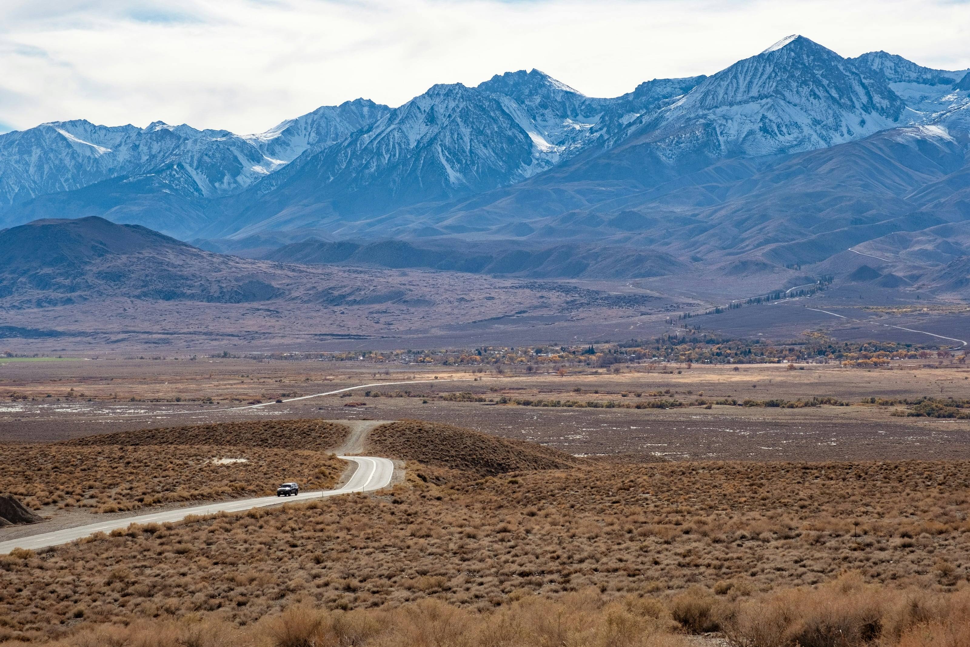
The National Park Service says Death Valley has more miles of roads than any other national park. Over 93 percent of its 3.4 million acres is roadless wilderness, yet nearly one thousand miles of paved and dirt roads run between the wilderness blocks, with the wilderness boundary 50 feet from the center line of most backcountry dirt roads. You drive a narrow legal corridor through country otherwise reached only on foot or horseback.
The park’s backcountry map lists what those corridors reach: canyon narrows, ghost town sites, the Eureka Dunes, the charcoal kilns and pinyon pine forest of upper Wildrose, and Butte Valley, which it calls famous for its isolation. The same agency warns that rescue out here is likely to be extremely delayed, and asks you to travel prepared to survive.
Source 1
When to go, and the campgrounds that anchor a trip
The park’s camping page splits the year in two. Winter and spring run from mid-October to mid-April. Summer runs from mid-April to mid-October, when “midnight temperatures can still be over 100 degrees.” Its summer advice: “Due to excessive summer heat, it is recommended to stay in developed campgrounds only,” because travel on primitive, unpaved roads “increases the risk of vehicle breakdowns, exposure to elements, poor cell service and lack of water.” In winter, the backcountry roads page adds, snow and ice at higher elevations may require tire chains.
Furnace Creek Campground takes reservations for its October 15 to April 15 season, up to 6 months in advance; every other NPS campground is first-come, first-served. Length limits are 25 feet total at Mahogany Flat, Thorndike and Wildrose, and 35 feet at Texas Springs and Mesquite Spring; Emigrant is tents only. Primitive campgrounds need a high clearance 4x4 and have no water or services. Camping is limited to 14 days per calendar year at Furnace Creek and 30 days per calendar year elsewhere in the park.
Source 4
How the park classes its dirt roads
Plan from the Backcountry and Wilderness Access Map. It calls Death Valley the largest national park outside of Alaska, sorts the unpaved roads into four classes and describes every major road, with the caveat “Subject to change. Weather will impact road conditions.”
It defines a high clearance four-wheel-drive vehicle as an SUV or truck with at least 15 inch tire rims, 8 inches or more of clearance from the lowest point of the undercarriage, mechanical power to both front and rear wheels at the same time, and a low gear transfer case. All-wheel-drive and crossover vehicles sit a class below because they lack low range.
Titus Canyon Road is high clearance, one-way from east to west, with no RVs, campers or trailers. Racetrack Road is high clearance “with off-road tires due to loose gravel, deep washboard, and sharp rocks,” flat tires are very common, and driving on the lakebed is prohibited. Lippincott Road, Steel Pass Road and Mengel Pass are rough four-wheel drive for experienced drivers only. Many roads change class partway: Echo Canyon is high clearance for the first three miles and four-wheel drive beyond, and Cottonwood Canyon is high clearance for the first 8 miles, then four-wheel drive where it drops into the wash.
The four road classes on the NPS map
- 01Low clearance two-wheel drive: maintained dirt, light to moderate washboard and packed gravel.
- 02High clearance two-wheel drive and all-wheel drive: maintained dirt with rocky areas, rough washboard, soft gravel or sand, unsafe for low clearance vehicles.
- 03High clearance four-wheel drive: unmaintained, with technical rocky areas, deep sand or gravel and steep grades.
- 04Rough four-wheel drive: remote and unmaintained, with tall rock ledges, deeply eroded ruts, tight switchbacks, exposed slopes and dry waterfalls.
Source 3
What your vehicle needs
Flat tires are the common failure. The backcountry roads page blames rough roads and unsuitable tires, and asks for “off-road” tires rather than highway or street tires. It also says to travel in a group of two or more four-wheel-drive vehicles in remote areas and on rough roads, or to leave a trip plan with someone who will follow up.
Most rental agreements restrict vehicles to paved roads, and the park tells renters to check that the spare is good, accessible and not locked into a keyed holder. Only licensed, street-legal vehicles may use park roads: ATVs, dirt bikes and vehicles with off-road “green sticker” registration are prohibited, paved or dirt.
What NPS says to carry
- 01At least one inflated spare tire, preferably two; the notice at the top of the page says 2 full size spares.
- 02Tire sealant or a plug kit, a 12-volt air compressor, a lug wrench and every part of your jack.
- 03Basic tools and a shovel.
- 04Water: at least a gallon per person per day in hot weather, plus a 5-gallon container as emergency backup.
- 05A full gas tank, and paper maps. “Don’t rely on GPS.” Most backcountry junctions are unmarked.
Do not skipDriving off roads is prohibited, and so is operating a vehicle in a manner that causes unreasonable damage to the surface of a park road. The park’s words: “Honor road closures. If in doubt, do not drive.”
Source 1
Roadside camping: where it is legal
Backcountry roadside camping is allowed “along dirt roads at least one mile down the road from the junction with any paved road or ‘day use only’ dirt road.” Camp only in previously disturbed areas and park immediately adjacent to the roadway.
Four areas are by reservation only: designated sites along Echo Canyon, Hole in the Wall and Cottonwood and Marble Canyon roads, and roadside camping in Greenwater Valley. Permits come from Recreation.gov up to 6 months in advance, and the park’s permit table lists them at $10 a night as of September 2026. Everywhere else a backcountry permit is free and recommended, from the Furnace Creek Visitor Center, the Stovepipe Wells Ranger Station or the park’s online form.
Where NPS says you may not camp, and the rules where you may
- 01No camping along paved roads, in pullouts or parking lots, or at the Keane Wonder Mine, Ubehebe Lead Mine and Skidoo Mill.
- 02None on the valley floor from Ashford Mill to 2 miles north of Stovepipe Wells, on the Eureka Dunes or in Greenwater Canyon.
- 03None on day use only dirt roads, among them Titus Canyon, West Side, Wildrose, Skidoo and Aguereberry Point roads, the first 8 miles of Cottonwood Canyon Road, Racetrack Road from Teakettle Junction to Homestake Dry Camp, and the 22 miles of Big Pine Road inside the park.
- 04Groups: 12 people and no more than 4 vehicles. Larger groups split up and camp at least 1/2 mile apart.
- 05Fires only in a fire pan, with all ash packed out. No wood gathering. Camp stoves and propane grills are allowed.
- 06Camp more than 100 yards from any water source. Bury human waste 4 to 6 inches deep, at least 200 yards from water or camp.
Do not skipDo not camp in dry washes or drainages. The park gives the reason plainly: potential flash flood danger.
Source 2
Fuel, water and breakdowns
NPS lists three gas stations inside the park. Furnace Creek sells two grades of gasoline and diesel, Panamint Springs sells gasoline and diesel, and Stovepipe Wells sells 87-octane gasoline but no diesel. Confirm hours and supply before you go, and top off before any backcountry loop.
Drinking water is available at Furnace Creek, Stovepipe Wells and Panamint Springs, according to the safety page. Springs may be dry or contaminated, and the park says not to depend on them.
There is no cell phone service along most park roads, and the dirt road entrances have no services for many miles. “Help may be many hours away; travel prepared to self-rescue.” If the vehicle fails, the backcountry roads page says to stay with it, leave the hood up and mark the road with a large X visible to aircraft. Towing charges are high, and auto club cover often does not extend to dirt roads.
Source 5
Heat, flash floods and old mines
The park’s safety page calls Death Valley the hottest place in the world, with summer temperatures as high as 130°F and nights up to 90°F. Drink at least one gallon of water a day. The weather page puts average rainfall at less than 2 inches, yet occasional thunderstorms, especially in late summer, can cause flash floods.
The park describes flash floods as quick, unpredictable and loaded with rocks and branches. The National Weather Service supplies the numbers that matter in a vehicle: 12 inches of rushing water can carry away most cars, and 2 feet can carry away SUVs and trucks. It is never safe, the agency says, to drive or walk into flood waters.
The safety page adds that most deaths in Death Valley are single vehicle rollovers, so obey posted speed limits and use low gear on steep downhill grades, and that old mines may have hidden shafts, bad air and poisonous gas. Stay out of them.
Do not skipIf you are caught in heavy rain or a flood, the park says to find higher ground immediately. Stay out of canyons during a rainstorm or when there is a high chance of rain.
Source 6
Entrance fees and passes
Every visitor needs an entrance pass. As of September 2026 the park’s fees page lists the private vehicle pass at $30, good for everyone in the vehicle for 7 days, and states that the park does not accept cash. Visitors entering on a dirt road can pay in advance on Recreation.gov and display a printed pass on the dashboard, the directions page adds.
Source 9
Who to check with before you go
The park’s Alerts and Conditions page carries a road status map, lists of paved and unpaved roads under closure or caution, campground status, and links to Inyo County, Caltrans and Nevada road information for the approaches. Read it the day you leave, because nothing in this guide tells you what is open. If in doubt whether a spot is legal for camping, ask a ranger at the Furnace Creek Visitor Center or call (760) 786-3200.
Source 10
Questions people ask
Do I need four-wheel drive for Death Valley’s backcountry roads?
It depends on the road. The park’s Backcountry and Wilderness Access Map sorts unpaved roads into four classes, from low clearance two-wheel drive to rough four-wheel drive, and many roads change class partway. It defines a high clearance four-wheel-drive vehicle as an SUV or truck with at least 15 inch rims, 8 inches or more of clearance and a low gear transfer case.
Where can I camp beside a dirt road in Death Valley?
Along dirt roads at least one mile from the junction with any paved road or day use only dirt road, in a previously disturbed area with the vehicle parked immediately adjacent to the roadway. Camping is not allowed on the valley floor from Ashford Mill to 2 miles north of Stovepipe Wells, on the Eureka Dunes, in Greenwater Canyon, on day use only roads or at the listed historic mining areas.
Do I need a permit for roadside camping?
A reserved permit from Recreation.gov is mandatory for designated sites along Echo Canyon, Hole in the Wall and Cottonwood and Marble Canyon roads and for roadside camping in Greenwater Valley. For all other roadside camping the park’s backcountry permit is free and recommended rather than required.
Can I have a campfire in the backcountry?
Only in a fire pan, and you pack out all the ash. The park prohibits campfires except in the metal fire rings it provides in campgrounds or in fire pans in the backcountry, and gathering wood is not allowed. Camp stoves and propane grills are allowed.
Where can I get fuel in Death Valley?
NPS lists three gas stations in the park: Furnace Creek (gasoline and diesel), Panamint Springs (gasoline and diesel) and Stovepipe Wells (87-octane gasoline, no diesel). Confirm before you go, and fill up before leaving pavement.
Should I drive the backcountry in summer?
The park advises against it. Its camping page recommends staying in developed campgrounds only during summer, because travel on primitive, unpaved roads increases the risk of breakdowns, exposure, poor cell service and lack of water.
 Bureau of Land Management (BLM)
 US Forest Service (USFS)
 National Park Service (NPS)
 US Fish and Wildlife (USFW)
 Bureau of Reclamation (USBR)
 Department Of Defense (DOD)
 Bureau of Indian Affairs (BIA)
 Other Federal
 State
 Local
 Alaska Native Lands (Patented or Interim Conveyed)
 Alaska Native Allotment
 Road
 Primitive Road
 Road
 Primitive Road
 Trail
 Roads open to all Vehicles, Yearlong
 Roads open to all Vehicles, Seasonal
 Roads open to highway legal vehicles only, Yearlong
 Roads open to highway legal vehicles only, Seasonal
 Special Designation, Yearlong
 Special Designation, Seasonal
 Trails open to all vehicles, Yearlong
 Trails open to all vehicles, Seasonal
 Trails open to vehicles 50" or less in width, Yearlong
 Trails open to vehicles 50" or less in width, Seasonal
 Trails open to motorcycles, Yearlong
 Trails open to motorcycles, Seasonal
 Special Designation, Seasonal
 Trails Open to Wheeled Vehicles Only < 50" in Width, Yearlong
 Trails Open to Wheeled Vehicles Only < 50" or Less in Width, Seasonal
 Wilderness Area
 Wilderness Study Area