-
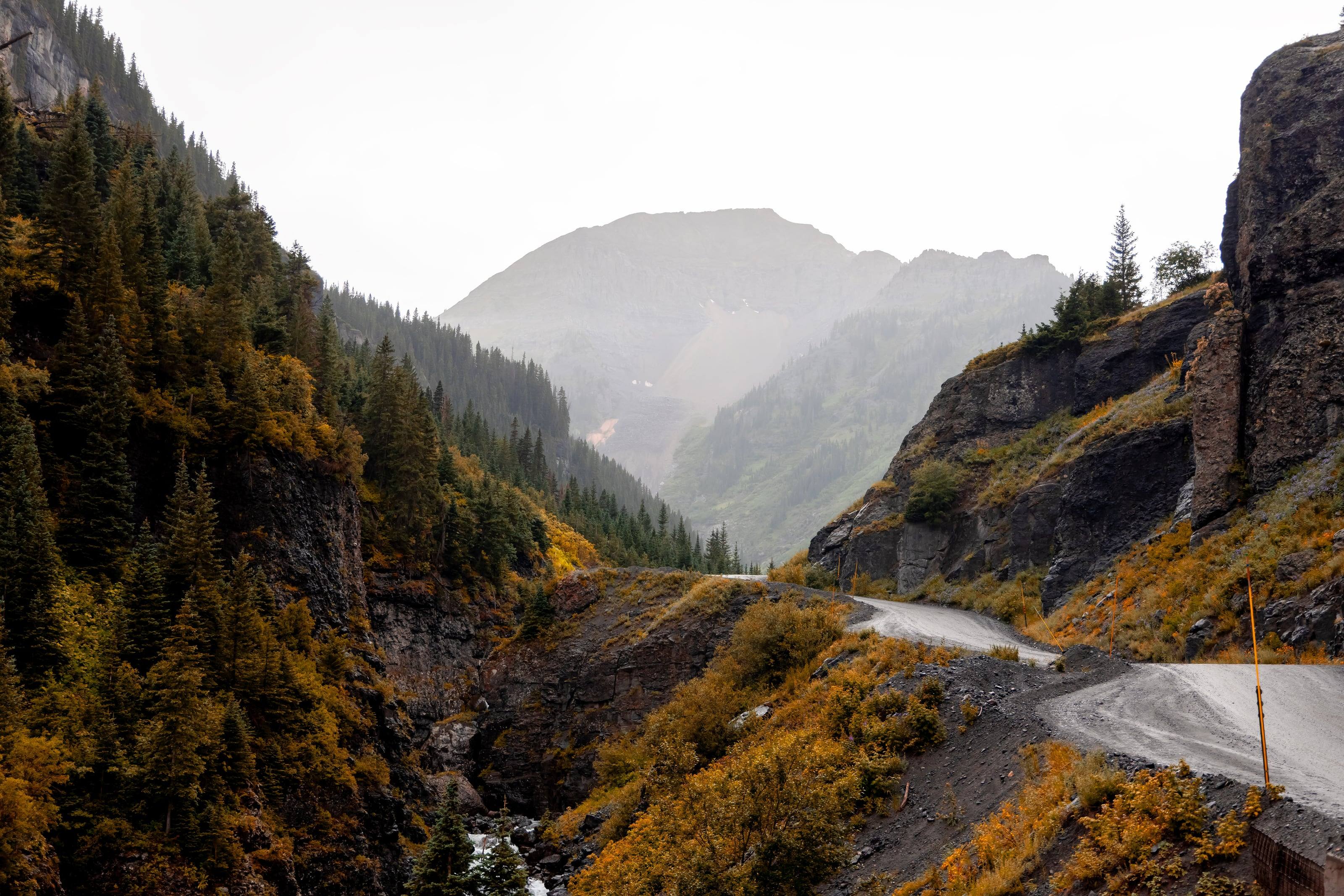
Alpine Loop Back Country Byway
12,800 ft 63 miles
Lake City, Silverton and Ouray
The BLM calls it a 4x4-only road and lists it at 63 miles (its 2023 brochure says 65). It crosses Engineer Pass at 12,800 feet and Cinnamon Pass at 12,620. The brochure gives 28 miles from Animas Forks to Lake City over Cinnamon and 26 miles back over Engineer. 14
- Vehicle
- High-clearance four-wheel drive
- Season
- Summer. Closed in winter; Ouray County aims to open its passes by July 4
-
Telluride and Ouray
Tomboy Road climbs from Telluride to 13,114 feet and joins Camp Bird Road on the Ouray side. The Forest Service opens it to all motor vehicles but strongly recommends a high-clearance four-wheel drive. 17
- Vehicle
- High clearance and four-wheel drive strongly recommended
- Season
- July, per the Forest Service. Ouray County aims to open it by July 4
-
Black Bear Pass
12,840 ft
US 550 at Red Mountain Pass, down to Telluride
The Forest Service calls it very technical. The switchbacks above Bridal Veil Falls are one-way downhill, and a short wheelbase is strongly recommended for them. 18
- Vehicle
- High clearance, short wheelbase, four-wheel drive. Not for inexperienced drivers
- Season
- July, per the Forest Service
-
Alma and Fairplay to Leadville
Steep and very rocky, and rated moderate to difficult by the Forest Service. Its auto tour covers the 9 1/2 miles from the Fairplay side to the 13,182-foot summit. 20
- Vehicle
- High-clearance four-wheel drive recommended
- Season
- Usually six to eight weeks after the snow melts in July
-
US 550 north of Silverton to Ophir
Rated a generally easy four-wheel-drive road. One narrow half-mile shelf on the Ophir side makes passing difficult. The same forest’s scenic travel corridors page puts the crossing at 11,789 feet, 25 feet lower than its own road page; the road page figure is used here. 19
- Vehicle
- High clearance and four-wheel drive recommended
- Season
- June, per the Forest Service
-
Last Dollar Road
10,000 ft
Ridgway and Telluride, west of CO 62 and CO 145
Forest Road 638, which the Forest Service offers as a scenic alternative to the paved highway between Ridgway and Telluride. It runs through rural ranch country before climbing into spruce, fir and aspen, and the forest lists it at an elevation of 10,000 feet. The warning is specific and worth taking at face value: the road is extremely slippery when wet, and portions can become impassable in wet conditions. 55
- Vehicle
- High clearance and four-wheel drive recommended
- Season
- June, per the Forest Service
-
Canyon Creek and Yankee Boy Basin
Ouray south on County Road 361, the Camp Bird Road, into Yankee Boy Basin below Mount Sneffels
The Forest Service lists this as a high-clearance four-wheel-drive road on the Ouray Ranger District, through a high-walled canyon and old mine sites to wildflower basins below the Mount Sneffels Wilderness. It says medium to high clearance vehicles are required to reach the basin and four-wheel drive is recommended beyond it to the Mount Sneffels trailhead, with the last mile gravel and rough. Ouray County clears its high-country roads from May and tries to have them open by July 4. No agency page read for this guide publishes a length or a summit elevation for it, so neither is given. 56
- Vehicle
- High-clearance four-wheel drive. Medium to high clearance to reach the basin, four-wheel drive recommended beyond it
- Season
- Usually open by mid-June, per the Forest Service
-
Crested Butte north up the Gothic Road to Marble
County Road 317 runs north from Crested Butte about 10 miles to the forest boundary and on over the pass, which Gunnison County describes as the high point on the Gothic Road linking Marble and Crested Butte. The county is blunt about it: accessible only by high-clearance four-wheel-drive trucks, with treacherous sections, and it warns drivers not to be lulled by the easy and beautiful stretches that lead into the upper Crystal River gorge. The county publishes no elevation for the pass itself, so none is given here. 57
- Vehicle
- High-clearance four-wheel-drive trucks only. Not for long wheelbase vehicles
- Season
- Closed except for one to two months in late summer, because of snow or mud
-
Vail Pass on I-70 to the town of Redcliff
Forest Road 712, a dirt road off exit 190 at Vail Pass that runs down to Redcliff and can be driven in either direction. It gives views of Mount of the Holy Cross in the Sawatch Range and access to the Shrine Mountain trail and the Holy Cross overlook 3.7 miles along. The White River lists a trailhead elevation of 8,669 feet at the site rather than a summit figure, so no pass elevation is given here, and the forest applies its Eagle-Holy Cross seven-day summer camping limit to the road. 58
- Vehicle
- Passable by all but the lowest passenger cars
-
Montezuma, in Summit County, south over the Divide toward Handcart Gulch
Forest Development Road 285 climbs to 12,098 feet from the old mining town of Montezuma, seven miles up County Road 5 from US 6 past Keystone. The Forest Service closes it in spring to prevent road damage, with over-the-snow machines exempt, and says it connects with other four-wheel-drive roads in the area. Dispersed camping is available along it. 59
- Vehicle
- Four-wheel drive recommended
- Season
- Typically July 1. Motor vehicles are prohibited from April 1 to June 30 every year
-
Boreas Pass
11,488 ft 21 1/2 miles
Breckenridge to Como, over the Continental Divide
A graded county road on the bed of the Denver, South Park and Pacific, once the highest narrow-gauge railroad in the country, which ran here from 1872 to 1938. Because it is a railroad grade it climbs at about 3 percent, which makes it one of the gentler ways over the Divide in Colorado. The Forest Service auto tour covers 21 1/2 miles from Como to Breckenridge, the White River puts the summit at 11,488 feet and gives 10.4 miles from there down to Como, and Summit County limits dispersed camping along the road to numbered designated sites. 60
- Vehicle
- Highway-legal vehicles only
- Season
- Open to highway-legal vehicles May to October, then closed at Summit County’s discretion
-
Rollins Pass
12,233 ft 15 miles from Winter Park to the Divide
Winter Park east to the Continental Divide. The Needle’s Eye Tunnel has collapsed, so it is no longer a through route by vehicle
County Road 80, Forest Road 149, leaves US 40 about a mile south of Winter Park and climbs 15 miles to 12,233 feet on the Divide, giving access to the Indian Peaks and James Peak wildernesses, the Moffat Railroad sites and the Continental Divide National Scenic Trail. The Forest Service says you may hike or bike around the collapsed Needle’s Eye Tunnel to the Forest Road 149 that leads down to Rollinsville, which is the plain way of saying a vehicle cannot cross. 62
- Vehicle
- High-clearance four-wheel drive highly recommended
- Season
- Closed November 15 to June 15, and snow usually holds it shut until late June or early July
-
Steamboat Springs northeast to Walden, over the Park Range
National Forest Road 60, about 15 miles of scenic dirt reached from Routt County Road 36 north of Steamboat Springs and then County Road 38. The Forest Service describes it climbing from sagebrush and gambel oak into lodgepole, aspen and spruce-fir, with elevations running from 6,700 feet in Steamboat Springs to 10,400 feet at Summit Lake Campground, which usually does not open until mid July because of the altitude. No summit elevation is published for the pass itself, so none is given here. 63
- Vehicle
- Dirt road, with no published vehicle class
- Season
- Mid-June to November
-
Owl Creek Pass Road
10,114 ft
The Cimarron Ridge country, on the Ouray Ranger District of the Uncompahgre National Forest
A surfaced Uncompahgre National Forest road over a 10,114-foot pass under the Cimarron Ridge, with the 12,152-foot monolith of Courthouse Mountain and 11,781-foot Chimney Rock above it. It is the gentlest of the Ouray Ranger District’s scenic travel corridors, and Ouray County lists Owl Creek Pass among the high-country roads it clears from May with the aim of opening by July 4. 54
- Vehicle
- Surfaced road
- Season
- Should be open by June, per the Forest Service
-
Gold Belt Tour Back Country Byway
131 miles
Cañon City, Florence, Florissant, Cripple Creek and Victor, by Shelf Road, Phantom Canyon and High Park Road
Three legs form a loop of about 131 miles: Phantom Canyon on an old railroad bed, Shelf Road on the 1892 stagecoach toll road, and paved High Park Road. CDOT says Phantom Canyon climbs 4,550 feet in about 30 miles and that both Phantom Canyon and Shelf Road are narrow and rugged in places, with one stretch of Shelf Road clinging to a canyon wall 200 feet above the stream bed. It has been a BLM Back Country Byway since 1989 and a National Scenic Byway since 2000, and the BLM applies a 14-day stay limit on the public land along it. 64
- Vehicle
- Four-wheel drive recommended on Upper Shelf. No vehicles over 25 feet on Phantom Canyon Road
- Season
- CDOT allows about five hours for the loop
-
Flat Tops Trail Scenic Byway
82 miles
Meeker and Yampa, across the White River Plateau on County Road 8
Eighty-two miles through the heart of the original White River Plateau Timberland Reserve, the second unit of what became the national forest system, and past Trappers Lake, where development was banned decades before the 1964 Wilderness Act. CDOT calls it a working byway of active mines, ranches and timber ground and gives two pieces of advice that tell you what kind of road it is: fill the tank in Yampa or Meeker, and stay off it when it is wet. 66
- Vehicle
- CDOT allows two hours and warns that the roads are muddy when wet
- Season
- Closed in winter on the west side at about mile point 31 and on the east side at Dunkley Pass
-
Kebler Pass, on the West Elk Loop
205 miles for the loop, with 31 miles of gravel over the pass
Crested Butte west to Paonia and the North Fork valley, within a loop through Carbondale, Hotchkiss, Crawford and Gunnison
CDOT puts the West Elk Loop at 205 miles and six to eight hours, anchored by Mount Sopris at one end and Black Canyon of the Gunnison at the other, with access to the White River and Gunnison national forests, Curecanti National Recreation Area and Crawford and Paonia state parks. The Grand Mesa, Uncompahgre and Gunnison give the loop as 204 miles on their own corridors page. The part that matters to a driver is the 31-mile gravel section over Kebler Pass, which closes for the winter. 67
- Vehicle
- Gravel. CDOT publishes no vehicle class for it
- Season
- The gravel section over Kebler Pass is closed in winter
-
Colorado River Headwaters Byway
80 miles
Grand Lake to State Bridge, by Granby and Kremmling
Eighty miles down the Colorado from its source at Grand Lake, Colorado’s largest natural lake, ending on a gravel road through Upper Gore Canyon. CDOT’s own note is the useful one: the road between Kremmling and State Bridge has a gravel surface and limited visitor services. It was designated a National Scenic Byway in 2005 and is one of the 13 America’s Byways in the state. 68
- Vehicle
- Gravel between Kremmling and State Bridge, where visitor services are limited
- Season
- CDOT allows two hours
-
San Juan SkywayPaved
236 miles
Durango, Silverton, Ouray, Ridgway, Telluride, Dolores, Mancos and Cortez in a loop
The paved loop the rest of this list hangs off. CDOT puts it at 236 miles past Mesa Verde National Park and five million acres of national forest, and names the Ouray to Silverton segment the Million Dollar Highway; the Forest Service calls it a paved state highway winding 236 miles through five million acres of the San Juan and Uncompahgre, and applies the Million Dollar Highway name to the whole loop. The U.S. Secretary of Transportation designated it an All-American Road, the highest level, in 1996. CDOT’s advice for summer is the Weather Service’s: be ready for afternoon thundershowers. Nearly every four-wheel-drive road in the San Juans, including the Alpine Loop, Imogene, Black Bear, Ophir and the Yankee Boy road, leaves this loop somewhere. 72
- Vehicle
- Any car
- Season
- CDOT allows six hours and tells drivers to ask about road conditions in winter
-
Grand Mesa Scenic and Historic BywayPaved
63 miles
I-70 at Mesa south over the Grand Mesa to Cedaredge
Sixty-three miles from the canyon of Plateau Creek up onto the Grand Mesa at about 11,000 feet, past more than 300 stream-fed lakes, with the Lands End Overlook on the rim. A paved state highway between I-70 and Cedaredge, in the words of the Forest Service, which gives the same 63 miles as CDOT, though the Lands End Road entry on the same page calls the byway 55 miles. It was designated a National Scenic Byway in 1996. 73
- Vehicle
- Any car. Services between Cedaredge and Mesa are limited
- Season
- CDOT allows two hours. The Grand Mesa Visitor Center opens Memorial Day weekend and closes the last Sunday in September
-
Leadville to Basalt, by Ruedi Reservoir
From Leadville the road crosses the pass into the White River National Forest and follows the Fryingpan valley to Highway 82. The Forest Service calls it very rough. 21
- Vehicle
- High-clearance four-wheel drive recommended
-
St. Elmo to Tincup
Forest Road 267 starts a quarter mile beyond the bridge in St. Elmo, 16 miles west of Nathrop on County Road 162. The Forest Service does not publish an elevation or a season for it, so neither is given here. 22
- Vehicle
- Four-wheel drive required
-
Medano Pass Primitive Road
10,040 ft 22 miles
Great Sand Dunes to the Wet Mountain Valley and Highway 69
A rough 22-mile road that fords Medano Creek nine times. The Park Service requires a low-range transfer case and bans all-wheel-drive and two-wheel-drive vehicles beyond the Point of No Return. 23
- Vehicle
- High-clearance four-wheel drive with low range. All-wheel drive is not allowed
- Season
- Usually mid to late May until late November
-
Rimrocker Trail
160 miles
Montrose to Moab, Utah, by Nucla
Fuel is available at Nucla, roughly halfway. The trail’s own site recommends the Nucla to Moab portion for high-clearance four-wheel drives and OHVs only. 24
- Vehicle
- Four-wheel drive and high clearance recommended west of Nucla
- Season
- Closed in winter. In 2026 it reopened on April 20
-
Colorado Backcountry Discovery Route
745 miles
Four Corners to the Wyoming border, by Telluride, Lake City, Buena Vista, Gypsum and Steamboat Springs
Backcountry Discovery Routes says the whole route is at least double-track, stays above 8,000 feet most of the time and tops out on California Pass at nearly 13,000 feet. 25
- Vehicle
- Built for adventure motorcycles. Drivable in a four-wheel drive
- Season
- July through September
-
Trail Ridge RoadPaved
12,183 ft 48 miles
Estes Park to Grand Lake
The Park Service calls it the highest continuous paved road in the United States. The earliest opening on record is May 7 and the latest June 26. 26
- Vehicle
- Any car. Timed-entry reservations at peak hours
- Season
- Historically opens Memorial Day weekend and closes in autumn
-
Mount Blue Sky Scenic BywayPaved
14,130 ft 28 miles
Idaho Springs to the top of Mount Blue Sky
It climbs more than 7,000 feet in 28 miles. The Forest Service and CDOT both call it the highest paved road in North America. 27
- Vehicle
- Any car under 30 feet. Reservation required
- Season
- Summit road open Memorial Day through Labor Day
 Bureau of Land Management (BLM)
 US Forest Service (USFS)
 National Park Service (NPS)
 US Fish and Wildlife (USFW)
 Bureau of Reclamation (USBR)
 Department Of Defense (DOD)
 Bureau of Indian Affairs (BIA)
 Other Federal
 State
 Local
 Alaska Native Lands (Patented or Interim Conveyed)
 Alaska Native Allotment
 Road
 Primitive Road
 Road
 Primitive Road
 Trail
 Roads open to all Vehicles, Yearlong
 Roads open to all Vehicles, Seasonal
 Roads open to highway legal vehicles only, Yearlong
 Roads open to highway legal vehicles only, Seasonal
 Special Designation, Yearlong
 Special Designation, Seasonal
 Trails open to all vehicles, Yearlong
 Trails open to all vehicles, Seasonal
 Trails open to vehicles 50" or less in width, Yearlong
 Trails open to vehicles 50" or less in width, Seasonal
 Trails open to motorcycles, Yearlong
 Trails open to motorcycles, Seasonal
 Special Designation, Seasonal
 Trails Open to Wheeled Vehicles Only < 50" in Width, Yearlong
 Trails Open to Wheeled Vehicles Only < 50" or Less in Width, Seasonal
 Wilderness Area
 Wilderness Study Area



















