Medano Pass Primitive Road is the back way into Great Sand Dunes National Park and Preserve, and the Park Service is unusually specific about what it takes. The road page calls it “a rough 22 mile road connecting Great Sand Dunes with the Wet Mountain Valley and Colorado State Highway 69,” passable only in the warmer months and only with high-clearance four-wheel-drive vehicles.
The same page publishes the details most agencies leave out: what tire pressure to run in the sand, where the free air station is, how many times you ford Medano Creek and where the 21 roadside campsites sit. This guide follows those instructions as the park writes them, and adds the camping and vehicle rules from the park and preserve compendiums.
What the road is
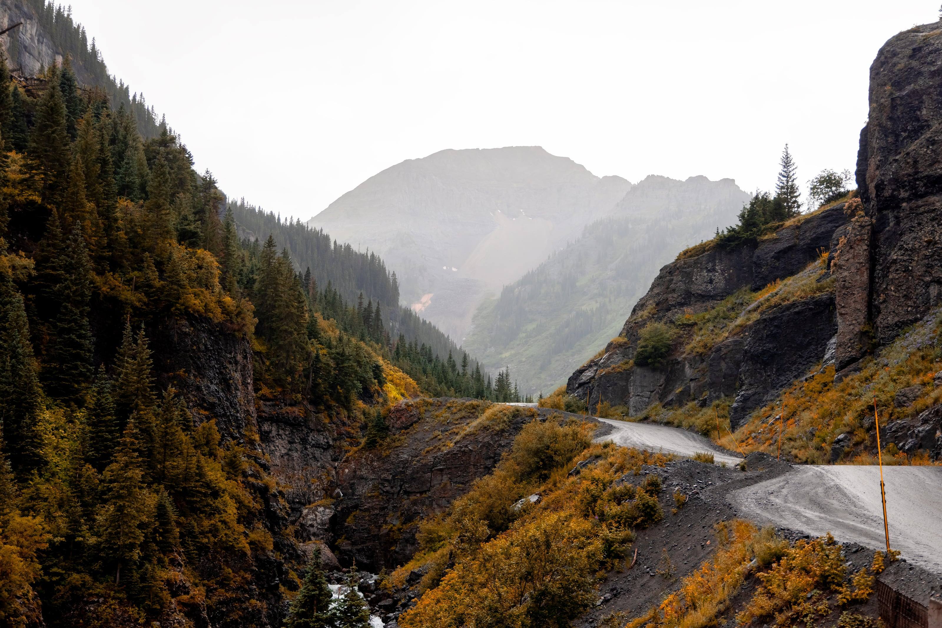
Medano Pass Primitive Road runs 22 miles from the paved road near Piñon Flats Campground, along the eastern edge of the dunefield, up Medano Canyon to Medano Pass at 10,040 feet, and down the far side to Colorado State Highway 69 in the Wet Mountain Valley. The Park Service says it “crosses areas of deep sand, traverses Medano Creek nine times, and passes through excellent habitat for bighorn sheep,” and gives an average driving time of about 2.5 to 3 hours for the whole thing.
It has three characters in one afternoon: sand at the dunes end, creek crossings and meadows in the middle, loose rock on the climb. The park is explicit that your vehicle, its clearance, its weight, the width of your tires and your own confidence in sand are all variables here. Fat bikes are allowed on the road, but not off it.
Source 1
The road, mile by mile
The park publishes a mileage chart and tells you to zero your odometer at the southern entrance. The first mile is the decision point: the Point of No Return parking area is at mile 1.1, and four-wheel-drive vehicles only go beyond it. The Sand Pit at mile 1.8 is the deep sand the road is known for, and the place the park tells you to air down.
Past Castle Creek Picnic Area at 2.6, the road reaches the first crossing of Medano Creek at 4.5, where the park warns spring runoff can be very deep. The park and preserve boundary comes at 5.2 and the roadside campsites begin there. The crossings then come steadily, at 5.6, 6.1, 6.4, 6.8, 7.2, 7.9 where the road steepens, and 9.6, with tributary crossings between them.
Landmarks fill the gaps: Ponderosa Point picnic area at 1.4 with its view of Mount Herard, the Herard family’s 1870s homestead site at 6.2, a tight squeeze at 6.9 with boulders at the roadside, beaver dams at 8.8, cabins burned in a 2010 wildfire at 9.0 and the Medano Lake trailhead at 10.7. A steep section starts at 11.0 and the pass comes at 11.2.
Do not skipTake note of the signs for creek crossings and campsites as you pass them. The park says there is no cellular signal along the road and asks you to know your location before calling dispatch for help.
Source 1
What your vehicle needs
This is one of the few roads in the country where the drivetrain requirement is a regulation rather than a recommendation. The superintendent’s compendium closes the road between the Point of No Return and the northwestern park and preserve boundary to two-wheel-drive and all-wheel-drive vehicles, and the preserve’s compendium closes its own stretch the same way. It defines the terms: a four-wheel-drive vehicle has a driveshaft that can directly power each wheel at the same time and a transfer case that shifts between two and four wheels in low or high gear, and all-wheel drive does not meet that definition.
The park gives the reason. All-wheel drive relies on a centre differential and is not designed to fully power the front tires in soft sand, creek crossings and steep loose rock. Stuck vehicles block a road that is mostly one lane wide, and pulling them out damages vegetation.
The rest of the advice is practical. Full-size four-wheel-drive pickups and SUVs have the clearance; running boards and step bars can bog down in sand or be torn off by rocks; heavy vehicles, or ones loaded with too much gear, may struggle. On the rocky sections the park recommends heavy duty off-road or all-terrain tires, 10 ply or greater sidewall rating. If you are unsure which system your vehicle has, read the owner’s manual rather than trust the badge.
Do not skipATVs, UTVs and side-by-sides are not permitted anywhere in Great Sand Dunes National Park and Preserve. Every vehicle on this road must be highway-legal in Colorado, and Colorado does not recognise ATVs and most UTVs as highway-legal.
Source 3
Sand, tire pressure and the air station
The park’s instruction is exact: “Reduce tire pressure to about 20 psi if the sand is dry and soft.” A free air station sits near the south entrance to the road in the warmer months, open between 7 a.m. and 9 p.m., and the park still advises carrying your own compressor. If you air down you have to air back up before the rocks in Medano Canyon, and the park says to use your own equipment for that.
Two more rules of sand driving come straight from the page. Do not stop in unstable areas, because that is how vehicles get stuck. Do not spin your tires, because that damages both the road and the vehicle. Self-recovery is the park’s first suggestion if you do get stuck and have the equipment for it, since law enforcement response is limited and can be delayed.
Source 1
Medano Creek and the crossings
Medano Creek is snowmelt, so its level is a season and a time of day rather than a fixed thing. Peak flow in an average year comes in late May or early June at about 40 cubic feet per second, measured where the creek first reaches the sand, and flow is typically highest at dawn and lowest in late afternoon.
The park publishes what an average year looks like month by month. The creek usually reaches the dunes parking area in April as a trickle, flow increases through May, and late May and early June bring surge flow along with crowds. By late June the water is often only an inch or two deep, and through the rest of the summer it usually keeps flowing gently, half an inch to an inch deep, along the eastern edge of the dunefield near Castle Creek Picnic Area.
The driving advice is one line: drive through crossings slowly, to avoid drowning your engine. The park publishes a live flow graph, so you can see whether the creek is rising or falling before you commit to the road.
Source 2
Camping along the road
Roadside camping is allowed only at the numbered sites in the national preserve, which begin 5.2 miles from where the road starts and are marked with a post and camping symbol. The sites are free, first-come, first-served, and need no permit. All of them fill on summer holiday weekends and often on other summer weekends.
The preserve’s compendium sets the rules at each site. Camping is permitted in designated, marked sites only. All vehicles must fit within the delineated parking area. Tents must be within 40 feet of, and in view of, the front of the bear-proof food storage locker. Campfires are allowed only in the metal fire grates at designated sites, or in existing fire pits where no grate exists, and firewood is limited to dead and down wood 4 inches or less in diameter.
Food, coolers, toiletries and trash go in the bear boxes, and all trash leaves with you. Human waste is buried six inches deep at least 100 feet from any water source, and toilet paper is carried out. Pets must be leashed or restrained, and there is no off-road driving: park only in designated campsites or parking areas.
Source 4
Getting there, fuel and supplies
The main park area is reached on pavement, by Highway 150 from the south or County Road 6 from the west, and the park is emphatic about navigation: “DO NOT USE COMPUTER MAPPING PROGRAMS IN THE ROCKY MOUNTAINS FOR HIGHWAY TRAVEL.” The common mapping programs, it says, have sent visitors over hiking trails and primitive four-wheel-drive roads, and people have been stranded doing it.
Distances from the visitor center set the scale for supplies. Mosca, the closest town, is 23 miles; Blanca is 25; Fort Garland 29; Alamosa, with full grocery stores, is 37. Medano Pass itself is 13 miles away. The park also lists Westcliffe in the Wet Mountain Valley at 45 miles by way of Pass Creek Pass, a high-clearance four-wheel-drive route, which is a reminder that the far end of the primitive road is a long way from anything.
A store just outside the park entrance and the campground store at Piñon Flats sell limited camping foods, ice and firewood in the warmer months. Buy fuel in the valley towns before you start, confirm hours before you count on anything, and carry your own drinking water: the road has no services.
Source 5
Season, weather and hazards
The road fully opens when weather and road conditions allow, typically in mid to late May, and remains fully open through the end of the fourth rifle hunting season near the end of November. The compendium lists what closes it: hazardous ice or excessive runoff at the crossings, snow, mud and wet conditions that would damage the road or push drivers off it, washouts, fallen hazard trees, and sand too dry to drive without getting stuck.
The weather at the dunes is a high desert pattern. Summer daytime highs average 75 to 80 degrees F, but the sand surface can reach 150 degrees F on sunny afternoons, and the park suggests spending summer afternoons in the mountain part of the park instead. At 8,200 feet, summer nights are cool, with lows that may drop into the 40s, so carry warm layers even in July. Afternoon thundershowers are common in July and August, with cool winds, heavy rain and lightning; the park says to leave the dunes promptly when thunderstorms threaten, because lightning strikes there are common and can be fatal.
Autumn is the other good window. Late September and early October are generally the peak of colour, and hunting is permitted in the preserve in the fall. Every visitor needs an entrance pass; the park’s fees page carries the prices and says there are no advance reservations or timed entries. For anything this guide does not answer, call the visitor center at (719) 378-6395.
Source 6
Questions people ask
Can I drive Medano Pass Primitive Road in an all-wheel-drive SUV?
No. The superintendent’s compendium closes the road to two-wheel-drive and all-wheel-drive vehicles between the Point of No Return and the northwestern park and preserve boundary. The park requires a high-clearance four-wheel drive with a 4 Low transfer case setting, and says all-wheel drive does not meet its definition of four-wheel drive.
What tire pressure should I run?
The park says to reduce tire pressure to about 20 psi if the sand is dry and soft. A free air station near the south entrance to the road is open in the warmer months from 7 a.m. to 9 p.m., but the park still advises carrying your own compressor, because you need to reinflate before the rocky section in Medano Canyon.
How deep are the creek crossings?
It depends on the season. The road crosses Medano Creek nine times, peak flow in an average year is about 40 cubic feet per second in late May or early June, and flow is typically highest at dawn and lowest in late afternoon. The park warns that spring runoff can make the first crossing very deep, and says to drive crossings slowly to avoid drowning your engine.
Do I need a permit to camp along the road?
No permit is needed. Camping is allowed only at the 21 numbered sites in the national preserve, which are free and first-come, first-served. Tents must be within 40 feet of the front of the bear box, fires only in the metal grates, and all vehicles must fit in the delineated parking area.
When is the road open?
The park says it fully opens when weather and road conditions allow, typically mid to late May, and stays fully open through the end of the fourth rifle hunting season near the end of November, as weather allows. It can be closed at any time for ice, runoff, snow, mud, washouts, fallen trees or sand too dry to drive.
Can I take an ATV or UTV?
No. ATVs, UTVs and side-by-sides are not permitted anywhere in Great Sand Dunes National Park and Preserve. All vehicles must be highway-legal in Colorado, and the park notes that Colorado does not recognise ATVs and most UTVs as highway-legal.
 Bureau of Land Management (BLM)
 US Forest Service (USFS)
 National Park Service (NPS)
 US Fish and Wildlife (USFW)
 Bureau of Reclamation (USBR)
 Department Of Defense (DOD)
 Bureau of Indian Affairs (BIA)
 Other Federal
 State
 Local
 Alaska Native Lands (Patented or Interim Conveyed)
 Alaska Native Allotment
 Road
 Primitive Road
 Road
 Primitive Road
 Trail
 Roads open to all Vehicles, Yearlong
 Roads open to all Vehicles, Seasonal
 Roads open to highway legal vehicles only, Yearlong
 Roads open to highway legal vehicles only, Seasonal
 Special Designation, Yearlong
 Special Designation, Seasonal
 Trails open to all vehicles, Yearlong
 Trails open to all vehicles, Seasonal
 Trails open to vehicles 50" or less in width, Yearlong
 Trails open to vehicles 50" or less in width, Seasonal
 Trails open to motorcycles, Yearlong
 Trails open to motorcycles, Seasonal
 Special Designation, Seasonal
 Trails Open to Wheeled Vehicles Only < 50" in Width, Yearlong
 Trails Open to Wheeled Vehicles Only < 50" or Less in Width, Seasonal
 Wilderness Area
 Wilderness Study Area