Ouray, Silverton, Lake City and Telluride sit in deep valleys of the San Juan Mountains, and the roads between them go over the top. They cross Bureau of Land Management and national forest land: the Alpine Loop over Engineer and Cinnamon passes, Imogene Pass between Ouray and Telluride, Ophir and Black Bear passes off US 550, and Camp Bird Road from Ouray up to Yankee Boy Basin.
This guide sets out what the BLM, the Forest Service, Ouray County and the state publish about those roads: which ones a stock four-wheel drive can manage, which are for experts, when the snow usually lets go, where you may camp and for how long. It does not report conditions. The offices that do are listed at the end.
Why go
What sets the San Juans apart is how high the public roads go, and that four towns sit at the bottom of them. The Forest Service describes the Alpine Loop as a 63-mile route that climbs to 12,800 feet, “crossing Engineer and Cinnamon Passes among five of Colorado’s spectacular ‘fourteeners’.” It calls Imogene “one of Colorado’s top 4WD routes,” a 13,114-foot pass linking two old mining towns, with the Tomboy mine and town site 3,000 feet above Telluride.
The BLM, which manages the loop, says driving all of it “is easily an all-day experience,” and that miles of designated side routes let you stretch a visit over several days. Along the way, in its words, are “old mines, ghost towns, and natural wonders.”
Source 6
When to go
Snow sets the calendar. Ouray County’s road and bridge crews seasonally open and maintain Yankee Boy, Red Mountain Town, Owl Creek Pass, Brown Mountain, Corkscrew Pass, Imogene Pass and Engineer Pass. They start clearing snow and debris in May, and the county says “every effort is made to open these roadways by July 4th,” working with San Miguel, San Juan and Hinsdale counties, the Forest Service and the BLM.
The Forest Service lists June as the season of use for Ophir Pass and July for Imogene and Black Bear, and says the Canyon Creek and Yankee Boy road is usually open by mid-June. The BLM gives the Alpine Loop’s best season simply as summer.
None of it is a promise. The county posts openings on its road and bridge department’s social media pages, and the offices listed at the end of this guide are the ones to ask.
Source 5
The main roads, by the BLM’s numbers
Start with the map in the BLM’s Alpine Loop brochure. It draws roads two ways: solid lines, open to all vehicles and marked “2WD Passable,” and dashed lines marked “4WD Recommended.” It also prints a table of distances and driving times.
The times say more than the mileages: 18 miles over Imogene takes four hours. Uphill traffic has the right of way, “but common courtesy works best,” and motor vehicles must stay on the designated routes the map shows. The map carries one warning of its own: Poughkeepsie Gulch is “for expert 4x4 drivers only. Winch strongly recommended.” The brochure tells anyone without that experience to use Engineer Pass instead.
To stay on pavement, take the San Juan Skyway, a 236-mile state byway through Durango, Silverton, Ouray and Telluride. The Colorado Department of Transportation calls the stretch from Ouray to Silverton the Million Dollar Highway.
Distances and driving times on the BLM map
- 01Silverton to Animas Forks: 13 miles, half an hour. The BLM says this road is passable in summer by two-wheel-drive vehicles.
- 02Animas Forks to Lake City over Cinnamon Pass, 12,620 feet: 28 miles, 2 hours.
- 03Lake City to Animas Forks over Engineer Pass, 12,800 feet: 26 miles, 2 hours.
- 04Ouray to Animas Forks by Mineral Creek: 11 miles, 1.5 hours.
- 05Ouray to Telluride over Imogene Pass: 18 miles, 4 hours.
- 06Silverton to Ophir: 14 miles, 2 hours.
Source 2
Imogene, Ophir and Black Bear
Three Forest Service roads link US 550 and Ouray with Telluride and Ophir. Ophir Pass Road is “generally an easy 4-wheel drive road,” rated moderate only for a narrow half-mile section on the Ophir side where two vehicles struggle to pass; downhill traffic yields to uphill there. It leaves US 550 about 4.2 miles north of Silverton.
Tomboy Road over Imogene Pass is open to all motor vehicles, but a high-clearance four-wheel drive is strongly recommended. From Telluride it climbs past the privately owned Tomboy townsite, crosses the pass and drops through Imogene Basin to Camp Bird Road above Ouray.
Black Bear Pass is “a very technical trail that is not for inexperienced drivers or riders.” It leaves US 550 just south of the Red Mountain Pass summit and reaches the 12,840-foot pass at 3.2 miles. At about mile 5.6 it starts down the Steps, a series of steep rock steps, then makes extremely tight switchbacks past Ingram Falls to the Bridal Veil powerplant.
Do not skipFrom the top of the Steps to the Bridal Veil powerplant, about one mile, Black Bear Pass Road is one-way, downhill only. The Forest Service strongly recommends a high-clearance, short-wheelbase four-wheel drive for that section.
Source 9
Camp Bird Road and Yankee Boy Basin
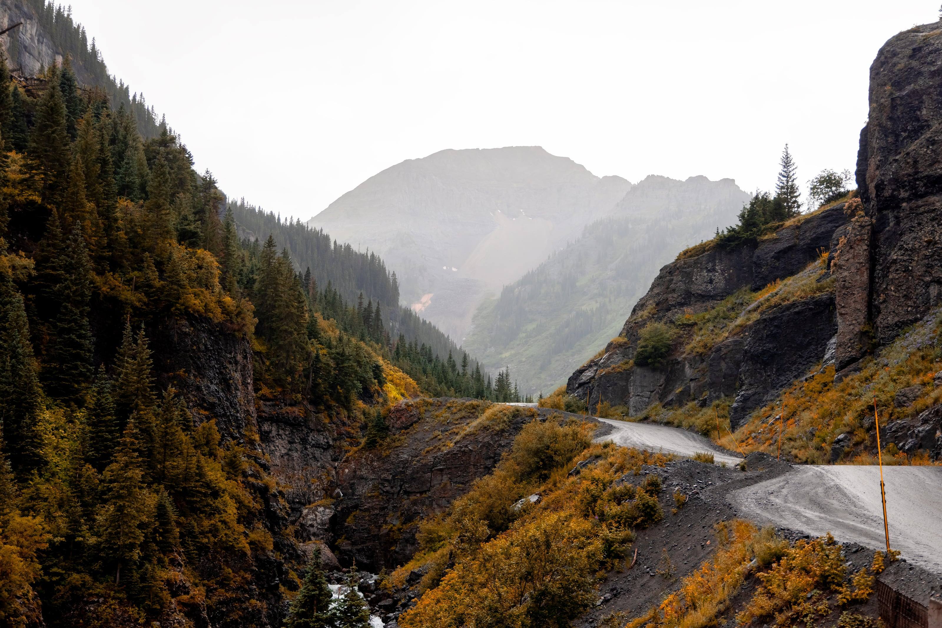
Camp Bird Road is County Road 361. It leaves US 550 at a bend about 0.3 miles south of Ouray, signed for Camp Bird Mine, Yankee Boy Basin and Box Canyon Falls. The Forest Service describes what follows: a graded dirt road that turns into a narrow shelf road blasted into the canyon’s west wall.
At mile 6, where Sneffels, Imogene and Canyon creeks meet, the left fork goes to the Camp Bird gold mine and Imogene Pass. The basin road narrows and follows Sneffels Creek past the site of Sneffels, a town founded in 1875. At mile 6.9 a left fork climbs toward Governor Basin. From there the road is rocky and climbs steeply for another mile or so into Yankee Boy Basin, above timberline under Mount Sneffels. There are vault toilets in the basin and no other services.
The vehicle advice is specific. Medium to high clearance is required to reach the basin. Four-wheel drive is recommended beyond it, where a steep, rough, rutted road that needs high clearance and low gears continues to the Mount Sneffels trailhead. Low-clearance passenger cars should not attempt the trip. Wildflowers are abundant from mid-July through early August, and weekends are crowded.
Source 7
What your vehicle needs, and the OHV permit
For the Alpine Loop the agencies agree. The BLM calls it a 4x4-only road, and the Forest Service says portions of it require high-clearance four-wheel-drive vehicles. Elsewhere the requirement changes road by road, as above.
Colorado adds a permit. Colorado Parks and Wildlife requires an OHV permit for “all plated, street legal vehicles (resident and nonresident) when traveling on any designated OHV trail and/or open area for recreational use on public lands,” and the BLM brochure repeats the rule. CPW lists the permit at $26.25 as of September 2026, valid April 1 through March 31 and displayed to the right of the front license plate. Ask CPW or the BLM which of the routes you plan to drive count as designated OHV trails.
Download or print maps before you leave town. The BLM says “cell phones and wireless devices do not work in most areas of the Alpine Loop.”
Source 16
Campgrounds
On the Ouray side the Forest Service lists three. Amphitheater, just south of town off US 550, is concession operated and reservations are recommended. Thistledown and Angel Creek are on Camp Bird Road, run by the Forest Service without reservations. Angel Creek is primitive: it requires a high-clearance vehicle and is not designed for trailers.
Near Silverton, South Mineral Campground has 26 first-come, first-served sites and drinking water, 4 miles up Forest Road 585 from US 550. The road is drivable in two-wheel drive as far as the campground and becomes four-wheel drive just past it. Dispersed camping along Forest Road 585 is allowed only in the designated Anvil, Bear and Sultan camping areas.
On the Lake City side, the BLM’s Mill Creek Campground sits on the Alpine Loop itself. It is covered in our guide to the loop.
Source 12
Dispersed camping and stay limits
Camping outside campgrounds is allowed on most of this land, under three sets of rules.
The BLM adds rules for the mining sites: do not camp, smoke or build campfires within 150 feet of historic buildings, and do not camp or build campfires within 800 feet of the Animas Forks historic site. Not all land along these roads is public. The brochure’s words are “respect private property.”
Stay limits by agency
- 01BLM land: no more than 14 days in any 30-day period at one location, then move at least 30 air miles.
- 02Grand Mesa, Uncompahgre and Gunnison National Forests, including the Ouray and Norwood ranger districts: no more than 14 consecutive days in one location, and no more than 28 days on one forest within 60 days. Amphitheatre Campground is limited to 7 consecutive days.
- 03San Juan National Forest, which includes South Mineral Creek: up to 16 days in a dispersed area, then at least 5 road miles to the next. Camp at least 100 feet from water.
Source 13
Weather, fuel and who to call
The National Weather Service says thunderstorms typically develop in the Colorado mountains after 11 a.m., so plan to be heading down by late morning. An enclosed, metal-roofed vehicle is safe shelter from lightning. A tent is not. Wait 30 minutes after the last thunder before getting out.
Above timberline, the BLM warns, the air is thinner and colder, high winds are common and there is no shelter from sun, wind or precipitation. The Forest Service adds altitude sickness, “which can be life threatening,” for Yankee Boy Basin. Old mine workings are the other hazard. The BLM’s rule is “Stay Out, Stay Alive.”
The BLM map puts Ouray at 7,792 feet, Lake City at 8,671, Telluride at 8,750 and Silverton at 9,318. Plan fuel around the towns and confirm before you go; the brochure’s advice is to “know how far you are going and where to stop for gas.”
Numbers from the BLM brochure
- 01BLM Gunnison Field Office: (970) 642-4940
- 02Ouray Ranger District: (970) 240-5300
- 03Columbine Ranger District, San Juan National Forest: (970) 884-2512
- 04Emergencies: 911. Sheriffs: Hinsdale County (970) 944-2291, Ouray County (970) 325-7272, San Juan County (970) 387-5531, San Miguel County (970) 728-1911.
Source 17
Questions people ask
Do I need four-wheel drive in the San Juan Mountains?
It depends on the road. The BLM calls the Alpine Loop a 4x4-only road, while it says the road from Silverton to Animas Forks is passable in summer by two-wheel-drive vehicles. The Forest Service strongly recommends a high-clearance four-wheel drive for Imogene Pass and a short-wheelbase one for Black Bear Pass.
When do the high passes open?
Ouray County starts clearing snow and debris in May and says every effort is made to open its passes, including Imogene and Engineer, by July 4. The Forest Service lists June as the season of use for Ophir Pass and July for Imogene and Black Bear. None of those is a guarantee, so check with the county or the ranger district before you go.
Can I drive to Yankee Boy Basin in a stock vehicle?
The Forest Service says medium to high clearance is required to reach the basin and that low-clearance passenger cars should not attempt it. Four-wheel drive is recommended beyond the basin to the Mount Sneffels trailhead, where the road is steep, rough and rutted.
Do I need a permit to drive these roads?
The BLM’s page for the Alpine Loop lists no entry fee. Colorado requires an OHV permit for plated, street-legal vehicles driven for recreation on designated OHV trails; Colorado Parks and Wildlife lists it at $26.25 as of September 2026. Ask CPW or the BLM which routes on your plan count.
Is Black Bear Pass one-way?
Part of it is. The Forest Service says that from the top of the Steps, at about mile 5.6, down to the Bridal Veil powerplant, about one mile, the road is one-way downhill only. It calls the road very technical and not for inexperienced drivers.
How long can I camp in one place?
On BLM land, 14 days in any 30-day period, then at least 30 air miles away. On the Grand Mesa, Uncompahgre and Gunnison National Forests, 14 consecutive days in one location. On the San Juan National Forest, 16 days, then at least 5 road miles away.
 Bureau of Land Management (BLM)
 US Forest Service (USFS)
 National Park Service (NPS)
 US Fish and Wildlife (USFW)
 Bureau of Reclamation (USBR)
 Department Of Defense (DOD)
 Bureau of Indian Affairs (BIA)
 Other Federal
 State
 Local
 Alaska Native Lands (Patented or Interim Conveyed)
 Alaska Native Allotment
 Road
 Primitive Road
 Road
 Primitive Road
 Trail
 Roads open to all Vehicles, Yearlong
 Roads open to all Vehicles, Seasonal
 Roads open to highway legal vehicles only, Yearlong
 Roads open to highway legal vehicles only, Seasonal
 Special Designation, Yearlong
 Special Designation, Seasonal
 Trails open to all vehicles, Yearlong
 Trails open to all vehicles, Seasonal
 Trails open to vehicles 50" or less in width, Yearlong
 Trails open to vehicles 50" or less in width, Seasonal
 Trails open to motorcycles, Yearlong
 Trails open to motorcycles, Seasonal
 Special Designation, Seasonal
 Trails Open to Wheeled Vehicles Only < 50" in Width, Yearlong
 Trails Open to Wheeled Vehicles Only < 50" or Less in Width, Seasonal
 Wilderness Area
 Wilderness Study Area