The Alpine Loop Back Country Byway is the best known four-wheel-drive route in Colorado, and the BLM manages it as one. Its page puts the loop at 63 miles, calls it a 4x4-only road and says it “traverses high alpine terrain up to 12,800 feet, connecting the historic towns of Lake City, Silverton, and Ouray.”
This guide is drawn from the BLM’s page and its 2023 brochure and map, plus the Forest Service, Ouray County and the state. It covers the order the loop is driven in, what the agencies ask of a vehicle, the permit a plated truck needs, where the campgrounds are and how long you may stay.
What the loop is
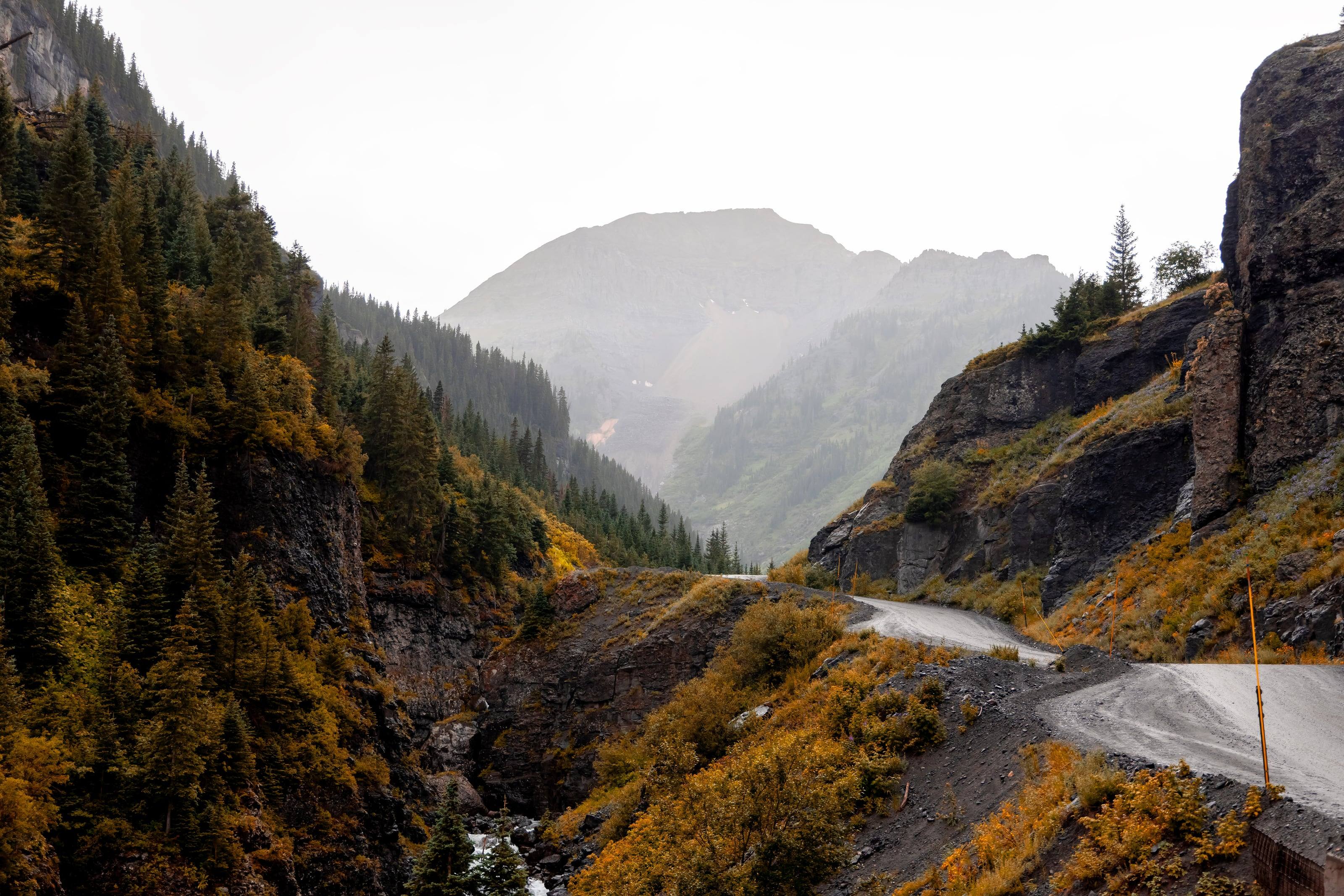
The Alpine Loop is a system of county and public land roads over two passes in the San Juan Mountains, designated by the BLM as a Type III Back Country Byway and by the state as a Colorado Scenic Byway. The BLM says it “offers a rugged, immersive backcountry experience,” that this 4x4-only road reaches 12,800 feet, and that driving the whole thing “is easily an all-day experience.” Miles of designated side routes let you take a short tour or stretch a trip over several days.
The attraction is the mining country it crosses. The BLM lists scenic overlooks, campgrounds, ghost towns, abandoned mines, interpretive kiosks and two National Historic Landmarks, the Silverton Historic District and the Shenandoah-Dives Mill. The loop also crosses the Brunot Area, where tribal hunting and fishing rights are recognised.
Source 1
The route, in the order you drive it
The BLM recommends driving the loop clockwise, and gives three ways in: from Lake City on County Road 30 or County Road 20, from Silverton on County Road 2, and from Ouray on County Road 18.
From Lake City, County Road 30 runs southwest up the Lake Fork of the Gunnison past Lake San Cristobal, then climbs over Cinnamon Pass at 12,620 feet to Animas Forks: 28 miles the brochure gives 2 hours for. Animas Forks is the hub where the two passes meet, and the road down to Silverton is 13 miles and half an hour.
The return leg from Animas Forks over Engineer Pass back to Lake City is 26 miles and another 2 hours, past Mineral Point, Rose’s Cabin, Whitmore Falls and Capitol City. The Ouray arm leaves the loop below Engineer Pass and drops by Mineral Creek to US 550: 11 miles, 1.5 hours.
Side routes have their own character. The brochure suggests short trips of about two hours, among them Camp Bird and Yankee Boy Basin from Ouray, and half-day trips taking in American Basin, Hurricane Pass and California Gulch.
Distances and times from the BLM brochure
- 01Silverton to Animas Forks: 13 miles, 0.5 hours.
- 02Animas Forks to Lake City by Cinnamon Pass: 28 miles, 2 hours.
- 03Lake City to Animas Forks by Engineer Pass: 26 miles, 2 hours.
- 04Ouray to Animas Forks by Mineral Creek: 11 miles, 1.5 hours.
- 05Silverton to Silverton by Lake City, the entire loop: 78 miles, 6 hours.
Source 2
Vehicle and driver
The Forest Service, which manages part of the ground the loop crosses, describes the same 63-mile route winding to an elevation of 12,800 feet and says portions of it require high-clearance, four-wheel-drive vehicles. The BLM brochure puts it the other way round: the route is managed for high-clearance vehicles and demands a leisurely pace, and most of it is drivable in full-size 4x4s, though side-by-sides, ATVs and motorcycles are popular here too.
On the BLM map, dashed roads are open to all vehicles with four-wheel drive recommended and solid ones are marked two-wheel-drive passable. The road from Silverton to Animas Forks is one of the latter: the BLM says it is passable in summer by two-wheel-drive vehicles, and that the road beyond, over Engineer Pass to Lake City, may require four-wheel drive.
One side route is singled out on the map: Poughkeepsie Gulch is “for expert 4x4 drivers only,” with a winch strongly recommended, and anyone without that experience is sent over Engineer Pass instead. The brochure’s advice on judging yourself is worth repeating: “if you have to ask yourself if your ‘expertise’ is enough to negotiate a harder trail, it probably isn’t.”
Do not skipThe BLM says electronics and wireless devices do not work in most areas within the Alpine Loop. Download or print maps, directions and emergency contacts before you leave town.
Source 7
The permit a plated truck needs
The BLM lists no entry fee for the byway, but Colorado’s off-highway vehicle rules reach ordinary trucks. Colorado Parks and Wildlife requires an OHV permit for “all plated, street legal vehicles (resident and nonresident) when traveling on any designated OHV trail and/or open area for recreational use on public lands.” The permit sticker goes to the right of the front licence plate, or you carry the bright green paper permit. CPW lists it at $26.25 as of September 2026, valid April 1 through March 31 however late in the year you buy it.
The BLM brochure says the same thing from its end: every OHV and motor vehicle with a valid licence plate must display a current OHV use permit sticker when travelling designated OHV trails in Colorado, and the money pays for trail maintenance, trailheads, signs and maps. Ask CPW or the Gunnison Field Office which parts of your route are designated OHV trails, and check the towns separately, because they set their own rules for unlicensed vehicles.
Source 10
Camping and stay limits
Mill Creek Campground is the BLM campground on the loop, 14 miles southwest of Lake City at 9,500 feet on the Lake Fork of the Gunnison. It has 22 sites for tents and medium-sized RVs, each with a metal fire ring and cooking grate, a picnic table and a bear-proof food box, plus vault toilets and hand pumps for potable water. Thirteen sites are reservable in peak season and the remaining nine are first-come, first-served, paid on site by cash or cheque. The BLM says the campground is accessible June through September and lists sites at $20 a night as of September 2026. Williams Creek, a Forest Service campground with drinking water, sits on the same road, and the brochure marks more near Silverton and Ouray.
Away from campgrounds, BLM Colorado’s camping and occupancy rules apply: no more than 14 days in any 30-day period at any one location, then a move of at least 30 air miles. The same fact sheet says camping is for recreation only and that personal property may not be left unattended for more than 48 hours. Forest Service land along the loop runs under a separate order with its own limits, so ask the ranger district if your trip is a long one.
Source 4
Fuel, water and services
There is no fuel on the loop. It is sold in the three towns at the ends of the route, and the BLM’s advice is to “bring plenty of water, food, and fuel to reach your destination” and to “know how far you are going and where to stop for gas.” The state byway page says the same in its considerations: bring a full tank of gas and extra food and water. Confirm hours before you rely on any of it, because these are small towns and the season is short.
Water is the other gap. Mill Creek has hand pumps and Williams Creek has drinking water; assume nothing else on the route is drinkable without treatment. Carry the brochure’s contact list, which has the BLM Gunnison Field Office at (970) 642-4940 and the four ranger districts.
Source 8
Season, weather and hazards
The BLM gives the best season as summer and the state lists the byway as closed in winter. On the Ouray arm, county crews seasonally open and maintain Engineer Pass along with Yankee Boy, Corkscrew and Imogene. They start clearing snow and debris in May, and Ouray County says “every effort is made to open these roadways by July 4th.” That is an aim, not a date, and the county posts openings through its road and bridge department rather than a calendar.
Above timberline the weather is its own hazard. The BLM warns that the air is thinner, making every activity harder, that high winds are common above the treeline and that there is no shelter from sun, wind or precipitation. The National Weather Service adds the daily pattern: thunderstorms typically develop in the Colorado mountains after 11 a.m., so plan to be off the high ground by late morning. An enclosed, metal-roofed vehicle is safe shelter from lightning and a tent is not, and the advice is to wait 30 minutes after the last thunder before going back outside.
The mines are the other hazard, and the BLM does not soften it. Many historic sites contain mine passages and unstable buildings: “DO NOT enter them.” Its words for the subject are “Stay Out, Stay Alive.” In an emergency, dial 911 or the sheriff: Hinsdale County (970) 944-2291, Ouray County (970) 325-7272, San Juan County (970) 387-5531, San Miguel County (970) 728-1911.
Source 11
Leaving it as you found it
The alpine vegetation here, the BLM says, “is incredibly vulnerable to damage by vehicle traffic and can take decades to recover.” One person leaving the designated route can cause damage that takes decades to repair, and others doing the same compounds it. Blazing a new trail, the brochure warns, could bring legal action and a hefty fine.
The rules of the road are short. Motor vehicles must stay on the routes designated on the map. Uphill traffic has the right of way, though common courtesy works best. Clockwise travel is recommended. Check with local cities and counties for additional regulations, because the towns set their own: the map notes that unlicensed vehicles must be trailered into Telluride.
Around the historic sites the BLM asks for more room than most people expect. Do not camp, smoke or build campfires within 150 feet of historic buildings, and do not camp or build campfires within 800 feet of the Animas Forks historic site. Keep pets leashed there, take no artifacts and do not enter the structures. Not all the land along the loop is public, so respect private property, and report looting or vandalism to BLM law enforcement at (970) 642-4940.
Source 2
Questions people ask
How long does the Alpine Loop take to drive?
The BLM says tackling the full loop is easily an all-day experience, and its brochure gives 6 hours for the 78 miles from Silverton back to Silverton by way of Lake City. The state byway page lists the driving time as 4 to 6 hours.
Do I need four-wheel drive?
Yes for the loop itself. The BLM calls it a 4x4-only road managed for high-clearance vehicles, and the Forest Service says portions require high-clearance four-wheel-drive vehicles. The road from Silverton to Animas Forks is the exception: the BLM says it is passable in summer by two-wheel-drive vehicles.
Do I need a permit?
There is no entry fee for the byway. Colorado requires an OHV permit for plated, street-legal vehicles driven for recreation on designated OHV trails and open areas on public land; Colorado Parks and Wildlife lists it at $26.25 as of September 2026, valid April 1 through March 31.
Where can I camp on the Alpine Loop?
Mill Creek Campground, the BLM site southwest of Lake City, has 22 sites with fire rings, picnic tables, bear boxes, vault toilets and hand pumps for water, and the BLM says it is accessible June through September. Williams Creek, a Forest Service campground with drinking water, is on the same road. Away from campgrounds, BLM Colorado allows 14 days in any 30-day period at one location.
When is the Alpine Loop open?
The BLM gives the season as summer and the state lists the byway as closed in winter. Ouray County begins clearing its passes in May and says every effort is made to open them by July 4. Check with the Gunnison Field Office at (970) 642-4940 or the county before you go.
Is there cell service?
The BLM says cell phones and wireless devices do not work in most areas of the Alpine Loop, and tells visitors to download or print maps and emergency contact information before the trip.
 Bureau of Land Management (BLM)
 US Forest Service (USFS)
 National Park Service (NPS)
 US Fish and Wildlife (USFW)
 Bureau of Reclamation (USBR)
 Department Of Defense (DOD)
 Bureau of Indian Affairs (BIA)
 Other Federal
 State
 Local
 Alaska Native Lands (Patented or Interim Conveyed)
 Alaska Native Allotment
 Road
 Primitive Road
 Road
 Primitive Road
 Trail
 Roads open to all Vehicles, Yearlong
 Roads open to all Vehicles, Seasonal
 Roads open to highway legal vehicles only, Yearlong
 Roads open to highway legal vehicles only, Seasonal
 Special Designation, Yearlong
 Special Designation, Seasonal
 Trails open to all vehicles, Yearlong
 Trails open to all vehicles, Seasonal
 Trails open to vehicles 50" or less in width, Yearlong
 Trails open to vehicles 50" or less in width, Seasonal
 Trails open to motorcycles, Yearlong
 Trails open to motorcycles, Seasonal
 Special Designation, Seasonal
 Trails Open to Wheeled Vehicles Only < 50" in Width, Yearlong
 Trails Open to Wheeled Vehicles Only < 50" or Less in Width, Seasonal
 Wilderness Area
 Wilderness Study Area