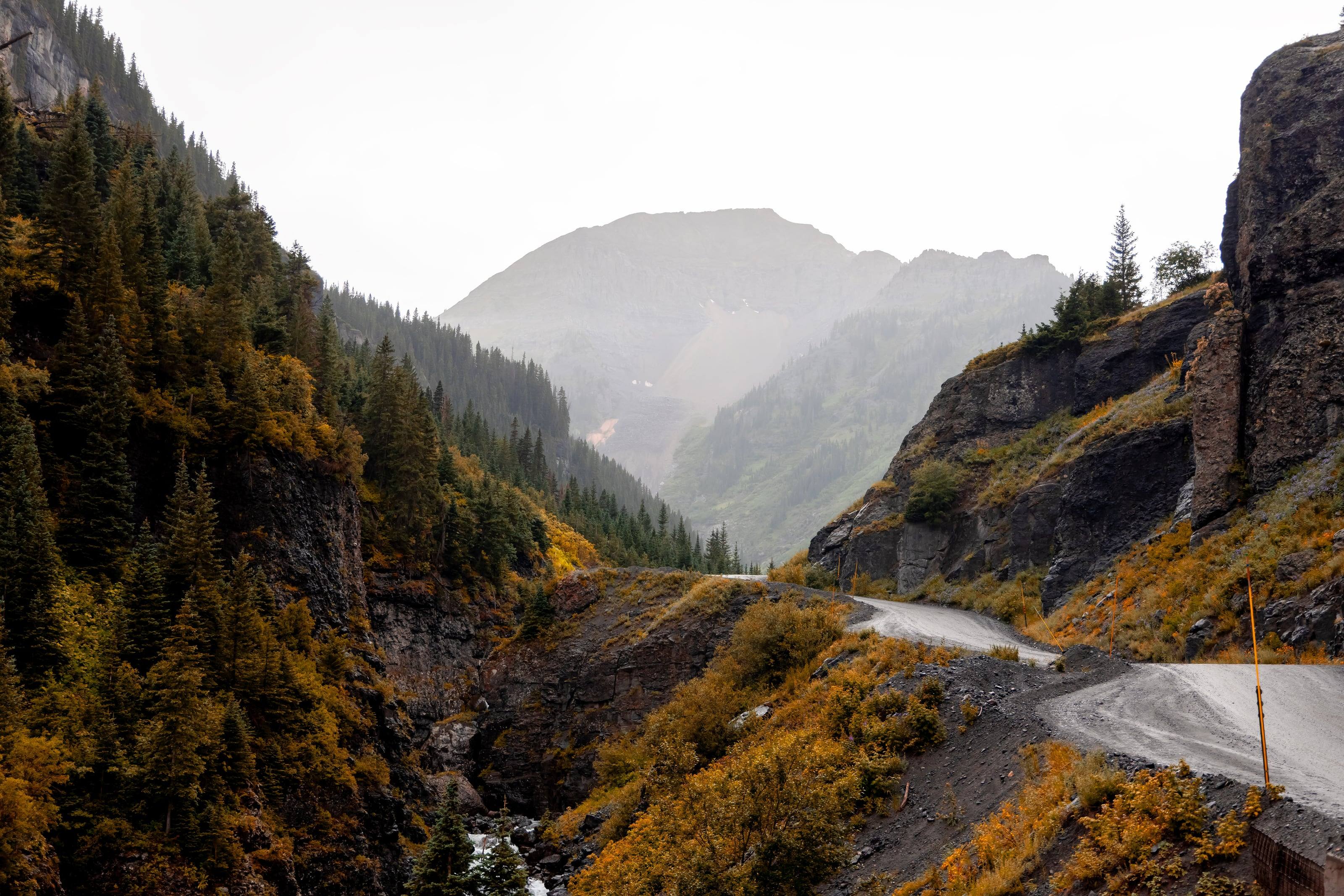
A narrow shelf road cut into a cliff above a rain-washed valley in the San Juan Mountains, aspens turning below.

The Overland Directory

Fabricators in Colorado

Metal shops that design, cut and weld the parts you cannot buy off a shelf: bumpers, sliders, racks, skid plates, mounts and repairs.

Camp Bird Road, Ouray, Colorado

Fabricators in Colorado

7 listings

  1. GOBI Racks USA Aurora, CO Manufactures welded vehicle specific roof racks, rear access ladders, crossbars and related accessories for SUVs.
  2. Sherpa Equipment Co. Berthoud, CO Makes roof rack and bed rack systems for a range of vehicles and sells load bars, interior fittings and camping accessories.
  3. HeftyFabworks Colorado Springs, CO Fabrication shop making front and rear bumpers, rock sliders, skid plate systems, recovery gear and lighting for off-road vehicles.
  4. High Country Performance 4x4 Englewood, CO 4x4 shop covering suspension, engine and driveline work, lighting, armor, wheels and tires and custom fabrication, and stocking recovery and overland gear.
  5. RCI Offroad Loveland, CO Manufactures skid plates, rock sliders, bumpers, bed racks and roof racks for off-road trucks and SUVs.
  6. Juggernaut USA Wheat Ridge, CO Makes skid plates and off-road armor and runs an installation shop for lift kits, bumpers, rock sliders and winches, and upfits Sprinter, Transit and ProMaster vans.
  7. Mountain Yotas Wheat Ridge, CO Toyota and Lexus off-road shop doing suspension, re-gearing and axle work, armor, custom fabrication, 4x4 alignments and overland outfitting.

Colorado by the numbers

Mean elevation, the highest of any state 2
6,800 ft
An approximate figure from the USGS
Mount Elbert, the highest point in Colorado 3
14,433 ft
Lake County. The lowest point is 3,315 feet
Mountains of 14,000 feet or more 4
58
The USGS list of named summits has 56 in Colorado, more than any other state
Acres of federal land 1
24.1M
36.3 percent of the state
Acres of national forest and grassland 5
14.5M
Eleven national forests, part of a twelfth, and two national grasslands
Acres of BLM public land 7
8.3M
Two national monuments and three national conservation areas
Miles of national forest road open to motor vehicles 12
13,500+
Plus about 2,950 miles of motorized trail
Miles of BLM route open to motor vehicles 13
6,987
Roads and trails managed for public motorized use
Federal campgrounds a vehicle can reach 44
350
305 Forest Service, 23 BLM and 22 National Park Service. 246 can be booked ahead and 69 are first come only
Federally designated byways, of 26 in the state 45
13
CDOT says that is more national byway designations than any other state. Add 10 national forest scenic byways and two BLM back country byways
Average annual precipitation statewide 4
18.1 in
From 7 inches in the San Luis Valley to over 60 inches in a few mountain locations. Wolf Creek Pass averages close to 400 inches of snow
Acres in the Weminuche, the largest wilderness in Colorado 47
499,771
Three quarters the size of Rhode Island by the Forest Service’s comparison, and closed to every vehicle and bicycle

Armor and racks for shelf roads and rock

Colorado’s pass roads are narrow, rocky and steep rather than muddy. The Forest Service describes Mosquito Pass as steep and very rocky and Black Bear as very technical, with switchbacks where a short wheelbase is strongly recommended. That puts the emphasis on rock sliders, skid plates and approach and departure angles, and on keeping bumpers and racks tight to the body so the vehicle stays as narrow and short as it can.

Every pound you bolt on is carried to 12,000 feet and held back on the way down. Ask a fabricator what each piece weighs and where it mounts before you ask what it costs.

The full guide to overlanding Colorado

What a fabricator does

When a catalog part does not exist for your vehicle, does not fit with what you already have, or is not strong enough for what you do, a fabricator builds it. Steel or aluminum, welded, finished, and mounted so the load goes into structure rather than sheet metal.

They also fix what breaks: cracked mounts, bent sliders, torn brackets and the frame damage that ends trips.

Common work

  1. 01Bumpers with winch mounts and rated recovery points
  2. 02Rock sliders and skid plates
  3. 03Roof racks, bed racks and ladders
  4. 04Swing-outs for tires, fuel and water
  5. 05Mounts for tanks, compressors and batteries
  6. 06Frame and bracket repair

How to choose a fabricator

Metalwork is easy to judge if you know where to look.

  1. 01Look at the welds, then at how the part mounts. Recovery points and sliders should tie into the frame.
  2. 02Ask whether they design in CAD or build to the vehicle, and whether you get drawings.
  3. 03Ask about material and finish. Raw, painted and powder coated parts age very differently.
  4. 04Ask if they have built for your platform before. Templates and fixtures save you money.
  5. 05Ask how a front bumper affects airbag sensors and crush zones. A shop that has done it properly will have an answer.

What to have ready before you ask for a quote

Photographs do most of the talking.

  1. 01Clear photos of the vehicle and the area the part mounts to
  2. 02What is already mounted there: winch model, lights, tire size
  3. 03What the part has to carry, and how much it weighs
  4. 04Steel or aluminum, and the finish you want
  5. 05A budget range and your timing

Questions people ask

Custom or off the shelf?

If a well-made part exists for your vehicle, it is usually cheaper and faster than custom, and a good fabricator will tell you so. Custom earns its cost when nothing fits, when parts from different makers have to work together, or when you need it stronger or lighter than the catalog offers.

Steel or aluminum?

Steel is stronger for the money, easier to repair in the field and heavier. Aluminum saves real weight on racks, skid plates and boxes, but costs more and needs a welder who works with it regularly. Many builds use both: steel where it hits rocks, aluminum where it just carries things.

Can a fabricator repair a cracked frame or mount?

Often, yes. Send clear photos with your request. A good shop will tell you whether it can be repaired properly or needs replacing.

How high is Colorado?

From Grand Junction at 4,591 feet to Mount Elbert at 14,433. Altitude decides what your engine, your brakes and your lungs have to work with, and how late in the year the passes open.

Towns

  1. Leadville The city calls itself the highest incorporated city in the United States. Hagerman Pass starts here and Mosquito Pass drops in from the east. 10,152 ft
  2. Silverton South end of the Million Dollar Highway. Alpine Loop access on County Road 2; Ophir Pass leaves US 550 just north of town. 9,318 ft
  3. Crested Butte At the upper end of Highway 135, on the West Elk Loop byway. 8,885 ft
  4. Telluride At the head of a box canyon. West end of Imogene Pass and the bottom of the one-way descent from Black Bear Pass. 8,789 ft
  5. Lake City On Highway 149 about 55 miles south of Gunnison. Eastern gateway to the Alpine Loop. 8,671 ft
  6. Buena Vista On US 24 below the Collegiate Peaks. The road to St. Elmo and Tincup Pass leaves the valley at Nathrop, just to the south. 7,960 ft
  7. Ouray North end of the Million Dollar Highway. Alpine Loop access on County Road 18, and the Ouray end of Imogene Pass. 7,786 ft
  8. Gunnison On US 50 at the start of Highway 135 to Crested Butte. Highway 149 to Lake City leaves US 50 to the west. 7,703 ft
  9. Salida On US 50 beside the Arkansas River, east of Monarch Pass. 7,084 ft
  10. Steamboat Springs On US 40 in the Yampa Valley. The Colorado Backcountry Discovery Route passes through on its way to Wyoming. 6,731 ft
  11. Durango Where US 160 meets US 550 on the San Juan Skyway. US 550 climbs north from here to Silverton and Ouray. 6,534 ft
  12. Colorado Springs On I-25 at the foot of Pikes Peak, where US 24 heads west into the mountains. 6,035 ft
  13. Montrose Where US 50 meets US 550. East end of the Rimrocker Trail and the gateway to Black Canyon of the Gunnison. 5,809 ft
  14. Denver State capital where I-25 meets I-70. The I-70 mountain corridor starts just west at Morrison. 5,280 ft
  15. Fort Collins Northern Front Range. East end of the Cache la Poudre byway up Poudre Canyon and over Cameron Pass. 5,004 ft
  16. Grand Junction On I-70 in far western Colorado, about 250 miles west of Denver. Kokopelli’s Trail starts at Loma, just to the west. 4,591 ft

Passes, high roads and summits

  1. Mount Elbert The highest point in Colorado. No road to the top 14,433 ft
  2. Mount Blue Sky Scenic Byway Idaho Springs to the top of Mount Blue Sky 14,130 ft
  3. Mosquito Pass Alma and Fairplay to Leadville 13,182 ft
  4. Imogene Pass Telluride and Ouray 13,114 ft
  5. Black Bear Pass US 550 at Red Mountain Pass, down to Telluride 12,840 ft
  6. Engineer Pass Alpine Loop Back Country Byway: Lake City, Silverton and Ouray 12,800 ft
  7. Cinnamon Pass Alpine Loop, between Lake City and Animas Forks 12,620 ft
  8. Rollins Pass Winter Park east to the Continental Divide. The Needle’s Eye Tunnel has collapsed, so it is no longer a through route by vehicle 12,233 ft
  9. Trail Ridge Road Estes Park to Grand Lake 12,183 ft
  10. Courthouse Mountain The monolith above the Owl Creek Pass road, on the Cimarron Ridge 12,152 ft
  11. Webster Pass Montezuma, in Summit County, south over the Divide toward Handcart Gulch 12,098 ft
  12. Independence Pass CO 82 between Twin Lakes and Aspen on the Top of the Rockies byway. Paved, closed all winter, and shut to vehicles 35 feet or longer 12,095 ft
  13. Hagerman Pass Leadville to Basalt, by Ruedi Reservoir 11,925 ft
  14. Ophir Pass US 550 north of Silverton to Ophir 11,814 ft
  15. Chimney Rock The other landmark of the Cimarron Ridge, seen from the same drive 11,781 ft
  16. Boreas Pass Breckenridge to Como, over the Continental Divide 11,488 ft
  17. Cameron Pass Where the Cache la Poudre to North Park byway crosses out of the Poudre canyon beside State Forest State Park 10,276 ft
  18. Owl Creek Pass Road The Cimarron Ridge country, on the Ouray Ranger District of the Uncompahgre National Forest 10,114 ft
  19. Medano Pass Primitive Road Great Sand Dunes to the Wet Mountain Valley and Highway 69 10,040 ft
  20. Last Dollar Road Ridgway and Telluride, west of CO 62 and CO 145 10,000 ft

Pass, road and summit elevations are the figures published by the agency that manages them. Town elevations are the town’s or county’s own figure where it publishes an exact one; the rest are from the U.S. Geological Survey (3D Elevation Program at the place’s official coordinates), retrieved September 18, 2026. Every source is listed at the foot of the page.

Free build quotes

Looking for fabricators in Colorado? Tell us about the project and get free quotes.
Tell us about your project

Free build quotes

Tell us about your project

What are you building on?

Do you have it yet?

What do you want done?

Choose everything that applies.

What are you working with?

Budget for this work

When you want it done

A range is enough. It tells a builder which conversation to have with you.

Where should the shop be?

How far will you go for the right shop?

Where should the quotes go?

Best way to reach you

Free, and no obligation. We use these details only to connect you with builders. See our privacy page.

Sources for this page

86
  1. Congressional Research Service. Federal Land Ownership: Overview and Data (R42346), Table 2, data as of September 30, 2024. Retrieved September 18, 2026.
  2. U.S. Census Bureau, from U.S. Geological Survey data. Statistical Abstract of the United States: 2012, Table 366. Extreme and Mean Elevations by State. Retrieved September 18, 2026.
  3. U.S. Geological Survey. Elevations and Distances in the United States, online edition. Retrieved September 18, 2026.
  4. Colorado Climate Center, Colorado State University. Climate of Colorado. Retrieved September 18, 2026.
  5. USDA Forest Service. Land Areas of the National Forest System, as of September 30, 2024, Table 4. Retrieved September 18, 2026.
  6. USDA Forest Service, Rocky Mountain Region. Rocky Mountain Region: find a forest. Retrieved September 18, 2026.
  7. Bureau of Land Management. Colorado state office. Retrieved September 18, 2026.
  8. Bureau of Land Management. National Conservation Lands: Colorado. Retrieved September 18, 2026.
  9. National Park Service. Colorado. Retrieved September 18, 2026.
  10. Colorado Parks and Wildlife. What We Do. Retrieved September 18, 2026.
  11. Colorado State Land Board. Public Access on Trust Land. Retrieved September 18, 2026.
  12. USDA Forest Service. Motor Vehicle Use Map: Roads and Trails. Sum of gis_miles for MVUM road and trail segments that lie entirely inside the state boundary box (Colorado and Wyoming are bounded by lines of latitude and longitude). Segments that cross the state line are left out, so the figures are floors.. Retrieved September 18, 2026.
  13. Bureau of Land Management. Ground Transportation Linear Features, public display. Sum of GIS_MILES by administrative state for routes managed for public or limited public motorized use.. Retrieved September 18, 2026.
  14. Bureau of Land Management. Alpine Loop Back Country Byway. Retrieved September 18, 2026.
  15. Bureau of Land Management. Alpine Loop Back Country Byway Off-Highway Vehicle Guide, 2023 brochure and map. Retrieved September 18, 2026.
  16. Ouray County, Colorado. Off-Highway Roads in the High Country. Retrieved September 18, 2026.
  17. USDA Forest Service, Grand Mesa, Uncompahgre and Gunnison National Forests. Tomboy Road - Imogene Road #869. Retrieved September 18, 2026.
  18. USDA Forest Service, Grand Mesa, Uncompahgre and Gunnison National Forests. Black Bear Pass Road #648. Retrieved September 18, 2026.
  19. USDA Forest Service, Grand Mesa, Uncompahgre and Gunnison National Forests. Ophir Pass Road #630. Retrieved September 18, 2026.
  20. USDA Forest Service, Pike-San Isabel National Forests. Mosquito Pass Auto Tour, and the interpretive brochure it links to. Retrieved September 18, 2026.
  21. USDA Forest Service, Pike-San Isabel National Forests. Hagerman Pass. Retrieved September 18, 2026.
  22. USDA Forest Service, Pike-San Isabel National Forests. Tunnel Lake Trail #1439 (directions to the Tincup Pass road). Retrieved September 18, 2026.
  23. National Park Service, Great Sand Dunes National Park and Preserve. Medano Pass Primitive Road. Retrieved September 18, 2026.
  24. Rimrocker Trail, Montrose County. About the Rimrocker Trail. Retrieved September 18, 2026.
  25. Backcountry Discovery Routes. Colorado Backcountry Discovery Route. Retrieved September 18, 2026.
  26. National Park Service, Rocky Mountain National Park. Trail Ridge Road. Retrieved September 18, 2026.
  27. USDA Forest Service, Arapaho and Roosevelt National Forests. Mount Blue Sky Recreation Area and Scenic Byway. Retrieved September 18, 2026.
  28. Colorado Department of Transportation. New Traction Law requirements and winter driving preparedness (news release, November 20, 2025). Retrieved September 18, 2026.
  29. Colorado Parks and Wildlife. Register an Off-Highway Vehicle. Retrieved September 18, 2026.
  30. Bureau of Land Management. Fact sheet: Colorado Camping and Occupancy Regulations (January 28, 2025). Retrieved September 18, 2026.
  31. USDA Forest Service, White River National Forest. Camping and Cabins. Retrieved September 18, 2026.
  32. USDA Forest Service, San Juan National Forest. Dispersed Camping Guidelines. Retrieved September 18, 2026.
  33. Colorado Division of Fire Prevention and Control. Fire Bans and Restrictions. Retrieved September 18, 2026.
  34. Stay The Trail Colorado. Trail Tips and Etiquette. Retrieved September 18, 2026.
  35. National Weather Service, Pueblo. Outdoor Lightning Risk Reduction. Retrieved September 18, 2026.
  36. U.S. Geological Survey. Geographic Names Information System and 3D Elevation Program point query. Elevation of the 3DEP surface at the GNIS coordinates of the named place, rounded to the nearest foot.. Retrieved September 18, 2026.
  37. City and County of Denver. Annual Comprehensive Financial Report 2024, City Profile. Retrieved September 18, 2026.
  38. City of Colorado Springs. Olympic City USA Facts. Retrieved September 18, 2026.
  39. City of Gunnison. City of Gunnison. Retrieved September 18, 2026.
  40. Hinsdale County, Colorado. About Hinsdale County. Retrieved September 18, 2026.
  41. Town of Crested Butte. Town of Crested Butte. Retrieved September 18, 2026.
  42. Town of Silverton. Community. Retrieved September 18, 2026.
  43. City of Leadville. Visitors. Retrieved September 18, 2026.
  44. Recreation.gov. Recreation Information Database (RIDB) full export. Federal campgrounds in Colorado a vehicle can reach, counted by managing agency.. Retrieved September 19, 2026.
  45. Colorado Department of Transportation. Colorado Scenic & Historic Byways: 26 byways, 13 of them America’s Byways, 10 national forest scenic byways and two BLM back country byways. Retrieved September 19, 2026.
  46. Colorado Department of Transportation. Colorado Scenic & Historic Byways Commission: the partnership with the Forest Service, the BLM and local byway groups. Retrieved September 19, 2026.
  47. USDA Forest Service, San Juan National Forest. Weminuche Wilderness: 499,771 acres, the largest wilderness area in Colorado, closed to motorized and mechanized travel. Retrieved September 19, 2026.
  48. USDA Forest Service. White River National Forest: 2.3 million acres, five ranger districts, eight wilderness areas, 11 ski resorts and 10 peaks over 14,000 feet. Retrieved September 19, 2026.
  49. USDA Forest Service, Rocky Mountain Region. About the Area: 17 national forests and 7 national grasslands, and the White River as the top recreation forest in the nation. Retrieved September 19, 2026.
  50. USDA Forest Service, White River National Forest. New Dillon District Ranger arrives: the 312,000-acre Dillon Ranger District and its 8.5 million annual visitors. Retrieved September 19, 2026.
  51. USDA Forest Service. Grand Mesa, Uncompahgre and Gunnison National Forests: over 3 million acres from 5,800 to 14,309 feet. Retrieved September 19, 2026.
  52. USDA Forest Service. San Juan National Forest: about 1.8 million acres in southwestern Colorado. Retrieved September 19, 2026.
  53. USDA Forest Service. Arapaho and Roosevelt National Forests and Pawnee National Grassland: 1.5 million acres across five districts. Retrieved September 19, 2026.
  54. USDA Forest Service, Grand Mesa, Uncompahgre and Gunnison National Forests. Scenic Travel Corridors: the forests’ own grading of their scenic drives, with Owl Creek Pass at 10,114 feet. Retrieved September 19, 2026.
  55. USDA Forest Service, Grand Mesa, Uncompahgre and Gunnison National Forests. Last Dollar Road #638. Retrieved September 19, 2026.
  56. USDA Forest Service, Celebrating Wildflowers. Yankee Boy Basin: County Road 361, the Camp Bird Road, and the vehicle it asks for. Retrieved September 19, 2026.
  57. Gunnison County, Colorado. Schofield: County Road 317 and the Gothic Road between Crested Butte and Marble. Retrieved September 19, 2026.
  58. USDA Forest Service, White River National Forest. Shrine Pass Road TH #709: Forest Road 712 from Vail Pass to Redcliff. Retrieved September 19, 2026.
  59. USDA Forest Service, White River National Forest. Webster Pass Road TH #285: 12,098 feet, and the April 1 to June 30 motor vehicle prohibition. Retrieved September 19, 2026.
  60. USDA Forest Service, Pike-San Isabel National Forests. Boreas Pass Auto Tour: 21 1/2 miles from Como to Breckenridge. Retrieved September 19, 2026.
  61. USDA Forest Service, White River National Forest. Boreas Pass Road TH #10: 11,488 feet, the 3 percent railroad grade and the May to October season. Retrieved September 19, 2026.
  62. USDA Forest Service, Arapaho and Roosevelt National Forests. Rollins Pass Trailhead, Continental Divide Trail access: 12,233 feet, the November 15 to June 15 closure and the collapsed Needle’s Eye Tunnel. Retrieved September 19, 2026.
  63. USDA Forest Service, Celebrating Wildflowers. Buffalo Pass: National Forest Road 60 between Steamboat Springs and Walden. Retrieved September 19, 2026.
  64. Colorado Department of Transportation. Gold Belt Tour: 131 miles by Phantom Canyon, Shelf Road and High Park Road, with its vehicle limits. Retrieved September 19, 2026.
  65. Bureau of Land Management. Gold Belt Tour Back Country Byway and the Gold Belt Recreation Management Area, with its 14-day stay limit. Retrieved September 19, 2026.
  66. Colorado Department of Transportation. Flat Tops Trail: 82 miles between Meeker and Yampa, and its winter closure points. Retrieved September 19, 2026.
  67. Colorado Department of Transportation. West Elk Loop: 205 miles, with a 31-mile gravel section over Kebler Pass closed in winter. Retrieved September 19, 2026.
  68. Colorado Department of Transportation. Colorado River Headwaters: 80 miles from Grand Lake to State Bridge, gravel between Kremmling and State Bridge. Retrieved September 19, 2026.
  69. Colorado Department of Transportation. Guanella Pass: 22 miles, closed on or about November 26 and reopened on Memorial Day weekend. Retrieved September 19, 2026.
  70. Colorado Department of Transportation. Top of the Rockies: 115 miles, and Independence Pass climbing from 9,200 feet to 12,095 feet at the summit. Retrieved September 19, 2026.
  71. Colorado Department of Transportation. Cache la Poudre to North Park: 101 miles, and 10,276-foot Cameron Pass beside State Forest State Park. Retrieved September 19, 2026.
  72. Colorado Department of Transportation. San Juan Skyway: 236 miles, an All-American Road, with the Ouray to Silverton segment called the Million Dollar Highway. Retrieved September 19, 2026.
  73. Colorado Department of Transportation. Grand Mesa: a 63-mile National Scenic Byway to 11,000 feet, with limited services between Cedaredge and Mesa. Retrieved September 19, 2026.
  74. USDA Forest Service, White River National Forest. Maroon Bells Scenic Area: reservations required on the shuttle or in a personal vehicle. Retrieved September 19, 2026.
  75. USDA Forest Service, White River National Forest. Maroon Bells Scenic Area reservation system: the May 15 road opening, the $10 parking reservation and the shuttle hours. Retrieved September 19, 2026.
  76. National Park Service, Rocky Mountain National Park. Timed Entry Permit System: the two permits, their hours, the $2 processing fee and the separate entrance pass. Retrieved September 19, 2026.
  77. USDA Forest Service, Pike-San Isabel National Forests. Wilderness: nine designated areas over 385,000 acres, and what federal regulation prohibits in them. Retrieved September 19, 2026.
  78. USDA Forest Service, Pike-San Isabel National Forests. Pike National Forest Occupancy and Use Restrictions: 14 days in 30 within a 20-mile radius, and 100 feet from water. Retrieved September 19, 2026.
  79. USDA Forest Service, Pike-San Isabel National Forests. Dispersed Camping Regulations for the Leadville Ranger District: within one car length of a designated route. Retrieved September 19, 2026.
  80. USDA Forest Service, White River National Forest. Forest officials offer tips for camping on the White River National Forest: Summit County designated sites and the Eagle-Holy Cross seven-day limit. Retrieved September 19, 2026.
  81. National Park Service. Entrance Passes: the $80 America the Beautiful annual pass, the agencies that honour it and the fees it does not cover. Retrieved September 19, 2026.
  82. Colorado Parks and Wildlife. Keep Colorado Wild Pass: $29 with a vehicle registration, and what it does not cover. Retrieved September 19, 2026.
  83. Colorado Parks and Wildlife. State Parks: 43 parks, camping at 30 of them, cabins at six and yurts at six. Retrieved September 19, 2026.
  84. Colorado Avalanche Information Center, Colorado Department of Natural Resources. About Us: the CAIC’s place in state government, its 1993 agreement with CDOT, and Colorado’s share of avalanche deaths. Retrieved September 19, 2026.
  85. Colorado Department of Transportation. CDOT prepares to open Independence Pass for the 2026 season: the opening dates of the last six seasons and the 35-foot vehicle prohibition. Retrieved September 19, 2026.
  86. National Park Service, Great Sand Dunes National Park and Preserve. Frequently Asked Questions: about 150,000 acres, a 30-square-mile dunefield, and elevations from 7,520 to 13,604 feet. Retrieved September 19, 2026.

Reviewed September 18, 2026. Conditions, closures and rules change; check with the managing agency before you travel.