The permit is a plate, and it only works one way
A Delaware annual park pass and a Delaware surf fishing permit are different purchases and the parks say so twice on the same page: the annual pass "does not allow vehicle access to drive on the beach for surf fishing. A surf fishing permit must be purchased." The permit runs the calendar year. A resident pays 90 dollars and a non-resident 180, with two year permits at 180 and 360, and senior rates below both.
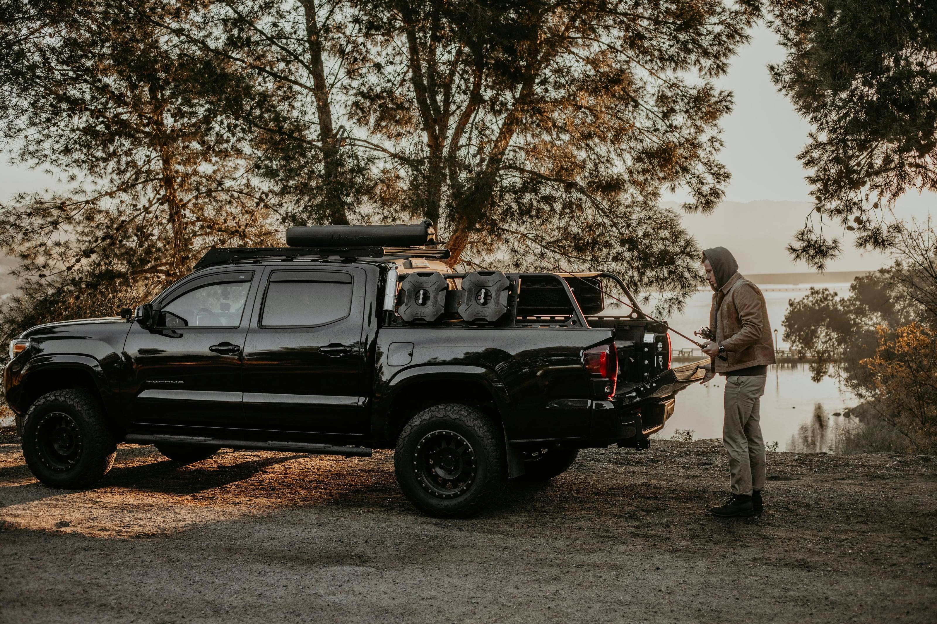
A valid permit is three things at once. An official Delaware State Parks surf fishing licence plate goes on the front of the vehicle. The decal for the current year goes on that plate, over the previous one. The receipt for the decal is the permit itself, and it lives in the glovebox to be produced for inspection at any time while the vehicle is fishing a state park beach. A first-time buyer needs the plate as well as the decal; after that, only the decal.
None of it transfers. Applying takes a valid vehicle registration, a phone number and an email address, and the permit is not transferable to anyone other than the people already listed on that registration. An online order can take two to three weeks to arrive. What it buys beyond the sand is entry to the other Delaware state parks that charge a daily fee, which at an ocean park is 10 dollars for a Delaware-registered vehicle and 20 for an out-of-state one, charged every day from 1 March to 30 November.
Source 7
Five tools, fifteen miles an hour, and a rod in the sand
The equipment rule is the sentence to read before buying anything: "Surf fishing vehicles must be equipped with a shovel, jack, tow rope or chain, board or similar support for the jack, and a low pressure tire gauge when being operated on state park beaches." Delaware does not publish minimum dimensions for any of the five, unlike the federal seashore over the Maryland line, but the Natural Resources Police Park Rangers Unit runs vehicle checks for them on the beach.
Speed is capped at 15 miles an hour and then capped again by judgement: the rule asks for the speed "necessary to maintain traction and steerage" and nothing above it. Dunes are off limits to every vehicle except a permitted one at an authorised dune crossing. Posted nesting areas are off limits to all of them. Swimming and surfboarding beaches are closed to vehicles during summer day-use hours.
The part that catches visitors is the fishing itself. "Actively engaged in surf fishing" is defined: taking all reasonable and necessary actions to hook and land game fish by rod, reel and line, or standing within fifty feet of your equipment while tending, casting and recasting it. A permitted vehicle parked on a state park beach for any length of time with nobody from it doing that is in violation. First offence runs 50 to 250 dollars, second 100 to 500, and the Division can suspend a permit for 90 days or pull it for three years.
Source 6
The twelve beaches, and which five need booking
DNREC names them. At Cape Henlopen: Gordons Pond, Herring Point, Navy Crossing and Point Crossing. At Delaware Seashore: Key Box, Conquest, Faithful Steward and 3 R’s. At Fenwick Island: York, Middle and South, reached through the park’s three dune crossings. And Beach Plum Island north of Lewes, the only publicly owned wild beach in the state to hold both dune and marsh habitat, where a small part of the beachfront takes surf fishing vehicles and most of the rest is shut for wildlife.
A reservation system came in during 2023 and was cut back in July 2025. Reservations are now required only at Gordons Pond, Herring Point, Navy Crossing, Point Crossing and 3 R’s, from 8am to 4pm on weekends and holidays between Memorial Day and Labor Day. The other seven were dropped because they had generally not filled, and DNREC put the change at nearly 64 percent of the state’s surf fishing beach availability. Reservations go to holders of one year and two year permits, first come and first served, one per day.
The off-peak permit is the cheaper way in and it never needs a reservation: Monday to Friday through the peak season from Memorial Day weekend to the Monday after Labor Day, with every holiday excluded, then seven days a week the rest of the year. A reservation also outranks the car park. Anglers holding one get on to those drive-on beaches even after the park has hit its day-use parking capacity, which the agency notes happens often at Cape Henlopen.
Source 14
What closes, and what it closes for
March belongs to the birds. The Point at Cape Henlopen has shut every March since 1993 for threatened and endangered beach-nesting and migratory shorebirds, among them piping plovers, oystercatchers, least terns and red knots, and it reopens in the late summer or early autumn once they have gone. DNREC announces the reopening date each year rather than fixing one, and the oceanside and bayside halves do not reopen together. The Point is one of only three places in Delaware set aside for shorebirds to rest and feed after the breeding season.
The wider rule covers any beach anywhere in the system: no vehicle may be driven through, over or upon a beach area posted as an endangered or protected species nesting area. That is a sign, not a calendar, and it moves.
Fires run on a different clock. Most open burning in Delaware is prohibited from 1 May to 30 September, the period the Division of Air Quality calls ozone season, with camping, cooking and ceremonial fires named as exemptions. All open burning stops on an Air Quality Action day, Code Orange or Code Red, including anything previously approved. On top of that the State Fire Marshal can ban burning by county or statewide and the Weather Service can post a red flag warning against it. Inside the state parks, campfires are banned at Delaware Seashore State Park at any time of year.
Source 15
Inland: three forests, nineteen wildlife areas, and no off-road anything
The Delaware Forest Service, which sits under the Department of Agriculture rather than DNREC, runs three state forests totalling more than 20,000 acres: Redden near Georgetown at more than 14,000 acres across 18 tracts, Blackbird near Smyrna at over 6,000 across ten tracts, and Taber near Harrington at 1,309, the smallest. Its position on vehicles has no exceptions in it: "Off-road vehicles, including electronic bicycles, are prohibited in all State Forests, whether they are registered or unregistered."
Nor will the forests take a rig. Camping is primitive, by permit, at mapped sites only, and tent-only: "pickup campers, travel trailers, and/or self-propelled motor homes are excluded due to access and parking limitations." Sixteen sites at Blackbird and eighteen at Redden, none at Taber, 25 dollars a night with a three night maximum, open 365 days a year, two vehicles and six people to a site, no hookups of any kind.
DNREC’s Division of Fish and Wildlife holds a separate system, roughly 68,000 acres across 19 public wildlife areas, and that one charges the vehicle rather than the person. A Conservation Access Pass is required for every registered motor vehicle entering a state wildlife area for any allowable activity, birdwatching and hiking included, not only hunting. It is 32.50 dollars a year against a Delaware plate and 65 against an out-of-state one, or 10 and 20 for three consecutive days. The C&D Canal Conservation Area and the Michael N. Castle Trail are exempt.
Source 19
Salt, tide and no elevation at all
The sixteen towns in this guide sit between 1 foot at Rehoboth Beach and 91 at Wilmington. The state high point is a roadside benchmark on Ebright Road at the Pennsylvania line, published by USGS at 448 feet; the Delaware Geological Survey puts the disk itself at 447.85 and, from later survey work and LiDAR contours, the actual ground just west of the road at around 450. Nothing in Delaware asks anything of a drivetrain on a gradient. Everything here asks something of it on sand and in salt.
The climate is moderate and wet: a mean annual temperature between 54.0°F in northern New Castle County and 58.1°F on the Atlantic coast, and about 45 inches of precipitation a year. The state climate office flags what actually interrupts travel, which is coastal rather than thermal: winter and spring nor’easters that can drop heavy snow or rain, autumn tropical systems and coastal flooding.
There is no chain law here and DelDOT publishes no traction requirement. What Delaware has instead is a three step driving restriction written into the emergency code. A Level 1 Driving Warning asks for extra caution and discourages unnecessary travel. A Level 2 Driving Restriction bars anybody but essential personnel from the roads unless they hold a waiver, which takes at least 21 days to process and cannot be applied for once an emergency has begun. A Level 3 Driving Ban closes the roads to everyone but first responders, first informers and essential personnel.
Source 5
Passes and routes
-
Cape Henlopen drive-on beaches
Four named crossings inside a park that Delaware State Parks calls 5,000 acres on its park page and 7,000 acres on its camping page: Gordons Pond, Herring Point, Navy Crossing and Point Crossing. All four are inside the reservation system on summer weekends and holidays, and the park is the one where day-use parking most often fills, which is why a reservation is worth holding: it gets a permitted vehicle on to the sand after the car parks have closed. 14
- Vehicle
- Two-axle, licensed and registered for public highways, front surf fishing plate and current decal, five tools aboard
- Season
- Reservations required 8am to 4pm on weekends and holidays, Memorial Day to Labor Day. The Point has closed every March since 1993
-
Delaware Seashore drive-on beaches
6.5 miles of ocean shoreline
Dewey Beach to Bethany Beach across the Indian River Inlet
Six and a half miles of barrier beach with 20 miles of bay shoreline behind it, reached from ten access points along the strip. DNREC names four drive-on beaches on this strip: Key Box, Conquest, Faithful Steward and 3 R’s. The inlet the road crosses was only stabilised when the federal government finished two steel and stone jetties in 1939; the state began managing the barrier as Indian River State Park in 1965 and renamed it in 1967. Campfires are prohibited in this park at any time. 10
- Vehicle
- Surf fishing permit, 15 mph, authorised dune crossings only
- Season
- 3 R’s needs a reservation on summer weekends and holidays; Key Box, Conquest and Faithful Steward do not
-
Fenwick Island drive-on beaches
3 miles of ocean beach
Bethany Beach to the Maryland state line
Delaware’s southernmost beach, three miles of Atlantic front with the Little Assawoman Bay behind it. Three dune crossings let a vehicle carrying a surf fishing plate and current decal on to the multi-use beach, reaching the York, Middle and South drive-on areas that DNREC names. None of the three sits inside the summer reservation system. The park separated from Delaware Seashore in 1981 because private land and the town of Bethany Beach sit between them. 11
- Vehicle
- Surf fishing permit. Three dune crossings
-
Beach Plum Island Nature Preserve
North of Lewes, the only publicly owned wild beach in Delaware that holds both dune and marsh habitat, and an important place for shorebirds and horseshoe crabs. A small portion of the beachfront allows surf fishing vehicle access and a pedestrian trail runs through part of it, but the majority is off limits to the public for wildlife conservation. 12
- Vehicle
- Surf fishing permit. A small part of the beachfront only
-
Bombay Hook Wildlife Drive
12 miles
A twelve mile loop through freshwater man-made pools, salt marshes, woodlands and fields on a refuge of 16,251 acres, four fifths of which is tidal salt marsh. Three observation towers stand thirty feet high, each reached by a quarter mile trail off the drive: Raymond, Bear Swamp and Shearness. This is the one place in Delaware where an agency lays out a route and expects you to drive it. 33
- Vehicle
- Entrance pass required. Ordinary road vehicles
- Season
- Half an hour before sunrise to half an hour after sunset, daily
-
Prime Hook, the four state roads
Delaware Bay marsh east of Milton, and no wildlife drive at all. Four state roads cross the refuge marshes and that is how the place is seen from a vehicle, with walking and paddling off them: Prime Hook Creek runs seven miles for canoes, kayaks and motorboats under 25 horsepower. The refuge charges no entrance fee. The headquarters area closes on scheduled days for deer hunting, which the refuge publishes in advance. 36
- Vehicle
- No entrance fee. Ordinary road vehicles
- Season
- Every day of the year, half an hour before sunrise to half an hour after sunset
-
Delaware Bayshore BywayPaved
100 miles or more
New Castle to Lewes
A two-lane road down the Delaware River and Bay, from the historic city of New Castle to the resorts just outside Lewes, and the byway that strings together the bayshore marshes, Bombay Hook, Prime Hook and the small working river towns. DelDOT gives it as roughly 100 miles depending on the route you pick and two to three hours without stopping. DelDOT says it covers much of the state geographically, which no other byway here does. 28
-
Harriet Tubman Underground Railroad BywayPaved
About 95 miles including the loops
The Maryland byway’s end on Willow Grove Road to the Pennsylvania line
The Delaware continuation of the Maryland route. It picks up where the Maryland byway ends on Willow Grove Road in Kent County, runs through Underground Railroad sites at Camden and Dover, north on US 13 through Smyrna, then on Route 15 to Middletown and Odessa, joins Route 9 up the river to Wilmington and thirteen sites there, and finishes on Kennett Pike at the Pennsylvania line. DelDOT allows about three hours. 29
-
Nanticoke Heritage BywayPaved
About 35 miles
US 13 at Bridgeville Road to Trap Pond State Park
Western Sussex County, from the Route 20 exit to Bridgeville Road on US 13, through Seaford, Bethel and Laurel, ending at Trap Pond State Park. DelDOT puts the drive at about 45 minutes and the visit at two to three days. The route alternates between farmland, woodland and small towns that were shipbuilding and trading centres on the water from the colonial period into the nineteenth century, and it crosses the Nanticoke River on the Woodland Ferry. 31
-
Brandywine Valley National Scenic BywayPaved
12.25 miles
Rodney Square, Wilmington to the Pennsylvania line
Delaware’s National Scenic Byway, north out of Wilmington on Routes 52 and 100 through the rolling piedmont to the Pennsylvania state line. DelDOT allows about an hour to drive it. At 12.25 miles it is the shortest of the six byways the state designates, and it runs through the Brandywine Valley unit of First State National Historical Park. 26
-
Red Clay Scenic BywayPaved
Approximately 27 miles
Route 52 to Route 48, northern New Castle County
A loop through the Red Clay valley in the far north of the state between Route 52 and Route 48, about an hour of driving by DelDOT’s reckoning and one to two days to take in properly. This is the northern piedmont, the only corner of Delaware with hills in it. The two named summits our places file could measure sit in the same county: Iron Hill at 335 feet and Chestnut Hill at 297, by our own reading of the elevation surface. 27
-
Historic Lewes Byway, Gateway to the BayshorePaved
12.35 miles
Cape Henlopen Drive, Kings Highway, Savannah Road and Pilottown Road
A short byway around the town that sits between the Delaware Bay and Cape Henlopen State Park, running on Pilottown Road and First Street, Gills Neck Road, New Road, Kings Highway, Cape Henlopen Drive and Savannah Road. It can be reached from New Jersey on the Cape May to Lewes ferry, which matters if you are bringing a vehicle down the coast without driving the whole Delmarva. 30
-
Redden and Blackbird State Forest roads
Redden, near Georgetown, is the largest state forest at more than 14,000 acres in 18 tracts, with over 44 miles of trails and the southern regional office on the Headquarters Tract. Blackbird, near Smyrna, has ten tracts and over 6,000 acres with 40 miles of trails and a 2,200 foot paved accessible nature trail. Both are working forests: hunting, firewood cutting by permit and timber harvesting carry on around you, and the Forest Service can limit or refuse camping permits when uses conflict. 19
- Vehicle
- Highway vehicles on forest roads only. Off-road vehicles, including electric bicycles, are prohibited whether registered or not
- Season
- Camping available 365 days a year at both. Sunday hunting is prohibited on all state forest property
-
Seaford to Laurel across the Nanticoke River
A free vehicle ferry across the Nanticoke, owned and operated by the Department of Transportation. The six-car Tina Fallon was built in 2008 and put into service that October, named after a long-serving Seaford representative by legislation. It carries roughly 225 vehicles on a typical summer day and about 45,000 trips a year, and it carries foot passengers as well. Traffic from Bethel, Blades and over the Maryland line at Galesville uses it too. 32
- Vehicle
- Six cars a crossing. No fee
- Season
- Monday to Friday, 7am to 4pm, closed 11am to noon and on Thursday mornings for maintenance. Closed at weekends
-
The inland park campgrounds
Three of Delaware’s five state park campgrounds sit away from the coast. Trap Pond, at the far end of the Nanticoke Heritage Byway, holds over 142 sites under loblolly pine with baldcypress out on the water. Lums Pond sits on the largest body of freshwater in the state. Killens Pond is the secluded forest one, with a nature centre and a pond to paddle. All three book site-specific through the same reservation system as the two ocean campgrounds, with the same 18 day change freeze. 9
- Vehicle
- One vehicle per site, overflow parking separate
- Season
- Three rate seasons: winter 1 November to 31 March, spring and autumn either side, summer from the Friday before Memorial Day to Labor Day
-
First State National Historical ParkPaved
The Brandywine Valley to the John Dickinson Plantation at Dover
The Park Service unit here is a driving itinerary rather than a place. Six sites are spread the length of the state, listed north to south as the Brandywine Valley unit, Old Swedes Historic Site and Fort Christina in Wilmington, the Sheriff’s House Welcome Center and the New Castle Court House Museum at New Castle, and the Dover Green and the John Dickinson Plantation at Dover. Most are run and interpreted by partners on their own seasonal hours, so check each before setting out, and the park also holds a few hundred acres over the line in Pennsylvania. 38
-
Assateague’s Maryland over-sand zone
The nearest permitted beach driving south of Fenwick Island is federal and runs to a different rulebook. Assateague Island National Seashore prices its over-sand vehicle permit at 110 dollars for the standard year and 200 for the Bullpen, caps the Maryland zone at 145 vehicles, and publishes minimum dimensions Delaware does not: a non-plastic shovel with a six inch blade and eighteen inch handle, a 12 by 12 inch jack support, a gauge reading 15 pounds or less, and a tow line of at least 6,000 pound pulling strength and ten feet. It asks for 15 to 20 pounds of tyre pressure and four boards. Camping and sleeping on the beach are prohibited outside the Bullpen. 37
- Vehicle
- 4-wheel drive or all-wheel drive, maximum 26 feet long and 8 feet wide, 2 axles, 4 wheels per axle. No rental cars, no ATVs or UTVs
- Season
- Partial or total closure to vehicles during piping plover nesting, which can run from 15 March to 31 August or later
Rules worth knowing
- The annual park pass is not the beach permit, and the beach permit is a plate
- Delaware State Parks state it twice: the annual pass "does not allow vehicle access to drive on the beach for surf fishing. A surf fishing permit must be purchased." The permit is a calendar-year purchase of 90 dollars for a Delaware-registered vehicle and 180 for an out-of-state one, and what you get is an official front licence plate, a decal for the current year applied over the last, and a receipt that must stay in the vehicle for inspection. Two year permits run 180 and 360. Off-peak permits are 70 and 140. Senior rates sit below each. Replacement is 10 dollars. 7
- Two axles, a road registration, and no lending
- A surf fishing permit is valid only for two-axle vehicles that are licensed and registered to operate on public highways, and the plate must be fitted before the vehicle goes on to the beach rather than once it is there. Permits are not transferable to anyone other than the people already listed on the vehicle registration. Lending a permit or plate, or trying to use one on another vehicle, is prohibited and both are confiscated and held as evidence. Numbered surf fishing plates issued before 2015 are invalid, and the three that still count are the blue-and-gold numberless, the white-and-blue numberless and a low-digit black-and-white tag. Refund requests on a surf permit purchase must be received within 30 days. 6
- Five tools, and the rangers check for them
- The regulation names them: "a shovel, jack, tow rope or chain, board or similar support for the jack, and a low pressure tire gauge". Delaware publishes no minimum size for any of the five, which is not an invitation to carry a token one. Violations of the surf fishing rules run 50 to 250 dollars for a first offence and 100 to 500 for a second, and the Division can suspend a permit for up to 90 days or revoke it for up to three years. 6
- "Actively engaged in surf fishing" is a defined term
- Vehicle use on the designated beaches is restricted to people actively engaged in surf fishing, and the phrase has a definition: taking all reasonable and necessary actions to maximise the probability of hooking and landing game fish by rod, reel and line attached to a baited rig, artificial lure or artificial fly, or being within 50 feet of your equipment while tending, casting and recasting it. A permitted vehicle parked for any period on a state park beach without somebody who arrived in it doing that is in violation. Driving the beach for any reason other than travelling to and from fishing is also prohibited. 6
- 15 miles an hour, dune crossings only, and nothing across a nesting closure
- Vehicles on a dune crossing or on any beach area may never exceed 15 mph, and within that the rule asks for the speed "necessary to maintain traction and steerage". Driving on, over or across state park sand dunes is expressly prohibited except by a permitted vehicle at an authorised, maintained dune crossing. No vehicle may be driven through, over or upon any beach area posted as an endangered or protected species bird nesting area. Driving on swimming and surfboarding beaches during summer day-use hours is not allowed at all. 6
- Five beaches need a reservation on summer weekends; seven do not
- Since July 2025 reservations are required only at Gordons Pond, Herring Point, Navy Crossing and Point Crossing in Cape Henlopen State Park and at 3 R’s in Delaware Seashore State Park, from 8am to 4pm on weekends and holidays from Memorial Day to Labor Day. Key Box, Conquest and Faithful Steward at Delaware Seashore, York, Middle and South at Fenwick Island, and Beach Plum Island north of Lewes need none. Reservations are open to one year and two year permit holders, first come and first served, one reservation per day. An off-peak permit never needs one, but it excludes weekends and every holiday in peak season. The Delaware Natural Resources Police Park Rangers Unit patrols the drive-on beaches with vehicle checks for valid permits, equipment and reservations where those apply. 14
- The Point shuts every March, and the reopening date is announced not fixed
- The Point at Cape Henlopen has closed annually since 1993, every March, for threatened and endangered beach-nesting and migratory shorebirds including piping plovers, oystercatchers, least terns and red knots, reopening in the late summer or early autumn. The oceanside and bayside beaches do not reopen on the same day and DNREC publishes each year’s dates when it has them. Point Crossing reservations open again when the oceanside beach does. Treat the closure as a certainty in the spring plan and the date as something to check. 15
- State forests bar off-road vehicles and will not take a camper
- The Delaware Forest Service allows hiking, horseback riding and in-season hunting on all three state forests and then says plainly that "Off-road vehicles, including electronic bicycles, are prohibited in all State Forests, whether they are registered or unregistered." Camping is tent-only by rule: pickup campers, travel trailers and self-propelled motor homes are excluded for access and parking reasons unless a forest employee says otherwise. Sites are mapped, permitted, 25 dollars a night with a 3.50 booking fee, three nights maximum, two vehicles and six people per site, with no electric, water or septic hookups anywhere. 20
- A wildlife area charges the vehicle, whatever you came to do
- A Conservation Access Pass is required for all registered motor vehicles entering Delaware’s state wildlife areas for any allowable activity, and DNREC lists birdwatching, hiking and photography alongside hunting. It is 32.50 dollars a year for a Delaware-registered vehicle and 65 for an out-of-state one, running 1 July to 30 June, or 10 and 20 for three consecutive days; Delaware residents aged 65 and over can buy a lifetime pass for a one-off 65. Transferring a pass between vehicles of the same owner costs 10. The C&D Canal Conservation Area and the Michael N. Castle Trail need none. 16
- State park camping: 14 days in 21, one vehicle to a site
- Camping is permitted for a maximum of 14 days within a 21 day period per park. A campsite takes one mobile camping unit and one tent, or two tents up to 300 square feet, with one vehicle per site and overflow parking elsewhere. Up to eight people per site, with fees covering the first four and 2 dollars a day for each extra. Reservations carry an 18 day change freeze from the day they are made, and the primary occupant on a booking cannot be changed and must show matching photo identification at check-in. The system runs three rate seasons: winter from 1 November to 31 March, spring and autumn either side of summer, and summer from the Friday before Memorial Day to Labor Day. 8
- Firewood does not travel, and Delaware Seashore has no fires at all
- Outside firewood is no longer permitted in Delaware State Park campgrounds because of quarantines and invasive insect threats, and firewood is sold at every state park campground instead. The state forests say the same and sell their own at 5 dollars cash, no other payment accepted, with gathering limited to dead and downed wood locally and no cutting of standing trees or shrubs. Campfires and open fires may be banned in selected campgrounds in dry conditions, with charcoal grills usually still permitted during a ban. Campfires are not permitted at Delaware Seashore State Park at any time. 8
- Open burning has a closed season, and an air quality trigger
- Most open burning in Delaware is prohibited from 1 May to 30 September, the period the Division of Air Quality calls ozone season, and camping, cooking and ceremonial fires are named exemptions to it. All open burning is prohibited on an Air Quality Action day, Code Orange or Code Red, including any burn previously approved, so the forecast is the thing to check rather than a posted stage. Separately, the State Fire Marshal may ban open burning by county or statewide, and the National Weather Service may issue a red flag warning against it. The rules themselves sit in 7 DE Admin. Code 1113. 18
- A plated truck is not an off-highway vehicle in Delaware
- Delaware’s definition of an off-highway vehicle in 21 Del. C. § 101 is wide enough to include "a multi-wheel drive or low pressure tire vehicle", but § 6810(a) of the registration chapter exempts "a vehicle registered under this title", which is any road-plated car or truck. That is our reading of the exemption rather than a quotation, and it means the 6 dollar three-year OHV registration is not about a plated vehicle. What applies to an actual OHV is strict: § 6814 keeps them off public highways, streets, sidewalks and rights of way except when pushed in neutral or run under a permitted special event. 21
- Riding without express permission is an impoundable offence
- Under 21 Del. C. § 6821 no person may operate an off-highway vehicle on any property, public or private, without the express permission of the person in control of it, and operating one on shared private roadways is presumed to be unauthorised. A first offence is a 100 dollar fine and impoundment of the vehicle for up to 30 days, which the court may suspend; a second within 24 months is 1,000 dollars and a minimum 60 day impoundment, plus restitution for any damage. Section 6819 separately bars operating in a manner causing excessive damage to land, wildlife or vegetation. 21
- Winter closes roads by level, not by chain law
- DelDOT publishes no chain or traction requirement. Delaware instead runs three declared levels under 20 Del. C. § 3116. A Level 1 Driving Warning asks every driver for extra caution and discourages travel without a significant safety, health or business reason. A Level 2 Driving Restriction bars anyone but essential personnel from the roads, with waivers granted only for significant safety, health or business necessity. A Level 3 Driving Ban closes them to all but first responders, first informers and essential personnel, and no employer may discipline a worker who stays off the road because one has been activated. 23
- Seventeen parks, twenty thousand acres, and no more than that
- The DNREC Division of Parks and Recreation says it oversees more than 20,000 acres in 17 state parks, and monitors conservation easements protecting more than 4,000 acres beyond them. That is the whole of the state park estate, and it is worth knowing before planning a week here: the system is small, concentrated on the coast and at a handful of inland ponds, and it is where almost all legal vehicle access in Delaware lives. The division also manages state nature preserves, which carry restrictions of their own on top of the park rules. 13
- Nineteen wildlife areas, and roughly 68,000 acres
- The DNREC Division of Fish and Wildlife manages approximately 68,000 acres at 19 public wildlife areas, which is more ground than the 17 state parks hold between them. They are managed for hunting and habitat rather than recreation, each has its own access rules and tract map on top of the general ones, and the printed maps carry a charge while the online versions do not. A Conservation Access Pass is the price of parking a vehicle on any of them. 17
- What Delaware calls an off-highway vehicle
- The statutory definition in 21 Del. C. § 101(50) is deliberately wide: "a motor driven off-road vehicle capable of cross-country travel without benefit of a road or trail, on or immediately over land, snow, ice, marsh, swampland or other natural terrain", including a multi-wheel drive or low pressure tire vehicle, a motorcycle or related two-wheel vehicle, an amphibious machine or a ground effect air-cushion vehicle. Farm, military, emergency, law-enforcement, construction and logging vehicles are excluded by name, as are electric bicycles and snowmobiles. An all-terrain vehicle is defined separately as an OHV on four low-pressure tyres with a straddle seat and handlebars. 22
- A Level 2 waiver is held in advance or not at all
- The Department of Safety and Homeland Security runs the waiver system for Level 2 driving restrictions online, and it is emphatic about timing: waivers must be obtained before an emergency, take at least 21 days to process, and applications are not processed during an emergency period. A driver using one must carry a valid licence, a company identification and the certified waiver. Delaware State Police honour waivers for travel to and from work. For a traveller this means a Level 2 declaration is a stop, not a delay to negotiate. 24
- Six byways, every one of them paved
- The Delaware Byways Program was authorised by Senate Bill 320 in the 2000 legislative session and designates six routes: the Brandywine Valley National Scenic Byway, the Red Clay Scenic Byway, the Delaware Bayshore Byway, the Harriet Tubman Underground Railroad Byway, the Historic Lewes Byway and the Nanticoke Heritage Byway. They are selected for scenic, historic, natural, cultural, recreational and archaeological qualities rather than for driving difficulty, and none of them is a backroad in the sense this guide usually means. Taken together they are how you see Delaware by vehicle when the beach permit is not the point. 25
- Bombay Hook is a wetland of international importance
- The refuge was established in 1937 and protects one of the largest remaining expanses of tidal salt marsh in the mid-Atlantic region. It is designated a Ramsar Wetland of International Importance and a Globally Important Bird Area. That standing is the reason its wildlife drive is a one-way loop with fixed hours and an entrance pass rather than a road: the vehicle is tolerated on terms, and the terms are set by what the marsh is for. 34
- Prime Hook is free, and mostly wet
- More than 10,000 acres of habitat sit east of Milton, roughly 80 percent of it a mix of fresh and saltwater wetlands, with 7.5 miles of hiking trails of varying distance and difficulty. The Fish and Wildlife Service charges no entrance fee and asks only that visitors stay to the four state roads, the trails and the water. It is the counterpart to Bombay Hook rather than a second version of it: no loop drive, no towers, and no gate. 35
- The federal ground here is refuge, not forest
- Delaware has no Bureau of Land Management land and no national forest. Of 29,934 federal acres, the Fish and Wildlife Service holds 25,543, the Department of Defense 3,501 and the National Park Service 890. Bombay Hook and Prime Hook are the two refuges a vehicle can use, both open half an hour before sunrise to half an hour after sunset, Bombay Hook needing an entrance pass and Prime Hook charging nothing. First State National Historical Park is six sites scattered from the Brandywine Valley to the John Dickinson Plantation at Dover rather than a block of ground, and most of them are run by partners on their own hours. 1
 Bureau of Land Management (BLM)
 US Forest Service (USFS)
 National Park Service (NPS)
 US Fish and Wildlife (USFW)
 Bureau of Reclamation (USBR)
 Department Of Defense (DOD)
 Bureau of Indian Affairs (BIA)
 Other Federal
 State
 Local
 Alaska Native Lands (Patented or Interim Conveyed)
 Alaska Native Allotment
 Road
 Primitive Road
 Road
 Primitive Road
 Trail
 Roads open to all Vehicles, Yearlong
 Roads open to all Vehicles, Seasonal
 Roads open to highway legal vehicles only, Yearlong
 Roads open to highway legal vehicles only, Seasonal
 Special Designation, Yearlong
 Special Designation, Seasonal
 Trails open to all vehicles, Yearlong
 Trails open to all vehicles, Seasonal
 Trails open to vehicles 50" or less in width, Yearlong
 Trails open to vehicles 50" or less in width, Seasonal
 Trails open to motorcycles, Yearlong
 Trails open to motorcycles, Seasonal
 Special Designation, Seasonal
 Trails Open to Wheeled Vehicles Only < 50" in Width, Yearlong
 Trails Open to Wheeled Vehicles Only < 50" or Less in Width, Seasonal
 Wilderness Area
 Wilderness Study Area



















