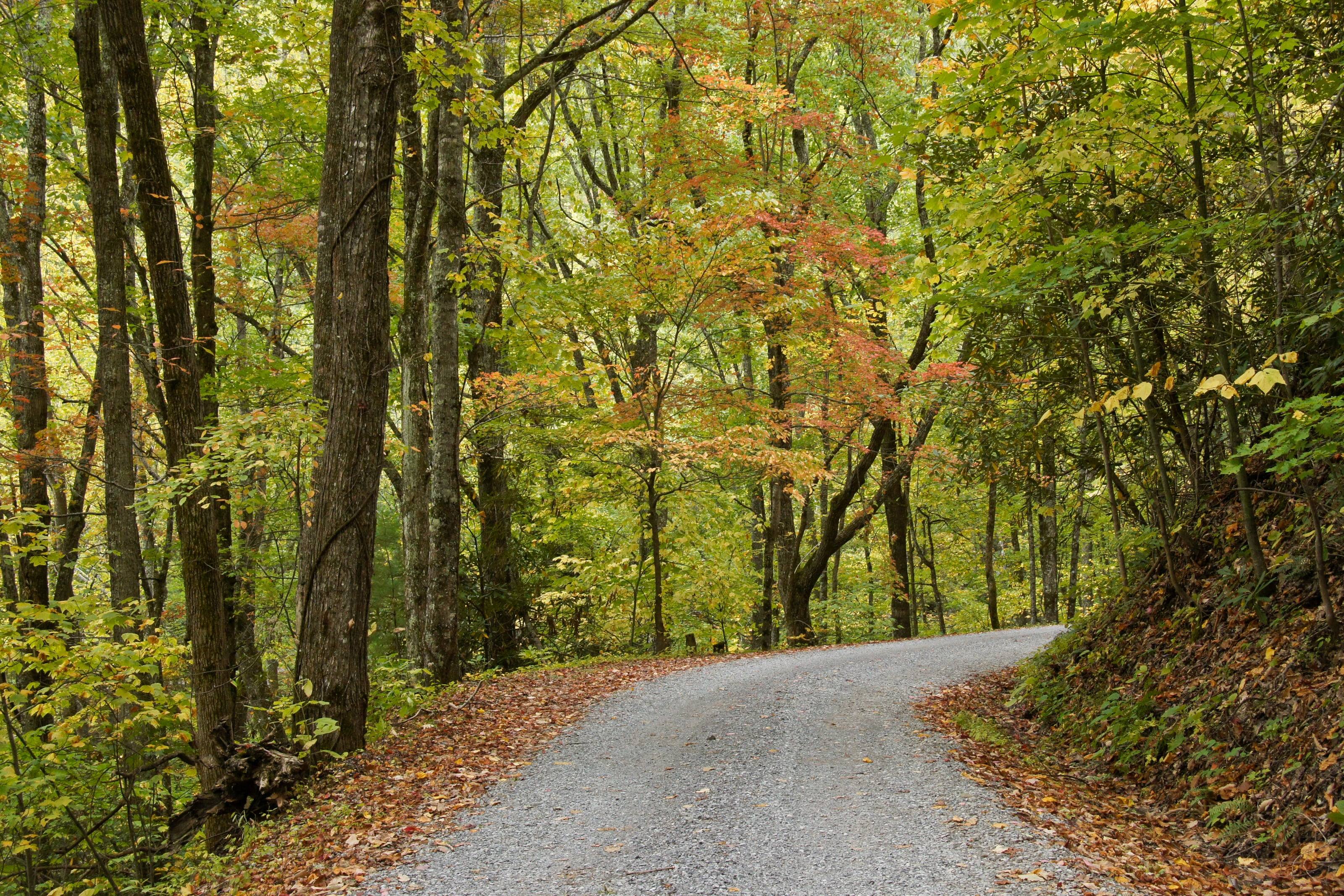
A one-lane gravel road under autumn hardwoods in the Great Smoky Mountains.

The Overland Directory

Clubs in North Carolina

Local and regional clubs: the fastest way to find people to travel with, learn from and call when you are stuck.

Rich Mountain Road, Great Smoky Mountains National Park, Tennessee

Clubs in North Carolina

2 listings

  1. North Carolina Off-Road Leasburg, NC Nonprofit off-road association working on trail access, trail cleanups, off-road education and community events across the state, and publishing trail maps and status updates.
  2. Central North Carolina 4x4 Club Raleigh, NC Non-profit four wheel drive club running trail rides and events for members, with trail information for North Carolina and a stated focus on responsible off-road recreation.

North Carolina by the numbers

Acres of federal land 1
2.43M
7.7 percent of North Carolina, and none of it BLM
Mount Mitchell, the highest point east of the Mississippi 2
6,684 ft
Yancey County. The low point is the Atlantic Ocean at sea level. Our own reading of the elevation surface at the summit point is 6,667 feet
Federal campgrounds a vehicle can reach 4
69
37 Forest Service, 27 National Park Service and five Army Corps of Engineers. Sixty-one can be booked ahead
Acres in the Nantahala, the largest of the four national forests 6
531,148
From 1,200 feet on the Hiwassee River to 5,800 feet at Lone Bald, with over 600 miles of trail
Of national forest road hit by Hurricane Helene 15
885 mi
Thirty percent of roadbeds completely destroyed, 48 road bridges damaged or destroyed and 43 major culverts to restore
Outer Banks Scenic Byway, two legs of it on state ferries 48
137.8 mi
The Federal Highway Administration allows 5.5 hours, 3.5 of them on the two ferries
Tunnels on the Blue Ridge Parkway, one in Virginia and the rest here 39
26
The Parkway runs from Milepost 0 in Virginia to Milepost 469 at Cherokee, and charges no entrance fee
Snowfall a year at the highest Appalachian elevations 58
100 in
Against about five inches statewide. Yearly precipitation has run from 34.8 inches in 2007 to 68.4 inches in 2018
State scenic byways 50
62
Five of them carry a federal designation: the Blue Ridge Parkway and Newfound Gap Road as All-American Roads, plus the Cherohala Skyway, Forest Heritage and Outer Banks routes
Acres in the Uwharrie, the only motorized trail system in the Piedmont 14
53,011
Approximately, across Montgomery, Randolph and Davidson counties. The forest’s About the Area page gives 51,546
Acres in Cape Hatteras National Seashore 36
24,470
Across Bodie, Hatteras and Ocracoke islands, with no entrance fee charged
Acres of game land 56
2M+
Public and private land the Wildlife Resources Commission manages for hunting, trapping, fishing and other wildlife-associated recreation

Clubs and the ground that is still closed

Access here is tighter than in most states and it has been getting tighter. The Pisgah Ranger District moved to designated sites only within 1,000 feet of public roads, Max Patch bans camping and fires, and Hurricane Helene closed hundreds of miles of forest road that volunteers have been helping to reopen since 2024.

A club is the quickest way to learn which of the four OHV areas is open this month, which pass you need for it, and which mountain district has finished its repairs.

The full guide to overlanding North Carolina

What clubs do

A club turns a vehicle into a calendar. Day runs, weekend trips, training days, garage nights, and a list of people who will come and get you.

Most clubs offer

  1. 01Organized runs and trips at different levels
  2. 02Training days for new members
  3. 03Trail maintenance and clean-ups
  4. 04A voice in local land-use planning
  5. 05Help, tools and advice

How to find the right one

Go on a run as a guest before you pay dues.

  1. 01Decide between a club built around one make and one open to anything.
  2. 02Ask about the pace and style: family camping, technical trails, long-distance travel.
  3. 03Ask what the dues pay for.
  4. 04Watch how they treat the newest driver on a run.

Why clubs matter

Routes stay open because someone shows up. Clubs that adopt trails, clear them after winter and take part in land-use planning are a large part of why there is still somewhere to drive.

Questions people ask

Do I need a certain vehicle?

Some clubs are built around one make. Many are open to anything with four-wheel drive and a willingness to learn.

How do I list my club?

Use the List your business form and choose Clubs. Tell us where you meet and how people can join a run.

How high is North Carolina?

From Nags Head at 5 feet to Mount Mitchell at 6,684. Altitude decides what your engine, your brakes and your lungs have to work with, and how late in the year the passes open.

Towns

  1. Boone Watauga County town on US 321 and US 421, the highest of the sixteen towns here, near the Parkway around Grandfather Mountain and Price Lake. 3,218 ft
  2. Burnsville Yancey County seat and the mailing town for Mount Mitchell State Park on NC 128. Last services before the Black Mountains. 2,823 ft
  3. Waynesville Haywood County seat on US 23 and US 276, between the Parkway’s high Balsams section and the Cataloochee side of the national park. 2,748 ft
  4. Brevard Transylvania County seat at the foot of the Pisgah Ranger District. The Forest Heritage byway and the Davidson River corridor both start from US 276 just north of town. 2,225 ft
  5. Asheville Where I-40 meets I-26 beside the Blue Ridge Parkway. The Parkway drops to 35 miles per hour through the corridor here, and the Pisgah National Forest supervisor’s office is in town. 2,128 ft
  6. Franklin Macon County seat and home of the Nantahala Ranger District office. Wayah Road and Forest Service Road 69 to the Wayah Bald tower leave from the west side. 2,121 ft
  7. Robbinsville Graham County seat and the North Carolina end of the Cherohala Skyway. Joyce Kilmer Memorial Forest and the Cheoah district office are both close by. 2,044 ft
  8. Cherokee Milepost 469, the southern end of the Blue Ridge Parkway, and the North Carolina entrance to Great Smoky Mountains National Park on US 441. 1,981 ft
  9. Bryson City Swain County seat on US 19 at the Nantahala Gorge end. Deep Creek and the Lakeview Drive side of the national park are reached from here. 1,732 ft
  10. Murphy Far southwestern corner on US 64 and US 19, with the Tusquitee Ranger District office. The Nantahala’s lowest ground, on the Hiwassee River, is in this county. 1,597 ft
  11. Morganton Burke County seat on I-40 below Linville Gorge. The usual fuel and supply stop for the Brown Mountain OHV trail system and the Wilson Creek country. 1,159 ft
  12. Troy Montgomery County seat and the site of the Uwharrie ranger district office. The Badin Lake OHV trail complex is reached from here. 657 ft
  13. Beaufort Carteret County seat across the water from Shackleford Banks. The Harkers Island visitor centre and the Core Banks vehicle ferries are a short drive east. 10 ft
  14. Buxton Hatteras Island village at the elbow of the cape, beside the Cape Point ramps and the seashore’s busiest beach driving routes. 10 ft
  15. New Bern Craven County seat at the head of the Neuse River estuary and the northern gateway to the Croatan National Forest. 10 ft
  16. Nags Head Northern Outer Banks town on NC 12 where the Outer Banks Scenic Byway begins. The last full-service stop before Hatteras Island. 5 ft

Passes, high roads and summits

  1. Mount Mitchell The highest point east of the Mississippi River. A paved state road, NC 128, reaches a parking area just below the summit 6,684 ft
  2. Kuwohi Road Newfound Gap on US 441 west along the state line ridge to the Kuwohi parking area 6,644 ft
  3. Richland Balsam Haywood County, above the Parkway’s high stretch through the Balsams. Our own measurement at the USGS point 6,408 ft
  4. Waterrock Knob Haywood County. Its access road off the Parkway is one of the two places the compendium drops the speed limit to 25 6,290 ft
  5. Black Balsam Knob Haywood County, in the Shining Rock country above the Forest Heritage byway. Our own measurement at the USGS point 6,209 ft
  6. Grandfather Mountain Avery County, beside the Parkway at the Linn Cove Viaduct. Our own measurement at the USGS point 5,919 ft
  7. Wayah Bald Road, Forest Service Road 69 Wayah Road west of Franklin up to the Wayah Bald tower 5,342 ft
  8. Cheoah Bald Swain County, above the Nantahala Gorge. Measured by us on the elevation surface, since no agency publishes a figure for it 5,054 ft
  9. Max Patch Mountain Madison County, against the Tennessee line in the Harmon Den area. Camping and fires are prohibited here 4,627 ft
  10. Brown Mountain OHV Trail System The Grandfather Ranger District above Morganton and Collettsville 2,741 ft

Pass, road and summit elevations are the figures published by the agency that manages them. Town elevations are the town’s or county’s own figure where it publishes an exact one; the rest are from the U.S. Geological Survey (3D Elevation Program at the place’s official coordinates), retrieved September 18, 2026. Every source is listed at the foot of the page.
Sources for this page

58
  1. Congressional Research Service. Federal Land Ownership: Overview and Data (R42346), Tables 1 and 2, data as of September 30, 2024. Retrieved September 18, 2026.
  2. U.S. Geological Survey. Elevations and Distances in the United States, online edition, Highest and Lowest Elevations table: Mount Mitchell, Yancey County, 6,684 feet, and the Atlantic Ocean at sea level. Retrieved September 19, 2026.
  3. U.S. Geological Survey. Geographic Names Information System and 3D Elevation Program point query. Elevation of the 3DEP surface at the GNIS coordinates of the named place, rounded to the nearest foot. Retrieved September 19, 2026.
  4. Recreation.gov. Recreation Information Database (RIDB) full export. Federal campgrounds in North Carolina a vehicle can reach, counted by managing agency. Retrieved September 19, 2026.
  5. USDA Forest Service, National Forests in North Carolina. About the Area: the four national forests, with the Croatan at 160,000 acres and the Uwharrie at 51,546, figures the forests’ own recreation pages state differently. Retrieved September 19, 2026.
  6. USDA Forest Service, National Forests in North Carolina. Nantahala National Forest: 531,148 acres, 1,200 to 5,800 feet, over 600 miles of trail, and the Cheoah, Nantahala and Tusquitee ranger districts. Retrieved September 19, 2026.
  7. USDA Forest Service, National Forests in North Carolina. Pisgah National Forest: over 500,000 acres across the Pisgah, Grandfather and Appalachian ranger districts. Retrieved September 19, 2026.
  8. USDA Forest Service, National Forests in North Carolina. Pisgah Ranger District: approximately 163,168 acres in Transylvania, Henderson, Buncombe and Haywood counties, with Shining Rock and Middle Prong. Retrieved September 19, 2026.
  9. USDA Forest Service, National Forests in North Carolina. Grandfather Ranger District: 193,385 acres in six counties, Wilson Creek, and the 4.5-mile gravel roads FSR 45 Watauga Turnpike and FSR 981 Roseboro Edgemont. Retrieved September 19, 2026.
  10. USDA Forest Service, National Forests in North Carolina. Appalachian Ranger District: approximately 161,400 acres across six counties, with Max Patch in the Harmon Den area. Retrieved September 19, 2026.
  11. USDA Forest Service, National Forests in North Carolina. Nantahala Ranger District: approximately 245,487 acres in Macon, Jackson and Swain counties. Retrieved September 19, 2026.
  12. USDA Forest Service, National Forests in North Carolina. Cheoah Ranger District: 121,985 acres in Graham and Swain counties, with Joyce Kilmer Memorial Forest and the Cherohala Skyway. Retrieved September 19, 2026.
  13. USDA Forest Service, National Forests in North Carolina. Croatan National Forest: 167,687 acres in Craven, Carteret and Jones counties, the Neusiok Trail and the Black Swamp OHV trailhead. Retrieved September 19, 2026.
  14. USDA Forest Service, National Forests in North Carolina. Uwharrie National Forest: approximately 53,011 acres in Montgomery, Randolph and Davidson counties, and the only public motorized trail system in the Piedmont. Retrieved September 19, 2026.
  15. USDA Forest Service, National Forests in North Carolina. Helene: September 27, 2024, more than 190,000 acres of damage, 885 miles of road, 30 percent of roadbeds destroyed, 48 bridges, 43 culverts and about 850 miles of trail. Retrieved September 19, 2026.
  16. USDA Forest Service, National Forests in North Carolina. Alerts: Forest Service Road 225B closed for post-Helene stream work, and Connely Creek Road NFSR 86 closed until October 2026. Retrieved September 19, 2026.
  17. USDA Forest Service, National Forests in North Carolina. Seasonal Closures: the annual gate dates for every ranger district, the Uwharrie and Wayehutta OHV areas and the Croatan roads. Retrieved September 19, 2026.
  18. USDA Forest Service, National Forests in North Carolina. Camping and Cabins: 14 days in a 30-day period, no relocating within 10 miles, present on the first night, two vehicles per unit, and the district restrictions. Retrieved September 19, 2026.
  19. USDA Forest Service, National Forests in North Carolina. Pisgah Ranger District Dispersed Camping Regulations, Order 08-11-07-23-163: designated sites only within 1,000 feet of a road open to public vehicle travel. Retrieved September 19, 2026.
  20. USDA Forest Service, National Forests in North Carolina. Max Patch Restrictions, Appalachian Ranger District: camping and fires prohibited, and the area closed an hour after sundown until an hour before sunrise. Retrieved September 19, 2026.
  21. USDA Forest Service, National Forests in North Carolina. Linville Gorge Wilderness area: the weekend camping permit May through October, the quota and group size, Kistler Memorial Highway (NC 1238) and Forest Service Road 210. Retrieved September 19, 2026.
  22. USDA Forest Service, National Forests in North Carolina. Off-Highway Vehicles (OHV): the four areas, the requirement that every OHV carry a valid pass, and that passes expire at midnight on the date written on them. Retrieved September 19, 2026.
  23. USDA Forest Service, National Forests in North Carolina. Brown Mountain OHV Trail System: 34 miles, four-wheel drives on Trail 8 and part of Trail 1, $5 a day and $30 a season, April 1 to January 1, and the 99 dBu noise limit. Retrieved September 19, 2026.
  24. USDA Forest Service, National Forests in North Carolina. Badin Lake OHV Trail Complex: nine trails over approximately 17 miles, open to full-size four-wheel drives, with six trailheads. Retrieved September 19, 2026.
  25. USDA Forest Service, National Forests in North Carolina. Passes: $30 annual and $5 daily OHV passes for the Uwharrie (Badin Lake) and the Grandfather Ranger District (Brown Mountain). Retrieved September 19, 2026.
  26. USDA Forest Service, National Forests in North Carolina. Wayehutta OHV Trail System, Nantahala Ranger District: the April 1 to December 15 season. Retrieved September 19, 2026.
  27. USDA Forest Service, National Forests in North Carolina. Wayah Bald Tower: Forest Service Road 69, 4.5 miles of gravel, closed seasonally January 1 to April 1. Retrieved September 19, 2026.
  28. USDA Forest Service, National Forests in North Carolina. Forest Heritage National Scenic Byway: a 79-mile loop on US 276, NC 215 and US 64 through the Pisgah Ranger District. Retrieved September 19, 2026.
  29. USDA Forest Service, National Forests in North Carolina. Curtis Creek Area: the first tract of eastern forest acquired under the Weeks Act in 1911. Retrieved September 19, 2026.
  30. USDA Forest Service, Cherokee National Forest. Cherohala Skyway: a 43-mile National Scenic Byway through the Cherokee and Nantahala national forests, with camping prohibited within 300 feet of the road. Retrieved September 19, 2026.
  31. National Park Service, Cape Hatteras National Seashore. Off-Road Vehicle Permits: $50 for ten consecutive days, $120 for a year, issued after the seashore’s ORV safety video. Retrieved September 19, 2026.
  32. National Park Service, Cape Hatteras National Seashore. Off-road Vehicle Use: the permit requirement, the low-pressure gauge, shovel, jack and jack support board, and the note that on-site signage outranks the beach access map. Retrieved September 19, 2026.
  33. National Park Service, Cape Hatteras National Seashore. Off-road Vehicle Frequently Asked Questions: the vehicle standard, the 15 mph limit, the under 20 psi recommendation and the seasonal night-driving hours. Retrieved September 19, 2026.
  34. National Park Service, Cape Hatteras National Seashore. Laws & Policies and the superintendent’s compendium: the ten priority ramps, the Ramp 45 to Ramp 48 vehicle-free area and the 5 mph limit within 100 feet of pedestrians. Retrieved September 19, 2026.
  35. National Park Service, Cape Hatteras National Seashore. Fees & Passes: no entrance fee, the ORV permit prices, and campground rates of $28 at Oregon Inlet, Frisco and Ocracoke and $20 at Cape Point. Retrieved September 19, 2026.
  36. National Park Service, Cape Hatteras National Seashore. Statistics: the seashore encompasses 24,470 acres. Retrieved September 19, 2026.
  37. National Park Service, Cape Lookout National Seashore. Beach Driving: vehicles on North and South Core Banks only, by ferry, with the driver age and licence rule and the ban on driving the dunes or the soundside beach. Retrieved September 19, 2026.
  38. National Park Service, Cape Lookout National Seashore. Beach Driving Permit: bought on Recreation.gov, valid for the calendar year, with the education video, the windshield decal and the printed copy carried in the vehicle. Retrieved September 19, 2026.
  39. National Park Service, Blue Ridge Parkway. Frequently Asked Questions: 26 tunnels, one in Virginia and the others in North Carolina, and no entrance fee. Retrieved September 19, 2026.
  40. National Park Service, Blue Ridge Parkway. Superintendent’s compendium, 36 CFR 4.21: a 45 mile per hour limit, thirteen 35 mph stretches including Mileposts 383.4 to 388.8 through Asheville, and 25 mph at Craggy Gardens and the Waterrock Knob access road. Retrieved September 19, 2026.
  41. National Park Service, Blue Ridge Parkway. Superintendent’s compendium, 36 CFR 4.11: the 50,000 pound gross vehicle weight limit across Price Lake Dam at Mileposts 296.6 to 296.7. Retrieved September 19, 2026.
  42. National Park Service, Blue Ridge Parkway. Getting Around: mileposts 0 to 469, no commercial traffic, and winter closures for ice and snow. Retrieved September 19, 2026.
  43. National Park Service, Blue Ridge Parkway. Road Closures: the Hurricane Helene closures posted in North Carolina in September 2026, including Mileposts 274.3 to 276.5 and 344.2 to 355.3. Retrieved September 19, 2026.
  44. National Park Service, Blue Ridge Parkway. Things to Know Before You Come: over 200 formal scenic overlooks, and most facilities open from Memorial Day until late October. Retrieved September 19, 2026.
  45. National Park Service, Great Smoky Mountains National Park. Seasonal Road Schedule: Heintooga Ridge Road May 15 to October 31 with the 25-foot vehicle limit, Kuwohi Road April 1 to November 29, and Straight Fork Road undetermined after Helene. Retrieved September 19, 2026.
  46. National Park Service. Heintooga Spur Road: a 9-mile paved spur 11 miles from the south end of the Blue Ridge Parkway, then 14 one-way gravel miles on the Heintooga Round Bottom Road. Retrieved September 19, 2026.
  47. National Park Service, Great Smoky Mountains National Park. Fees & Passes: parking tags required over 15 minutes, at $5 daily, $15 weekly and $40 annual, and the note that the tag is not an entrance fee. Retrieved September 19, 2026.
  48. Federal Highway Administration, America’s Byways. Outer Banks Scenic Byway: 137.8 miles and 5.5 hours, including 3.5 hours on the two ferries. Retrieved September 19, 2026.
  49. Federal Highway Administration, America’s Byways. North Carolina byways: the Blue Ridge Parkway and Newfound Gap Road as All-American Roads, and the Cherohala Skyway, Forest Heritage and Outer Banks routes as National Scenic Byways. Retrieved September 19, 2026.
  50. North Carolina Department of Transportation. North Carolina Byways: 62 state scenic byways selected by NCDOT. Retrieved September 19, 2026.
  51. North Carolina Department of Transportation, Ferry Division. Ferry Schedule: 21 ferries on seven regular routes, with Hatteras to Ocracoke and Ocracoke to Cedar Island part of the Outer Banks National Scenic Byway. Retrieved September 19, 2026.
  52. North Carolina Department of Transportation. Snow-Clearing Policy: the Bare Pavement System first, then other U.S. and N.C. routes, then paved secondary routes, then unpaved secondary routes. Retrieved September 19, 2026.
  53. North Carolina Department of Transportation. Driving in Winter Weather: the vehicle and trunk kits, and excessive speed as the leading cause of winter wrecks. Retrieved September 19, 2026.
  54. North Carolina State Parks. Mount Mitchell State Park: 6,684 feet, the highest point east of the Mississippi River, reached on NC 128 from the Asheville side of the Parkway. Retrieved September 19, 2026.
  55. North Carolina State Parks. State parks visitation and system size: 262,074 acres at the end of 2023 and more than 20.1 million visitors. Retrieved September 19, 2026.
  56. North Carolina Wildlife Resources Commission. Game Lands Program: over 2,000,000 acres of public and private land managed for hunting, trapping, fishing and other wildlife-associated recreation. Retrieved September 19, 2026.
  57. North Carolina General Assembly. G.S. 20-171.19, Prohibited acts by owners and operators: no all-terrain vehicle on an interstate or limited-access highway, and helmet and eye protection where street operation is otherwise permitted. Retrieved September 19, 2026.
  58. NOAA National Centers for Environmental Information, North Carolina Institute for Climate Studies. North Carolina State Climate Summary 2022: precipitation from 34.8 inches in 2007 to 68.4 inches in 2018, about five inches of snow statewide with up to 100 in the high Appalachians, and a hurricane about once every three years. Retrieved September 19, 2026.

Reviewed September 19, 2026. Conditions, closures and rules change; check with the managing agency before you travel.

More in North Carolina